Uncharted Territories: Navigating America’s Ancestral Lands Through Maps
Forget the conventional tourist map. To truly understand the depth, history, and spirit of the lands we traverse across North America, a different kind of cartography is essential: one that acknowledges and illuminates the ancestral territories of Native American tribes. This isn’t a review of a single location, but rather an immersive exploration of the experience of using ancestral land maps as an indispensable travel tool – a review of a perspective that transforms any journey into a profound historical and cultural pilgrimage.
The Location (Concept): Beyond the Pavement, Into the Past
Our "location" here is less a fixed point on a GPS and more a way of seeing the entire North American continent. It’s the overlay of millennia of human history, culture, and sovereignty onto the modern landscape. When we talk about "ancestral lands," we’re referring to the traditional territories, hunting grounds, trade routes, and sacred sites that Native American tribes inhabited and stewarded long before European contact. These lands are not merely historical footnotes; they are living landscapes imbued with the stories, resilience, and ongoing presence of indigenous peoples.

The core "place" being reviewed is the act of mapping these ancestral territories onto your travel experience. This means consciously seeking out and utilizing resources that depict pre-colonial tribal boundaries, historical migration routes, significant cultural sites, and contemporary tribal nations. It’s a journey that re-centers indigenous perspectives, moving beyond the colonial names and narratives that often dominate our understanding of geographical spaces.
Why Maps Are Your Most Powerful Travel Companion
For the discerning traveler seeking more than just scenic views, ancestral land maps offer an unparalleled depth of engagement. They are far more than navigational aids; they are keys to unlocking hidden layers of meaning in every landscape.
-
Deeper Historical Context: Modern maps often erase indigenous history, presenting a blank slate onto which colonial narratives are etched. Ancestral land maps immediately challenge this by showing who was here first, and for how long. Imagine standing in a national park – say, Yellowstone – and seeing not just its modern boundaries, but the overlapping territories of the Shoshone, Crow, Nez Perce, and Blackfeet. This instantly contextualizes the land, transforming it from a "wilderness" into a homeland with a rich, complex human story.
-

Understanding Place Names: Many of the rivers, mountains, and regions we know by English or Spanish names originally bore indigenous names, often descriptive of their features or spiritual significance. Consulting ancestral maps, or maps that include original place names, can reveal these layers. For example, learning the original names for peaks in the Sierra Nevada or rivers in the Pacific Northwest connects you to the deep linguistic and cultural ties indigenous peoples had with their environment. It’s a powerful act of remembrance and respect.
-
Appreciating Indigenous Sovereignty: These maps aren’t just about the past; they’re about the present. They depict not only ancestral territories but also current tribal reservations and trust lands. This visual representation highlights the ongoing presence and sovereignty of Native American nations. It reminds travelers that these are distinct political entities with their own laws, cultures, and governance, demanding respect and understanding. Traveling with this awareness transforms a passive observation into an active acknowledgement of living cultures.
-

Informed and Respectful Exploration: Knowing whose land you are on, both historically and currently, profoundly impacts how you travel. It informs decisions about where to visit, how to behave, and what questions to ask. It helps identify sacred sites or culturally sensitive areas that require particular reverence, or even avoidance, out of respect for indigenous protocols. This knowledge fosters a more ethical and mindful form of tourism.
-
Revealing Complex Human Geographies: Ancestral land maps often illustrate dynamic territories, trade networks, seasonal migration routes, and even historical conflicts and alliances between tribes. This challenges simplistic notions of fixed boundaries and reveals the intricate human geographies that shaped the continent for millennia. It paints a picture of vibrant, interconnected societies thriving across vast landscapes, a stark contrast to the often-depicted "empty wilderness."

Practical Application: Transforming Your Journey
Let’s illustrate how integrating ancestral land maps transforms the travel experience, using broad geographical examples rather than specific sites, emphasizing the mapping aspect.
The Southwest: A Tapestry of Ancient Homelands
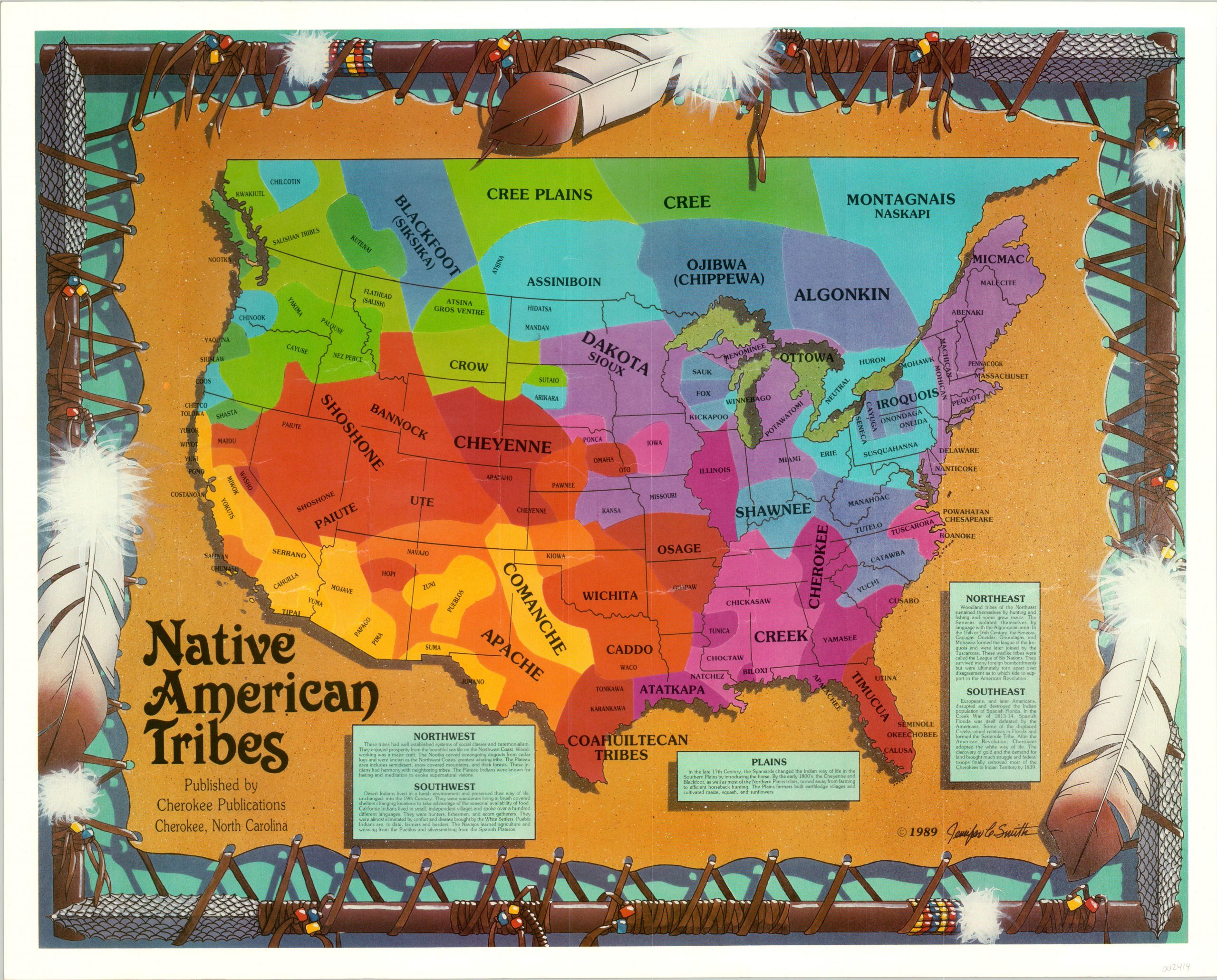
Consider a road trip through the Four Corners region – Arizona, New Mexico, Utah, Colorado. Without ancestral maps, you might see a landscape of stunning red rock formations and ancient ruins. With them, you see the ancestral lands of the Navajo Nation (Diné), the Hopi, the Zuni, the Ute, the Apache, and numerous Ancestral Puebloan peoples. Interactive online maps, such as those provided by Native Land Digital, allow you to zoom in and see the overlapping territories, the movements of peoples like the Ute across seasonal hunting grounds, or the historical extent of Ancestral Puebloan settlements.
When visiting places like Mesa Verde National Park or Canyon de Chelly National Monument, understanding these mapped overlays adds immense context. You realize the "cliff dwellings" weren’t isolated anomalies but part of a vast, interconnected civilization. You see the traditional agricultural lands, the vital water sources, and the trade routes that linked these communities. This perspective moves beyond mere archaeology to a deeper appreciation of living cultures with ancient roots in the very ground beneath your feet.
The Pacific Northwest: Rivers, Forests, and Coastal Nations
Imagine exploring the lush rainforests and rugged coastlines of Washington or Oregon. A standard map shows national forests and state parks. An ancestral map reveals the territories of the Coast Salish peoples, the Chinook, the Nez Perce, the Yakama, and many others. It highlights the traditional fishing grounds along the Columbia River, the cedar forests vital for canoes and longhouses, and the intricate network of trade routes that connected coastal and inland tribes.
Using these maps, you can trace the historical movements along salmon-rich rivers, understand the significance of specific mountains as spiritual sites, and connect modern tribal communities to their ancient homelands. When hiking through Olympic National Park, for instance, you’re not just in a wilderness; you’re in the traditional territory of the Quinault, Hoh, and Makah peoples, whose histories are intrinsically woven into the landscape’s fabric. You begin to notice the indigenous names of rivers and mountains, understanding them not as arbitrary labels, but as reflections of a deep, historical relationship with the land.
The Eastern Woodlands: Echoes of Mighty Confederacies
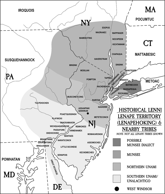
Even in the densely populated East Coast, ancestral maps unveil a vibrant indigenous past often obscured by centuries of colonial development. Traveling through the Appalachian Mountains, you might encounter maps showing the vast ancestral lands of the Cherokee, the Catawba, or the Iroquois Confederacy (Haudenosaunee). These maps depict the extensive trade networks that stretched from the Great Lakes to the Atlantic, the locations of traditional villages, and the significance of rivers as highways for travel and communication.
A visit to the Great Smoky Mountains National Park, with an ancestral map in hand, reveals it as the heartland of the Cherokee. You can trace their historical trails, understand their relationship with the forest for food and medicine, and appreciate the devastating impact of the Trail of Tears, which is also geographically represented on some maps. This mapping experience turns a beautiful landscape into a poignant reminder of resilience and forced migration, connecting present-day Cherokee communities to their enduring heritage.
How to Find and Use These Essential Maps
The accessibility of ancestral land maps has grown significantly, making this transformative travel experience more achievable than ever:
-
Native Land Digital (Native-Land.ca): This is arguably the most accessible and comprehensive online resource. It’s an interactive map that allows you to input any location and see the overlay of indigenous territories, treaties, and languages. It’s an essential starting point for any trip planning.
-
Tribal Websites and Cultural Centers: Many individual tribal nations provide maps of their ancestral lands, current reservations, and historical sites on their official websites. Visiting tribal cultural centers or museums (e.g., the National Museum of the American Indian) often provides access to physical maps and interpretive materials.
-
University and Archival Collections: Academic institutions often host digitized collections of historical maps, including those depicting indigenous territories and land cessions. These can offer incredibly detailed insights into specific regions and time periods.
-
National Park Service and State Parks: While often focused on colonial narratives, many parks are increasingly incorporating indigenous history. Look for interpretive signage, visitor center exhibits, and ranger programs that specifically address ancestral lands and tribal connections. Some parks even provide maps with these overlays.
-
Specialized Books and Atlases: Publications like "An Indigenous Peoples’ History of the United States" or various indigenous atlases often include detailed maps that can serve as excellent companions for your travels.
When using these maps, remember to interpret them critically. Boundaries were often fluid, and different tribes might have overlapping claims. The goal isn’t to find a single, definitive "truth," but to appreciate the complexity and richness of indigenous land relationships.
The Ethical Traveler’s Compass
Integrating ancestral land maps into your travels isn’t just about geographical understanding; it’s about ethical engagement. It encourages:
- Acknowledgement: A simple acknowledgement of whose ancestral lands you are on is a powerful act of respect.
- Support: Seek out opportunities to support tribal economies, whether through purchasing authentic art, staying at tribally owned hotels, or hiring indigenous guides.
- Respect for Sacred Sites: Understand that some areas are sacred and may not be open to visitors, or may require specific protocols. Always follow local guidance.
- Education: Use these maps as a starting point for further learning. Read books, listen to podcasts, and engage with tribal history.
- Listen: If you have the privilege to interact with tribal members, listen to their stories and perspectives.
Conclusion: A Journey of Re-Discovery
Reviewing the experience of traveling with ancestral land maps is to review a profound shift in perspective. It transforms every road, every mountain, every river from a mere geographical feature into a living testament of human history, resilience, and connection. It’s an invitation to step beyond the familiar, to peel back the layers of colonial naming and claim, and to see North America through the eyes of its original inhabitants.
This isn’t just about reviewing a "place"; it’s about reviewing a way of seeing all places. It’s about enriching your travels with a depth of understanding and respect that conventional tourism rarely offers. So, next time you plan a trip, don’t just pack your hiking boots and camera. Pack your ancestral land maps. They are the true guides to the uncharted territories of history and culture, waiting to be discovered beneath the surface of the familiar. Embark on this journey, and you’ll find that the landscape itself begins to speak in a language you never knew it possessed.
