The Living Atlas: Navigating the Colorado River Basin Through Native American Maps
Forget the grid lines and arbitrary borders of modern cartography. To truly comprehend the immense, sculpted landscape of the Colorado River Basin, one must learn to read the land itself – not as a static image, but as a living atlas, rich with millennia of indigenous knowledge. This isn’t a review of a single museum exhibit, but an invitation to embark on an experiential journey across one of North America’s most iconic regions, guided by the very spirit of Native American mapping. It’s about understanding the basin not just as a geographical space, but as a deeply interconnected web of life, history, and spiritual significance.
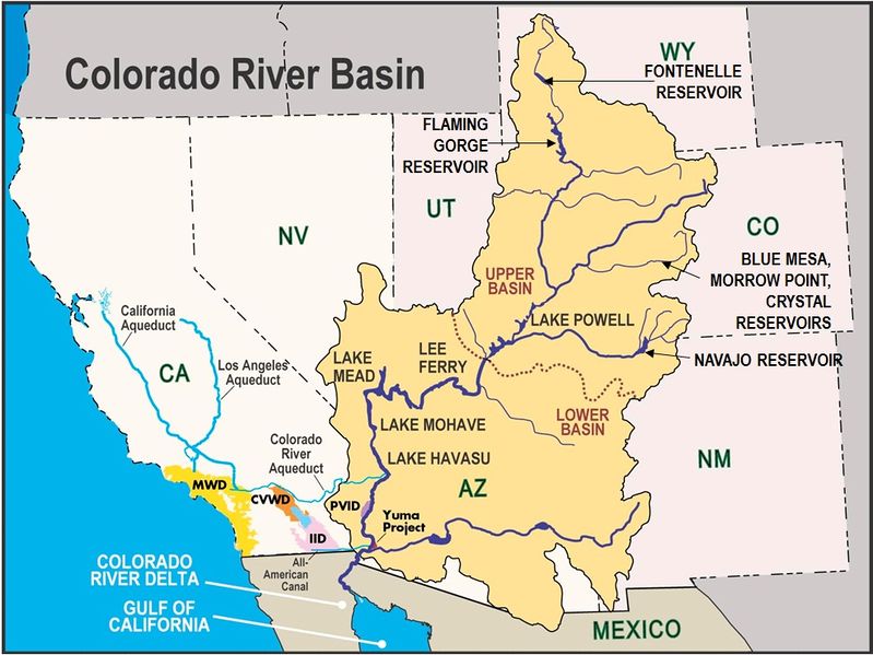
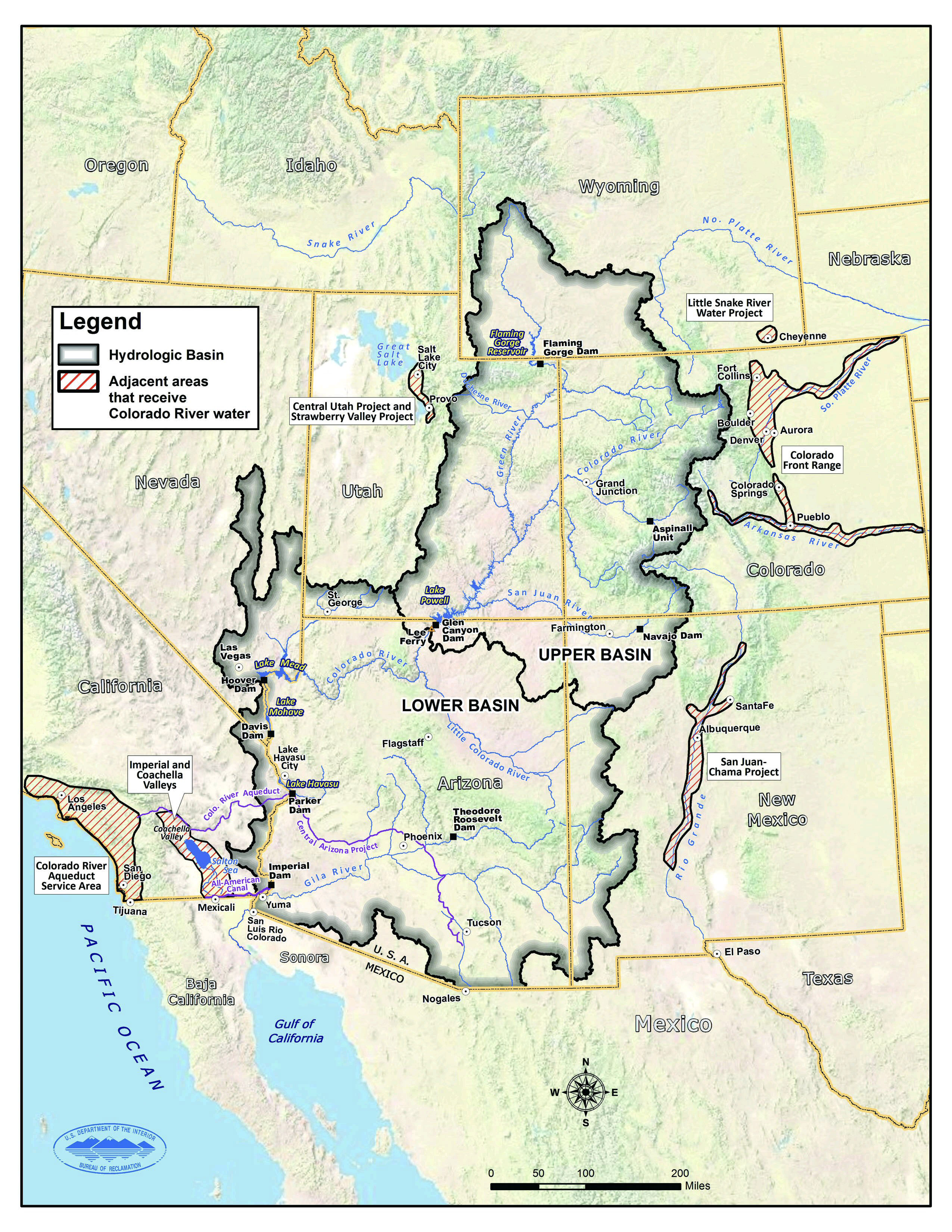
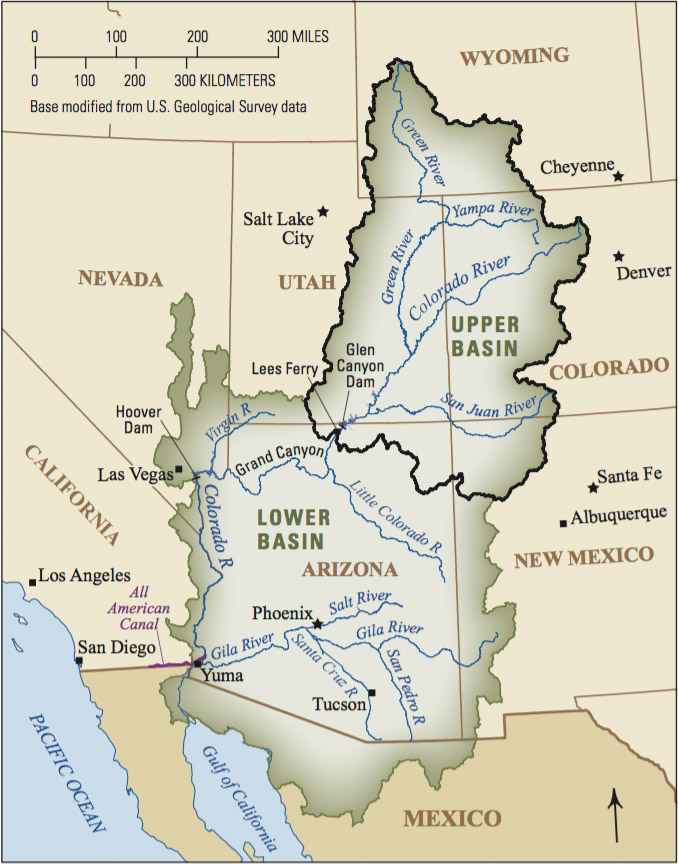
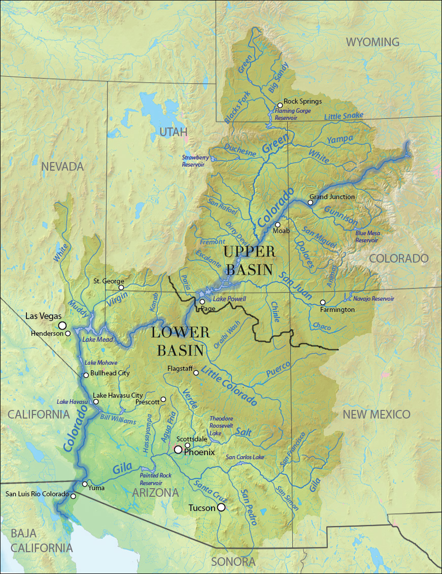
The Colorado River Basin, a vast expanse stretching across seven U.S. states and parts of Mexico, has been home to diverse indigenous peoples for over 10,000 years. Ancestral Puebloans, Navajo, Hopi, Ute, Havasupai, Hualapai, Paiute, Mojave, Quechan, and countless other nations have lived within its canyons, mesas, and riparian corridors, developing intricate systems of navigation, resource management, and cultural memory. Their "maps" were not drawn on parchment with compasses and scales; they were etched into memory, recounted through oral histories, painted on rock walls, woven into textiles, and embodied in ceremonial practices. These were dynamic, multi-layered representations of the world, focused not on property lines but on relationships: between humans and the land, between water and life, between the seen and unseen.
To engage with Native American maps of the Colorado River Basin is to fundamentally shift your perception of travel. It means prioritizing water sources over paved roads, understanding seasonal migrations of game and people, recognizing sacred sites as navigational markers, and interpreting geological formations as ancestral narratives. It’s a journey that challenges the colonial gaze and invites a deeper, more respectful engagement with the landscape.

Decoding the Landscape: A Journey Through Key Basins
Imagine setting out into the basin, not with a GPS, but with the collective wisdom of generations.
The Grand Canyon: A Sanctuary of Flow and Memory
Our journey begins, perhaps, in the breathtaking chasm of the Grand Canyon, a place central to the origin stories and ancestral territories of numerous tribes, including the Havasupai, Hualapai, Navajo, and Hopi. While modern maps depict a formidable barrier, indigenous maps highlight pathways through and within the canyon. They emphasize the precious springs and perennial creeks – Havasu Creek, Bright Angel Creek – not just as water sources, but as sacred arteries. A Havasupai map, for instance, might focus on the intricate network of trails leading to their secluded village of Supai, highlighting the specific plants and medicinal herbs found along the descent, the safest river crossings, and the locations of ancestral dwellings.

To experience the Grand Canyon through this lens means more than just gazing from the rim. It involves descending into its depths, feeling the profound shift in ecosystems with every thousand feet, and recognizing the geological layers not merely as scientific data but as chapters in the earth’s autobiography, interwoven with human history. Indigenous maps remind us that the canyon isn’t just a spectacle; it’s a living sanctuary, a source of sustenance, and a repository of profound spiritual power. The very flow of the Colorado River, often depicted as a meandering serpent or a life-giving vein, is the central artery, connecting disparate communities and resources across vast distances.
The Four Corners Region: Confluence of Ancient Paths and Cultures
Moving eastward into the Four Corners region – the heartland of the Navajo (Diné), Ute, Hopi, and Zuni peoples – the mapping tradition takes on different forms. Here, the landscape is a mosaic of mesas, canyons, and ancient ruins. An Ancestral Puebloan "map" might be less about a drawn diagram and more about the strategic placement of their monumental structures like Chaco Canyon or Mesa Verde. These sites, often aligned with celestial events, served as nodes in a vast network of trade routes, pilgrimage paths, and resource-gathering territories.
For the Navajo, their homeland, Dinétah, is bounded by four sacred mountains, acting as cardinal points in their mental map of the world. Their "maps" are embedded in their language, their Blessingway ceremonies, and their intricate sand paintings, which depict the cosmos and the relationship of their people to it. A journey here, guided by indigenous perspectives, involves understanding the subtle cues of the desert: where water collects after a rain, the location of medicinal plants, the best routes for herding sheep, and the stories associated with every prominent rock formation. The "review" of this region becomes an appreciation for the profound continuity of human presence and the enduring power of cultural identity tied to specific places. Visiting places like Canyon de Chelly National Monument, with its ancient cliff dwellings and current Navajo residents, offers a tangible connection to this living cartography.

Utah’s Canyon Country: Water, Agriculture, and Petroglyphic Narratives
Further north, in the red rock landscapes of southern Utah – ancestral lands of the Ute and Paiute – the Colorado River and its tributaries carve an elaborate maze. Here, indigenous maps highlight the critical importance of water management in an arid environment. Ancestral Puebloans, for example, engineered sophisticated irrigation systems and dry farming techniques that are themselves a form of environmental mapping – a deep understanding of where water flows, where it can be diverted, and which soils will yield sustenance.
The petroglyphs and pictographs emblazoned on canyon walls throughout places like Canyonlands National Park or Capitol Reef National Park serve as another powerful form of indigenous cartography. These aren’t just art; many depict hunting routes, seasonal resource locations, celestial observations, and ancestral journeys. They are visual narratives that tell stories of movement, survival, and connection to the land. To "review" these sites through a Native American lens is to try and decipher these ancient messages, to imagine the lives lived along these riverbanks, and to respect the continuity of their traditions. It’s about recognizing that the "wilderness" was, and is, a carefully managed and understood homeland.
The Experience: More Than Just Sightseeing
What, then, is being "reviewed" in this experiential journey?
- The Living Landscape: You’re reviewing the Colorado River Basin as a dynamic entity, not a static backdrop. You learn to see the subtle signs of water, the patterns of erosion, the migration routes, and the sacred significance of prominent features. The land itself becomes the map.
- A Deeper Sense of Place: Modern travel often rushes from one "attraction" to another. This approach fosters a profound sense of rootedness. By understanding the millennia-old human connection to a spring, a mesa, or a river bend, your own connection deepens.
- Cultural Immersion (Respectful): Engaging with contemporary indigenous communities, where appropriate and respectful, offers invaluable insight. Visiting tribal parks, supporting indigenous-owned businesses, and participating in cultural events (when invited) transforms a tourist visit into an educational and enriching exchange. It’s about recognizing that these mapping traditions are alive and evolving.
- Challenging Perceptions: The experience challenges the dominant Western narrative of exploration and discovery. It reminds us that these lands were not "empty" or "unmapped" before European arrival; they were intimately known and extensively mapped through sophisticated indigenous systems.
- Spiritual Connection: For many indigenous peoples, the land is sacred. Traveling with an awareness of these spiritual dimensions adds a layer of reverence and humility to the journey, transforming it from mere sightseeing into a pilgrimage of understanding.

Practicalities for the Modern Explorer
While you won’t literally be handed an ancient map, you can prepare yourself to "read" the basin through indigenous eyes:
- Read Deeply: Seek out books, academic papers, and oral histories from indigenous scholars and community members about their relationship to the land.
- Visit Tribal Parks & Cultural Centers: Places like the Navajo Nation Parks & Recreation, Havasupai Tourism, or the Hopi Cultural Center offer direct engagement and support tribal economies. Always be respectful of rules and customs.
- Hire Indigenous Guides: If possible, seek out guided tours led by tribal members. Their insights into the land, history, and culture are unparalleled.
- Observe and Listen: Spend time simply observing the landscape, listening to the sounds, and noticing the subtle details. Let the land speak to you.
- Respect the Land: Practice Leave No Trace principles, respect sacred sites (often unmarked), and always prioritize the well-being of the environment and its inhabitants.
Conclusion: A Transformative Perspective
To engage with Native American maps of the Colorado River Basin is to embark on a transformative journey. It’s a review not of a static place, but of a dynamic, living system – one that demands respect, deep listening, and an open heart. It challenges us to look beyond the lines on a modern map and to truly see the land, not as a collection of features, but as an ancient, intelligent, and sacred entity.
By embracing this indigenous cartographic perspective, your travels through the Colorado River Basin will transcend mere sightseeing. You will navigate not just the physical landscape, but also the profound depths of human history, cultural resilience, and the enduring power of a people deeply connected to their ancestral lands. It is an experience that promises to leave an indelible mark, reshaping your understanding of place, belonging, and the very act of knowing the world around you. This is a journey worth taking, a perspective worth adopting, and a living atlas waiting to be explored.
