The air thick with the scent of damp earth and ancient cedar, I step into a realm where time bends, and every rustle of leaves whispers stories centuries old. This isn’t just a forest; it’s a living archive, a sacred landscape deeply etched with the wisdom and enduring presence of the Squamish Nation. My journey here isn’t to a single, pinpointed tourist attraction, but to the very heart of their traditional territory, a place defined by and understood through the lens of their traditional cedar harvesting maps. This is a review of an experience, a landscape, and a profound cultural connection that transcends mere geography.
Forget your conventional GPS. The "maps" we’re discussing here aren’t static, cartographic lines on paper. They are dynamic, intergenerational knowledge systems, passed down orally, through practice, and in the very landscape itself. These are mental maps, spiritual maps, and practical guides that delineate the Squamish Nation’s ancestral relationship with the land, particularly their harvesting of Ts’its’apl’ – the Western Red Cedar, or "Tree of Life." To review this "location" is to review a philosophy, a history, and a future.
The Location: Squamish Nation Traditional Territory – A Cedar-Woven Landscape
The physical "place" I’m reviewing encompasses vast swathes of what is now known as the Sea-to-Sky corridor in British Columbia, Canada, stretching from Vancouver’s Burrard Inlet northwards through Squamish, Whistler, and beyond. But more specifically, it’s the areas within this territory where the old-growth cedar forests still stand tall, where the presence of the Squamish Nation is palpable, and where their traditional harvesting practices have shaped the very ecology and cultural memory of the land. Think of it as a mosaic of specific forest groves, river valleys, and coastal areas, all interconnected by the enduring presence of cedar and the knowledge of its people.

The town of Squamish itself, nestled between towering granite peaks and the waters of Howe Sound, serves as a gateway to this experience. But the true immersion begins when you leave the paved roads and venture into the surrounding provincial parks and Crown lands – places like sections of Garibaldi Provincial Park, the forests surrounding the Stawamus Chief, or the numerous trails that crisscross the region, many of which were once traditional travel and harvesting routes. Here, you’re not just hiking; you’re traversing a living cultural landscape.
The Significance of Ts’its’apl’ (Cedar): The Heart of the Maps
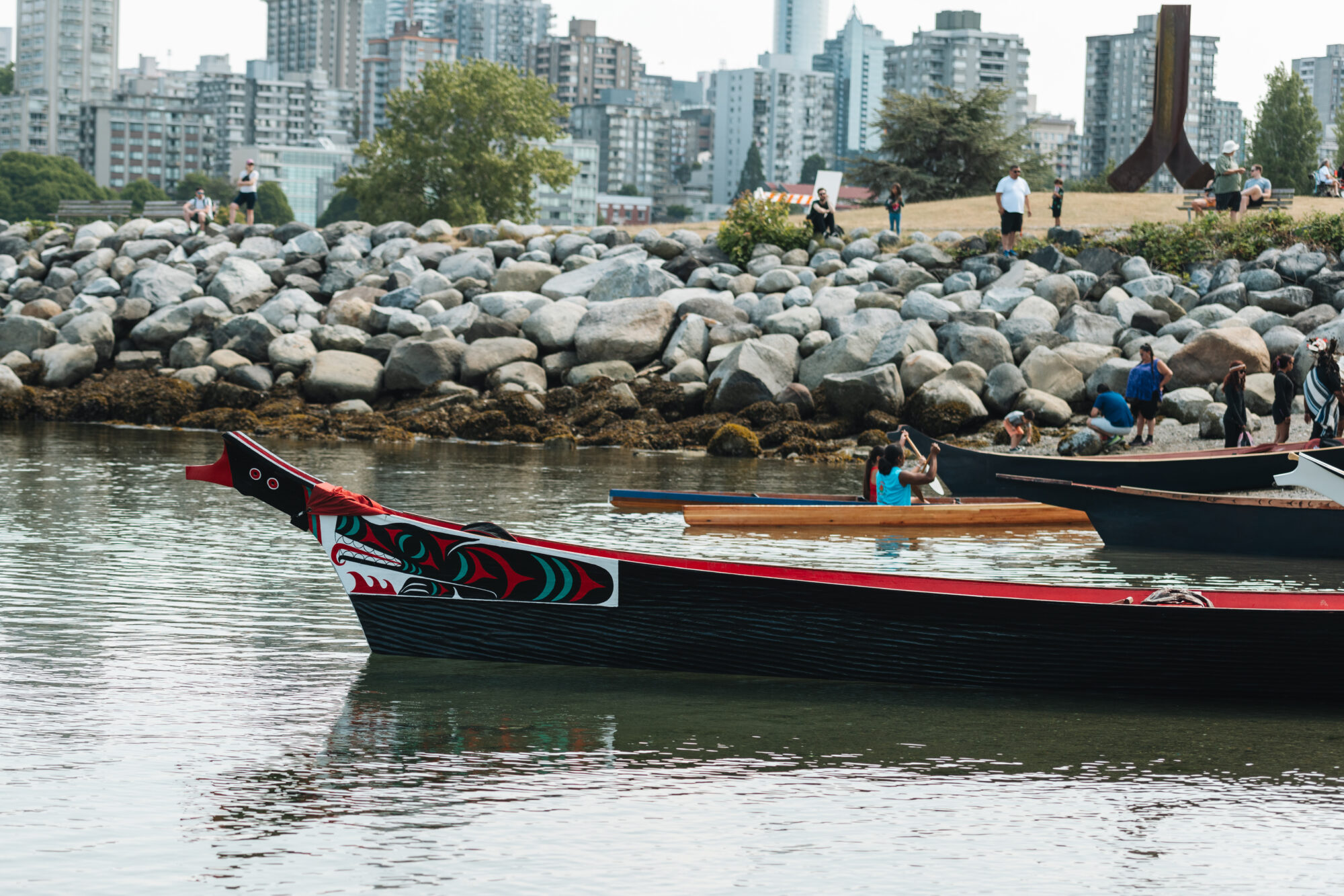
Central to understanding these traditional harvesting maps is the profound reverence for Ts’its’apl’. For the Squamish Nation, cedar is not merely a tree; it is the "Tree of Life," providing everything necessary for physical and spiritual sustenance. Its bark was woven into clothing, baskets, and mats. Its wood was carved into monumental longhouses, ocean-going canoes capable of navigating the Pacific, tools, and spiritual regalia. Its roots were used for medicine, and its branches for ceremonial purposes.
The traditional harvesting maps, therefore, weren’t just about where to find cedar, but how to harvest it sustainably, respectfully, and in a way that ensured its abundance for future generations. They outlined specific areas for bark stripping, plank harvesting, and canoe tree selection. They incorporated knowledge of tree health, seasonal cycles, and the spiritual protocols necessary before taking from the land. These maps were dynamic land management plans, predating modern forestry by millennia, based on intimate ecological knowledge and a reciprocal relationship with nature.

The Maps as Living Archives: Beyond Cartography
To truly appreciate this "location," one must understand the nature of these maps. Unlike the static, property-line-driven maps of colonial powers, Squamish Nation traditional maps were:
- Oral and Experiential: Passed down through stories, songs, and direct mentorship in the forest. Elders taught youth by walking the land, pointing out specific trees, groves, and culturally modified trees (CMTs) – scars left on cedars from bark stripping or plank removal generations ago, still visible today. These CMTs are living proof of the maps’ accuracy and the Nation’s long-term presence.
- Resource-Focused: They highlighted areas rich in specific resources – not just cedar, but also berry patches, fishing spots, hunting grounds, and medicinal plant locations. They were comprehensive guides to sustainable living.
- Spiritual and Sacred: Certain areas were known as sacred sites, ceremonial places, or burial grounds, interwoven with the harvesting routes. The act of harvesting itself was often accompanied by prayer and ceremony, reflecting the spiritual reverence for Ts’its’apl’.
- Territorial and Jurisdictional: While not delineating rigid borders in the Western sense, they communicated the traditional territories of families and communities, emphasizing shared responsibilities and rights to resources.
- Dynamic and Adaptive: They evolved with changing environmental conditions, population needs, and inter-community relationships. This adaptability ensured resilience and long-term sustainability.

Today, these traditional maps are invaluable in modern land-use planning, land claims, and reconciliation efforts. They provide irrefutable evidence of the Squamish Nation’s continuous occupation and stewardship of their territory, challenging colonial narratives and informing contemporary conservation strategies.

Experiencing the Cedar Forests Today: A Traveler’s Guide to Respectful Engagement
For the modern traveler, "reviewing" this location means immersing oneself in the remaining cedar forests within the Squamish Nation’s traditional territory, not as a passive observer, but as a respectful guest.
What to See and Do:
- Hike the Ancient Groves: Seek out trails known for their old-growth cedar. While specific named trails might change, many routes around Squamish offer glimpses into these magnificent forests. Look for towering cedars, some thousands of years old, their trunks gnarled and their branches reaching skyward like ancient sentinels. The sheer scale and presence of these trees are awe-inspiring.
- Identify Culturally Modified Trees (CMTs): With a keen eye and respectful awareness, you might spot CMTs. These are often cedars with long, vertical strips missing from their bark, or rectangular cuts where planks were removed. These marks are not damage but historical signatures, testaments to generations of sustainable harvesting. Do not touch or disturb them.
- Visit the Squamish Lil’wat Cultural Centre (in nearby Whistler): While not in Squamish, this centre is an essential stop for understanding the Squamish and Lil’wat Nations’ cultures, including the significance of cedar. It provides context, art, and stories that enrich any visit to the territory. Consider this a crucial part of "mapping" your understanding.
- Engage with Indigenous Tourism: Where available, seek out Squamish Nation-led tours or experiences. These offer authentic insights directly from the people whose ancestors created and lived by these maps.
- Practice Forest Bathing (Shinrin-Yoku): The deep tranquility of these cedar forests is perfect for mindful immersion. Slow down, breathe deeply, and allow the forest to envelop your senses. The scent of cedar is not just pleasant; it’s grounding and deeply connected to well-being.
- Paddle the Waters: If you have the opportunity to kayak or canoe Howe Sound or local rivers, remember that these waterways were once the highways for cedar canoes, connecting communities and resource sites mapped out by generations.
Why This "Place" is Special: Beyond Scenic Beauty
This "location" is more than just beautiful scenery; it is a profound journey into cultural heritage, ecological wisdom, and the enduring spirit of a people.
- A Living History Lesson: Every giant cedar, every moss-covered boulder, every whisper of the wind carries the weight of millennia of Squamish Nation history. It’s a place where you can tangibly feel the connection between the past and the present.
- A Masterclass in Sustainability: The traditional cedar harvesting maps represent an indigenous model of land management that prioritizes balance, respect, and long-term sustainability – lessons desperately needed in our modern world.
- A Call to Reconciliation: Visiting these areas with an awareness of their true history and the ongoing presence of the Squamish Nation transforms a simple nature walk into an act of reconciliation and respectful engagement. It encourages visitors to acknowledge whose traditional territory they are on and to support Indigenous self-determination.
- Spiritual Resonance: There’s an undeniable spiritual power to these ancient cedar forests. They evoke a sense of timelessness, resilience, and profound connection to the earth that is deeply moving.
Responsible Travel: Being a Good Guest
When exploring these areas, remember you are on the unceded traditional territory of the Squamish Nation.
- Acknowledge and Respect: Begin by acknowledging the Squamish Nation as the traditional custodians of the land.
- Leave No Trace: Stick to marked trails, pack out everything you pack in, and leave nature undisturbed. This includes not touching or damaging CMTs.
- Educate Yourself: Learn about the Squamish Nation, their culture, history, and current initiatives. Resources like the Squamish Nation website are excellent starting points.
- Support Local and Indigenous Businesses: Where possible, direct your tourism dollars to Indigenous-owned enterprises.
- Be Mindful: Be aware of your surroundings, listen to the sounds of the forest, and respect its quietude.
In conclusion, a review of the "location" related to Squamish Nation traditional cedar harvesting maps is not about a single point on a map. It’s an invitation to experience a vibrant cultural landscape, to walk among giants that have witnessed generations of stewardship, and to understand the profound wisdom embedded in the Squamish Nation’s relationship with Ts’its’apl’. It is an experience that promises not just breathtaking natural beauty, but a deep, transformative connection to history, culture, and the very essence of life itself. Come with an open heart and a willingness to learn, and these ancient cedar forests, guided by the wisdom of the maps, will reveal their profound secrets.
