The Southern Ute Indian Tribe Reservation Map: A Cartographic Chronicle of Resilience and Identity
The Southern Ute Indian Tribe Reservation map is far more than a geographical delineation; it is a living document, a testament to enduring identity, a canvas painted with centuries of history, resilience, and an unbreakable connection to the land. For the curious traveler and the earnest history enthusiast, understanding this map offers a profound entry point into the narrative of the Ute people – the Nuche, "The People" – who have shaped and been shaped by the rugged, beautiful landscapes of the American Southwest for millennia. This article delves into the historical layers and cultural significance embedded within the Southern Ute reservation map, providing a crucial context for appreciating its contemporary reality.
The Landscape as Identity: A Pre-Colonial Tapestry
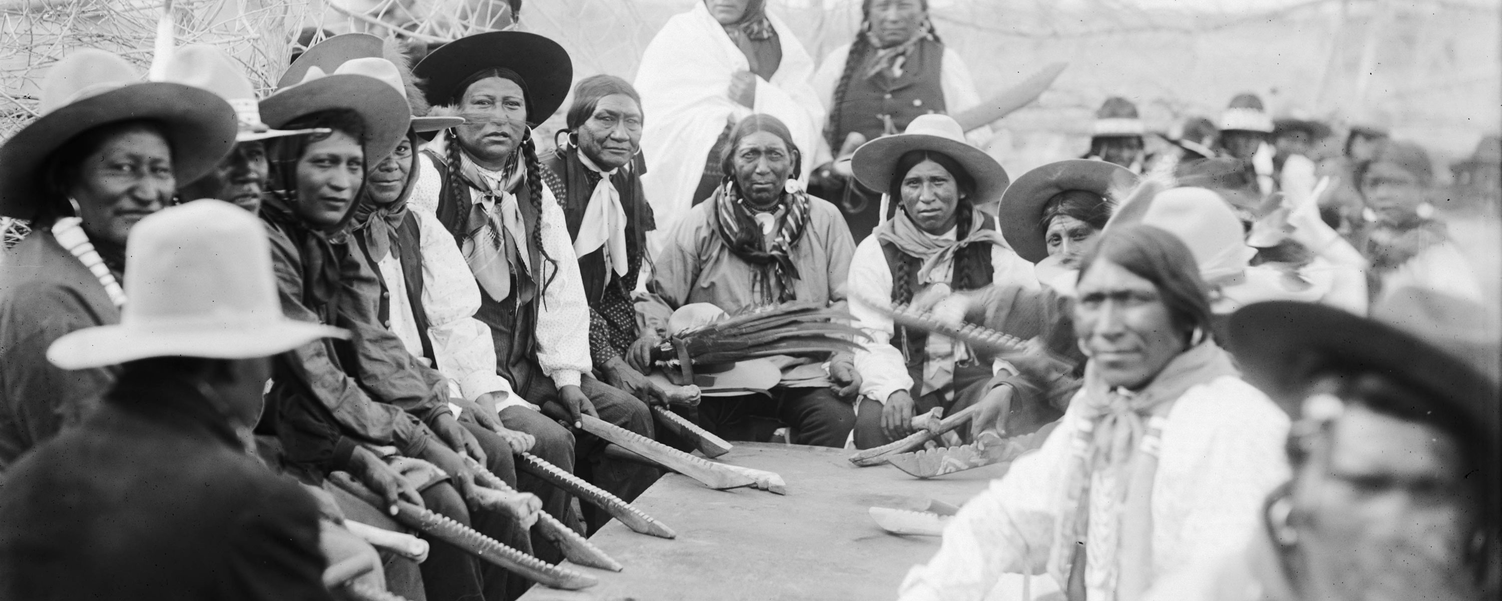
Before lines were drawn on paper by distant governments, the Ute people thrived across a vast territory encompassing much of present-day Colorado, Utah, northern New Mexico, and parts of Wyoming and Arizona. They were, and remain, the "People of the Shining Mountains," intrinsically linked to the towering peaks, verdant valleys, and high deserts of the Rocky Mountains. This expansive domain, defined by seasonal movements and rich natural resources, was their identity. The San Juan Mountains, the rivers that flowed from them – the Animas, the Los Pinos, the Florida – and the diverse ecosystems provided everything needed for a nomadic hunter-gatherer existence.

Ute culture was deeply interwoven with this land. Their oral traditions, spiritual beliefs, hunting practices, and social structures were all dictated by the rhythms of the seasons and the availability of game and plant resources. They were skilled horsemen, their lives transformed by the arrival of horses in the 17th century, which facilitated hunting bison and engaging in trade and defense across their vast traditional territories. Their interactions with neighboring tribes, including the Navajo, Pueblo peoples, Apache, and Shoshone, were a complex mosaic of trade, alliances, and occasional conflict, all occurring within the boundless expanse that would later be confined by maps. The current Southern Ute reservation, situated in southwestern Colorado, represents only a fraction of this ancestral domain, yet it remains the spiritual and physical heart of the Southern Ute people.
The Era of Contraction: Treaties, Gold, and Diminishment
The arrival of European-Americans brought an abrupt and devastating shift to the Ute way of life. Spanish explorers and later American settlers viewed the vast Ute lands as ripe for exploitation, particularly after the discovery of gold and silver in the Rocky Mountains. What followed was a series of treaties, each more restrictive than the last, systematically shrinking the Ute land base. These treaties, often signed under duress or misunderstanding, represent a painful chapter of broken promises and forced displacement.
The Treaty of 1868 was particularly significant. It consolidated various Ute bands onto a large reservation covering approximately 15 million acres in western Colorado. However, this peace was short-lived. The insatiable demand for mining lands and agricultural expansion by settlers led to further encroachments. The Ute people were perceived as an obstacle to "progress." Subsequent agreements and congressional acts, driven by intense political pressure from white settlers, further reduced the reservation’s size. By 1873, the Brunot Agreement ceded the mineral-rich San Juan Mountains, a critical blow.

The ultimate fragmentation occurred with the Act of 1880, which dismembered the unified Ute reservation. The Northern Ute bands were removed to Utah, while the Southern Ute bands were left with a narrow strip of land along the Colorado-New Mexico border. This act effectively created the Southern Ute Indian Reservation, though its boundaries and internal structure were still subject to further manipulation. This period marks the transition from a people with vast, open territories to one confined to a specific, shrinking plot on a government-drawn map.
The Checkerboard Map: A Legacy of Allotment
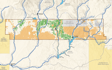
The Southern Ute Reservation map as it exists today is a complex mosaic, often referred to as a "checkerboard" pattern. This intricate design is a direct legacy of the General Allotment Act of 1887, also known as the Dawes Act. This federal policy aimed to assimilate Native Americans by breaking up communal tribal lands into individual allotments, encouraging farming, and dissolving tribal governments. "Surplus" land, beyond what was allotted to individual tribal members, was then opened for settlement by non-Natives.
On the Southern Ute Reservation, this meant that individual tribal members were assigned specific plots of land. Once these allotments were made, millions of acres of "unallotted" reservation land were declared surplus and sold off to non-Native homesteaders. Furthermore, over time, some allotted lands were sold by individual Native owners, or passed out of Native ownership through inheritance to non-Natives. The result is a patchwork of land ownership: tribal trust land (held by the U.S. government for the benefit of the tribe), individual Indian trust allotments, fee simple land owned by individual tribal members, and private fee simple land owned by non-Natives, all intermingled within the external boundaries of the reservation.

This checkerboard pattern creates immense challenges for the Southern Ute Indian Tribe. It complicates resource management, law enforcement jurisdiction, land-use planning, and economic development. For example, a tribal member might own an allotment surrounded by non-Native private land, limiting access or tribal control over adjacent resources. The map, therefore, is not just a picture of land; it’s a visual representation of a century-long struggle for sovereignty and self-determination against a backdrop of imposed fragmentation.
Identity and Governance on the Modern Map
Despite the historical trauma and the complexities of the checkerboard, the Southern Ute Reservation map today represents a thriving, self-governing nation. Centered around the town of Ignacio, Colorado, the tribal headquarters, the reservation is home to a vibrant community committed to preserving its culture while embracing modern economic development.
The Southern Ute Indian Tribe is a federally recognized sovereign nation, meaning it exercises governmental authority over its territory and its members. This sovereignty is crucial to understanding the map. The lines on the map delineate the jurisdictional boundaries within which the tribe operates its own police force, courts, education systems, healthcare facilities, and infrastructure. Tribal enterprises, such as the Sky Ute Casino Resort, Red Willow Production Company (an oil and gas venture), and various agricultural and tourism initiatives, are vital to the tribe’s economic independence and are strategically located within the reservation’s boundaries, reflecting a modern approach to leveraging resources and generating revenue for tribal programs and services.
The Southern Ute Cultural Center and Museum, located in Ignacio, stands as a beacon of cultural preservation and education. Its presence on the map signifies the tribe’s commitment to sharing its rich history, language, and traditions with both its members and the wider public. Annual events like the Bear Dance and the Sun Dance, while not explicitly marked on a map, are deeply tied to specific locations and the overall landscape of the reservation, reinforcing the spiritual connection to the land that transcends legal boundaries.
Visiting the Southern Ute Reservation: Respect and Understanding
For the traveler and history enthusiast, the Southern Ute Reservation offers a unique opportunity for educational and respectful engagement. It is essential to approach a visit with an understanding of the historical context and a deep respect for tribal sovereignty and culture.
- Cultural Center & Museum: A visit to the Southern Ute Cultural Center and Museum in Ignacio is highly recommended. It provides an immersive experience into Ute history, art, and contemporary life, offering crucial context for understanding the reservation’s past and present.
- Respect Private and Tribal Lands: Remember the checkerboard. Much of the land within the reservation boundaries is private property (both Native and non-Native) or tribal trust land. Always respect "No Trespassing" signs and seek permission before entering any land that is not clearly designated as public access or part of a tribal enterprise open to visitors.
- Support Tribal Businesses: Engage with the local economy by supporting tribal-owned businesses, including the Sky Ute Casino Resort, gas stations, or local shops.
- Outdoor Recreation: Opportunities for outdoor activities like fishing, hiking, and camping may exist on certain parts of the reservation. Always inquire about permits and regulations through the tribal government or relevant departments before engaging in such activities.
- Cultural Sensitivity: Be mindful and respectful of local customs and traditions. Photography may be restricted in certain areas or during specific cultural events.
Conclusion: A Map of Enduring Spirit
The Southern Ute Indian Tribe Reservation map is not merely a static representation of land; it is a dynamic narrative of struggle, adaptation, and enduring identity. It tells a story of a people who have faced immense challenges – forced relocation, land loss, and cultural assimilation attempts – yet have maintained their distinct identity, their connection to their ancestral lands, and their sovereign right to self-governance. For those seeking to understand the true spirit of the American West, engaging with this map and the living history it represents is an indispensable journey. It is an invitation to move beyond simplistic lines on paper and to appreciate the profound resilience of the Nuche, the People of the Shining Mountains, who continue to thrive on their ancestral homeland.

