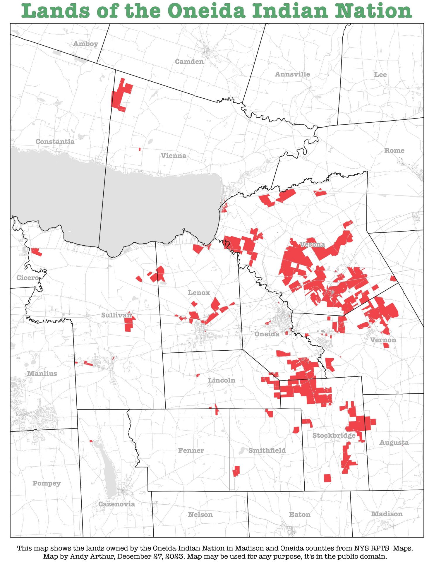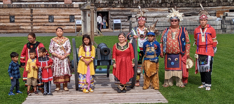
To truly understand the Oneida Nation of New York, one must look beyond contemporary boundaries and delve into the intricate tapestry of their historical lands. A map depicting the ancestral territories of the Oneida is not merely a geographic representation; it is a living document, a testament to identity, sovereignty, resilience, and an enduring connection to the earth. For travelers and history enthusiasts, exploring this map offers a profound entry point into the rich cultural heritage and complex past of one of the original nations of the Haudenosaunee (Iroquois) Confederacy.
The Pre-Colonial Landscape: A Living Map of Prosperity
Before European contact, the Oneida Nation’s ancestral lands spanned a vast and fertile region of what is now central New York State. This pre-colonial map would have shown a territory stretching from the eastern shores of Oneida Lake, encompassing its entire length and the surrounding watersheds, eastward towards the Mohawk River, and south into the Susquehanna headwaters. It was a land of verdant forests, teeming with game – deer, bear, beaver, and fowl – and a labyrinth of waterways that served as both travel routes and abundant fishing grounds. The iconic Oneida Lake, known as Tsia’skö:n (white stone) or Oneyotea Oka (standing stone place) in their language, was the heart of their domain, a spiritual and economic nexus.
The Oneida, like their Haudenosaunee brethren, were skilled agriculturalists. Their "three sisters" – corn, beans, and squash – formed the bedrock of their diet and culture, cultivated in clearings along riverbanks and lake shores. Their villages, often palisaded for defense, were strategically located, interconnected by well-trodden trails. This pre-colonial map, while not drawn with colonial precision, would have been etched in the minds of the Oneida people through generations of use, ceremony, and oral tradition. It represented a holistic understanding of their world, where every stream, hill, and forest held cultural and spiritual significance, defining their very identity as the "People of the Standing Stone." The "Standing Stone," a sacred glacial erratic, was not just a landmark but a symbol of their strength and steadfastness, deeply tied to their origin story and the foundation of their nation. Within the Haudenosaunee Confederacy, the Oneida were considered one of the "Younger Brothers," holding a crucial position in the Great Law of Peace, often acting as arbitrators or providing council.

The Dawn of Contact and Shifting Alliances (17th-18th Century)
The arrival of European powers – the Dutch, French, and English – fundamentally altered the geopolitical landscape of North America and, consequently, the Oneida’s traditional map. Initially, these interactions were primarily economic, centered on the lucrative fur trade. The Oneida, strategically positioned between the burgeoning colonial settlements and other Indigenous nations, became key players in these early exchanges. However, with European presence came new diseases, technologies, and, most significantly, escalating conflicts over land and resources.
The 17th and early 18th centuries saw the Haudenosaunee Confederacy embroiled in the "Beaver Wars," a series of conflicts primarily with the Huron and other Algonquian nations, driven by control over the fur trade. While these wars expanded Haudenosaunee influence, they also introduced new pressures and vulnerabilities. The subsequent French and Indian War (1754-1763), a proxy conflict between Britain and France, further complicated allegiances. The Oneida, like other Haudenosaunee nations, found themselves navigating a perilous path, attempting to preserve their sovereignty and lands amidst competing colonial empires. While often maintaining neutrality or playing a delicate balancing act, the encroaching colonial presence meant that the idea of their land — as an undivided, sovereign domain — began to be challenged by European concepts of ownership, deeds, and surveyed boundaries.
The American Revolution: A Divided Confederacy, An Enduring Oneida

The American Revolutionary War (1775-1783) stands as a pivotal and tragic chapter in Oneida history, dramatically reshaping their territorial map and their relationship with the nascent United States. Unlike the majority of the Haudenosaunee Confederacy, who sided with the British, the Oneida (along with a significant portion of the Tuscarora) chose to ally with the American colonists. This decision was not made lightly. It stemmed from a complex mix of factors, including long-standing relationships with certain colonial figures, diplomatic efforts by American representatives, and a desire to maintain their distinct identity and autonomy.
The consequences of this alliance were profound. The war brought devastation to Oneida lands. Their villages were destroyed, their fields burned, and their people displaced. Yet, their contribution was invaluable to the American cause. Oneida scouts, warriors, and strategists provided crucial intelligence and military support, often fighting alongside figures like George Washington and Marquis de Lafayette. Their loyalty was acknowledged by the Continental Congress, and promises were made regarding the protection of their lands.
However, the war also created an irreparable rift within the Haudenosaunee Confederacy, shattering centuries of unity under the Great Law of Peace. The "map" of the Confederacy, once a contiguous expanse of allied nations, became fragmented, a wound that would take generations to heal. For the Oneida, while their alliance earned them a unique (albeit temporary) position with the new American government, it also marked the beginning of intense pressure on their ancestral lands from a victorious and land-hungry population.
Post-Revolutionary War: Treaties, Cessions, and Dispossession

The period immediately following the American Revolution saw the most dramatic and rapid reduction of the Oneida’s historical lands. Despite their alliance and the promises made, the Oneida faced an unrelenting wave of land speculation and settler encroachment. The federal government, under the Articles of Confederation and later the Constitution, often struggled to assert its authority over individual states, particularly New York, which viewed Indigenous lands within its borders as its own to claim and sell.
A series of coercive treaties, often orchestrated by New York State, systematically chipped away at the Oneida’s vast domain.
- Treaty of Fort Stanwix (1784): While establishing boundaries for other Haudenosaunee nations, it also set the stage for future land cessions.
- Treaty of Fort Schuyler (1788): This state-level treaty, signed under duress, saw the Oneida cede millions of acres to New York, retaining only a fraction of their original territory. The language of the treaty was often deceptive, and the Oneida were frequently denied proper legal representation or fair compensation.
- Treaty of Canandaigua (1794): Signed between the Haudenosaunee and the United States, this federal treaty aimed to establish peace and confirm the boundaries of remaining Haudenosaunee lands. While it theoretically protected the Oneida’s remaining territory, New York State often disregarded federal authority, continuing its aggressive land acquisition policies.

By the early 19th century, the Oneida’s ancestral map had shrunk from millions of acres to a mere fraction, fragmented into smaller, isolated "reservations" – a term that itself speaks to a confinement previously unknown. The vibrant, interconnected landscape of their ancestors was being systematically dismantled and replaced by a grid of colonial farms and towns. This period of rapid dispossession was a profound assault on Oneida identity, as their connection to the land was not merely economic but spiritual, cultural, and political. Losing land meant losing the physical manifestation of their history, their ceremonies, and their very way of life.
The Era of Removal and Fragmentation (19th Century and Beyond)
The pressure did not cease. The 19th century witnessed the broader "Indian Removal" policies of the United States, which, while primarily targeting nations in the Southeast, had a profound impact on the Oneida. Faced with dwindling land, cultural assimilation pressures, and continued encroachment, segments of the Oneida Nation made the difficult decision to relocate.
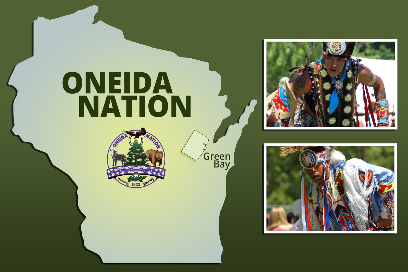
- Wisconsin Oneida: In the 1820s and 1830s, a significant portion of the Oneida Nation, seeking to escape the oppressive conditions in New York, migrated westward to what is now Green Bay, Wisconsin. They established a new community, adapting to a different environment while striving to maintain their cultural heritage.
- Thames Oneida (Ontario, Canada): Another group migrated north to Ontario, Canada, settling near the Thames River. This community, too, sought refuge from American expansion and the loss of their traditional lands.
This period resulted in the fragmentation of the Oneida Nation into three distinct, federally recognized communities: the Oneida Nation of New York, the Oneida Nation of Wisconsin, and the Oneida Nation of the Thames in Ontario. For those who remained in New York, their map became even smaller, reduced to a few hundred acres by the mid-19th century. Yet, despite immense hardship, a core group of Oneida people steadfastly refused to leave their ancestral homelands, maintaining a continuous presence in New York. Their resilience in the face of such overwhelming odds is a testament to the depth of their connection to their land and their identity.
Modern Revival and Reclaiming Identity (20th-21st Century)
The 20th century, particularly its latter half, marked a turning point for the Oneida Nation of New York. From a small, landless community struggling to survive, they embarked on a remarkable journey of cultural revitalization, economic self-sufficiency, and the reclamation of their sovereign rights. This modern "map" is not about vast territorial expansion but about the reassertion of inherent sovereignty within their ancestral footprint.
A crucial aspect of this revival has been the pursuit of land claims. The Oneida Nation of New York initiated landmark legal battles, arguing that the land cessions orchestrated by New York State in the late 18th and early 19th centuries were illegal under federal law, specifically the 1790 Nonintercourse Act, which required congressional approval for any land transfers from Native American nations. While these legal battles have been long and complex, they have brought national attention to the historical injustices faced by the Oneida.
Economic development, most notably the establishment of the Turning Stone Resort Casino in 1993, has been a cornerstone of their modern sovereignty. This enterprise, while sometimes controversial, has provided the Oneida Nation with the financial resources to rebuild their community, invest in education, healthcare, infrastructure, and cultural programs. It represents a practical manifestation of their self-determination, allowing them to shape their own future on their own terms.
Today, the map of the Oneida Nation of New York reflects this resurgence. While their land base is still relatively small compared to their ancestral territory, it is growing through strategic land purchases and the assertion of sovereign jurisdiction. More importantly, this land is not merely property; it is a foundation for the revitalization of their language (Oneida), traditional ceremonies, governance, and educational initiatives. Cultural centers, museums, and educational programs are actively preserving and promoting Oneida history and identity for future generations. The map now includes symbols of their modern achievements, intertwined with the echoes of their ancient past.
Conclusion: The Map as a Living Document
The historical lands map of the Oneida Nation of New York is far more than a static image of geographic boundaries. It is a dynamic narrative, illustrating a journey from pre-colonial abundance and sovereignty, through periods of colonial encroachment, devastating warfare, and systematic dispossession, to a modern era of resilience, self-determination, and cultural revival.
For the traveler and the student of history, understanding this map means understanding the profound and enduring connection between a people and their land. It means recognizing the injustices of the past, appreciating the tenacity of the Oneida people, and acknowledging their ongoing contributions to the fabric of New York State and the nation. Visiting the Oneida Nation today, engaging with their history, and witnessing their vibrant culture offers a powerful lesson in resilience and the enduring spirit of identity. The map, in its various historical iterations, continues to be a living testament to the Oneida’s presence – past, present, and future – on their ancestral lands. It reminds us that while physical boundaries may shift, the spirit of a people, rooted in their heritage and homeland, can never be truly erased.
