Ocmulgee Mounds: Decoding Ancient Earth Maps of the Mississippian Heart
Forget the paper maps and GPS coordinates you typically rely on for travel. To truly understand Ocmulgee Mounds National Historical Park in Macon, Georgia, you must learn to read a different kind of map: one carved into the very earth by generations of Native Americans. This isn’t a cartographic representation in the modern sense, but a living, breathing testament to an intricate understanding of space, power, spirituality, and community – a monumental, three-dimensional chronicle of life along the Ocmulgee River over millennia.
As a travel destination, Ocmulgee Mounds offers far more than just a historical site; it presents an immersive journey into the mind of an ancient civilization. It challenges visitors to see the landscape not just as scenery, but as an intentional design, a sacred geometry that mapped out everything from trade routes to celestial alignments. For anyone seeking a deeper connection to American history and a profound understanding of indigenous ingenuity, Ocmulgee is an unparalleled experience.
The Landscape as a Strategic, Spiritual Map

Ocmulgee’s story begins not with a single tribe, but with waves of human habitation dating back 17,000 years to the Paleo-Indian period. However, it was the Mississippian culture, flourishing here from roughly 900 CE to 1200 CE, that left the most dramatic and enduring "maps" on the landscape. They chose this precise location for a reason: positioned on the Fall Line, where the Piedmont plateau meets the Coastal Plain, it offered a wealth of diverse resources, fertile land, and a strategic position on the Ocmulgee River – a natural highway for trade and communication. This geographical advantage was the first layer of their map: a recognition of prime real estate.
The Mississippian people transformed this landscape into a complex urban center, a bustling ceremonial and residential hub that, at its peak, housed thousands. Their "maps" were not drawn but built, sculpted from tons of earth moved by hand, basket by basket. These earthworks defined space, articulated power structures, guided movement, and connected the human world with the cosmos.
Navigating the Great Temple Mound: A Map of Power and Perspective
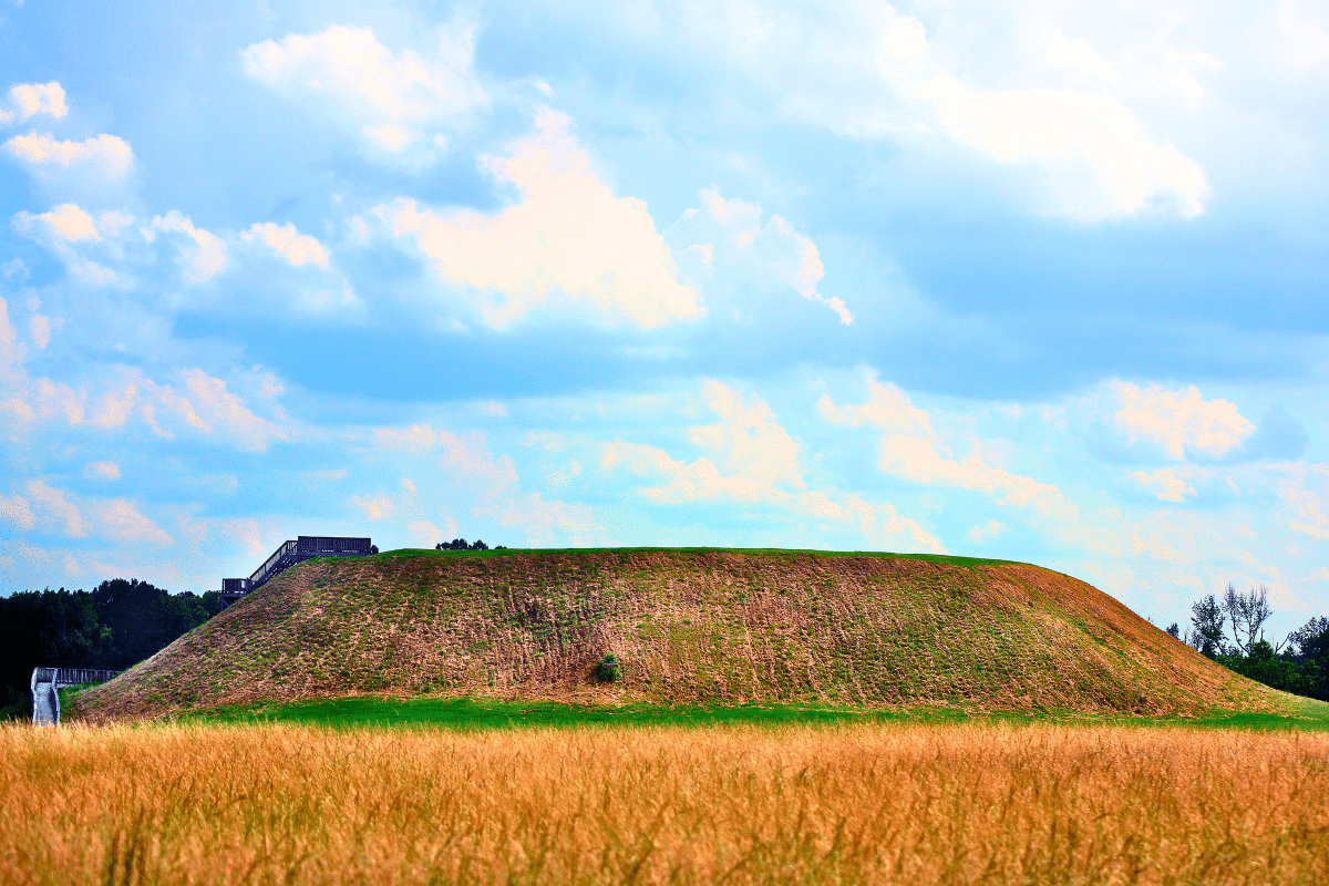
The most dominant feature, and arguably the most explicit "map" of power and social hierarchy, is the Great Temple Mound. Standing over 50 feet tall, its flat top once supported a large temple or chief’s residence, a visual testament to the authority and spiritual connection of those who resided there. Climbing its 146 steps today is not merely an exercise; it’s an act of re-tracing a path of reverence and authority.

From its summit, the view stretches across the vast park, offering a panoramic "map" of the entire Mississippian complex. You can visually trace the outlines of the other mounds, discern the path of the Ocmulgee River, and imagine the sprawling village that once surrounded it. This vantage point reveals the intentional layout: the strategic placement of structures, the relationship between ceremonial spaces, and the defensive capabilities of the plateau. It’s a map of control, of oversight, and of the spatial organization of a thriving community. The very act of ascending and looking out provides an understanding of how the Mississippians likely viewed their world, with the chief at the apex, literally overseeing his domain.
The Earth Lodge: A Map of Community and Cosmos
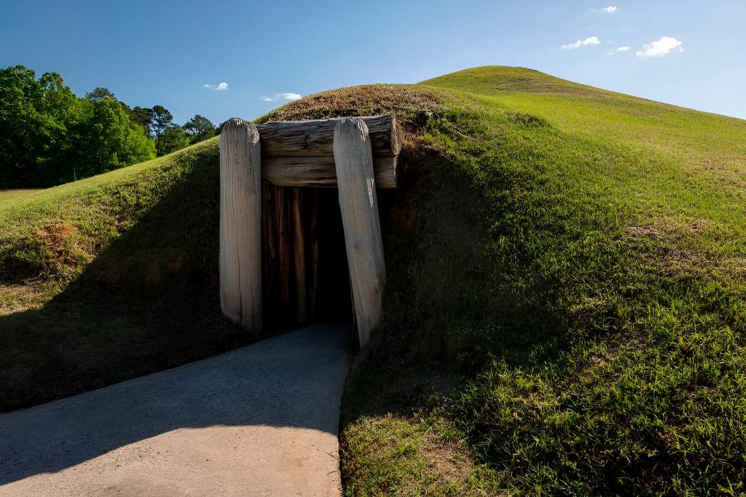
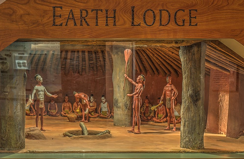
Perhaps the most astonishing and spiritually resonant "map" at Ocmulgee is the Earth Lodge. This partially reconstructed subterranean council chamber, dating to around 1015 CE, is an architectural marvel and a profound statement about community and cosmology. Its circular design, measuring 42 feet in diameter, with a raised clay platform shaped like an eagle or hawk (a revered symbol in Mississippian culture), speaks volumes.
The Earth Lodge served as a gathering place for important decisions, ceremonies, and communal activities. Its very structure is a map of their worldview: the floor representing the earth, the central fire pit representing the heart of the community and the sun, and the smoke hole connecting to the sky world. Critically, an entry passage is precisely aligned with the sunrise during the equinoxes, demonstrating an advanced understanding of celestial mechanics. This alignment isn’t just an architectural detail; it’s a map of time, a calendar, and a connection to the cycles of the sun – vital for agricultural societies.

Inside the cool, dark chamber, with the sounds of the modern world muted, you can almost hear the voices of ancient councils. The 47 seating indentations around the perimeter are a physical map of social order and communal participation. This space mapped out their social interactions, their spiritual beliefs, and their relationship with the cosmos, all within a single, powerful structure.
Funeral Mound and Lesser Mounds: Maps of Memory and Daily Life
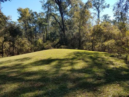
Beyond the grand statements of the Temple Mound and Earth Lodge, other earthworks provide further layers to the Ocmulgee "map." The Funeral Mound, a smaller, conical mound, served as a burial place for important individuals. It’s a map of memory, lineage, and spiritual continuity, marking the presence of ancestors within the landscape. The very act of interring the dead within the earth reinforced the connection between the people, their land, and the cycle of life and death.
The presence of numerous Lesser Mounds across the plateau and floodplain, once topped with residences, workshops, or smaller ceremonial structures, forms a detailed map of daily life. These mounds demarcated family units, clan territories, and functional areas within the larger village. They reveal the spatial organization of domesticity, craftsmanship, and local governance, showing how an entire society was physically structured.
The Trading Post and Beyond: Maps of Exchange and Transition
Ocmulgee’s significance didn’t end with the Mississippian decline. Its strategic location meant it continued to be a crossroads. The Trading Post Site, a reconstruction of a British trading post from the 1690s, offers a glimpse into a later chapter. This site, though not Native American in origin, highlights how Ocmulgee’s inherent "map" – its prime location for resource access and river travel – continued to attract human activity. It represents a different kind of map: one of colonial expansion, trade networks, and the eventual impact of European contact on indigenous societies.

Even the later presence of a Civil War era trench, still visible on the grounds, speaks to Ocmulgee’s enduring strategic importance, albeit in a tragically different context. These layers of history, built upon the foundation of ancient earthworks, demonstrate how the fundamental "map" of the land persisted through changing eras.
Experiencing the Ancient Maps Today: A Traveler’s Guide
Visiting Ocmulgee Mounds is an active engagement with history. The park is beautifully maintained, offering miles of walking trails that guide you through the various mounds and along the Ocmulgee River.
- Start at the Visitor Center: This is crucial. The museum here provides essential context, artifacts, and interpretive displays that help unlock the meaning of the earthworks. The rangers are incredibly knowledgeable and can offer insights that bring the "maps" to life.
- Walk the Main Loop: The primary trail is a well-marked loop that takes you to the Earth Lodge, Great Temple Mound, and other significant features. Allow at least 2-3 hours for a thorough visit, more if you want to explore all the trails.
- Climb the Mounds: Ascending the Great Temple Mound is non-negotiable. The effort is rewarded with that unparalleled panoramic view and the unique perspective it offers.
- Enter the Earth Lodge: This is a truly special experience. Take your time inside, sit on the benches, and absorb the atmosphere. It’s a place of quiet contemplation and powerful historical resonance.
- Look Beyond the Obvious: As you walk, try to visualize the bustling city that once stood here. Imagine the people, the sounds, the daily life that unfolded around these monumental structures. Consider how the river flowed, how the sun moved across the sky, and how these natural elements informed the "maps" they built.
Practical Considerations for Your Journey:
- Best Time to Visit: Spring and fall offer the most pleasant weather for walking. Summers can be hot and humid, while winters are generally mild but can be chilly.
- What to Bring: Comfortable walking shoes are essential. Bring water, especially in warmer months. Sunscreen and insect repellent are also recommended.
- Accessibility: The visitor center and some main pathways are accessible. However, climbing the Great Temple Mound requires navigating steps, and some trails are unpaved.
- Respect the Site: Remember that this is a sacred and historic place. Stay on marked trails, do not climb on the mounds except where designated, and leave no trace.
- Nearby Attractions: Macon itself is a city rich in history, music (home of the Allman Brothers Band and Otis Redding), and Southern charm. Consider combining your Ocmulgee visit with exploring downtown Macon.
The Enduring Legacy of Earth Maps
Ocmulgee Mounds isn’t just a collection of dirt piles; it’s a profound cultural landscape, a masterwork of ancient engineering and spiritual expression. It’s a place that teaches us to read the land differently, to understand how indigenous peoples viewed their world not through abstract symbols on paper, but through the deliberate shaping of the earth itself.
The Native American "maps" of Ocmulgee speak of continuity, community, power, and a deep connection to the natural world and the cosmos. They are maps that reveal a worldview far removed from our own, yet universally human in their desire to understand, organize, and thrive within their environment. Visiting Ocmulgee is an invitation to step back in time, to walk among giants of history, and to learn how to read the most ancient and enduring maps of all – those etched into the very soul of the land. It’s a journey that will not only inform your understanding of the past but also enrich your perception of the world around you.
