North Dakota’s Enduring Tapestry: A Journey Through Native American Tribes and Their Lands
To truly understand North Dakota is to understand its original inhabitants. The state’s landscape, history, and very identity are inextricably woven with the stories, struggles, and enduring presence of its Native American tribes. Far from being relics of the past, the maps detailing their historical territories and current reservations are living documents, charting centuries of vibrant culture, profound change, and remarkable resilience. This article serves as a guide for the curious traveler and the eager student, delving into the rich tapestry of North Dakota’s Native American nations, exploring their historical footprints, the impact of colonial expansion, and their sovereign presence today.
The Land Before Borders: A Dynamic Pre-Colonial Landscape
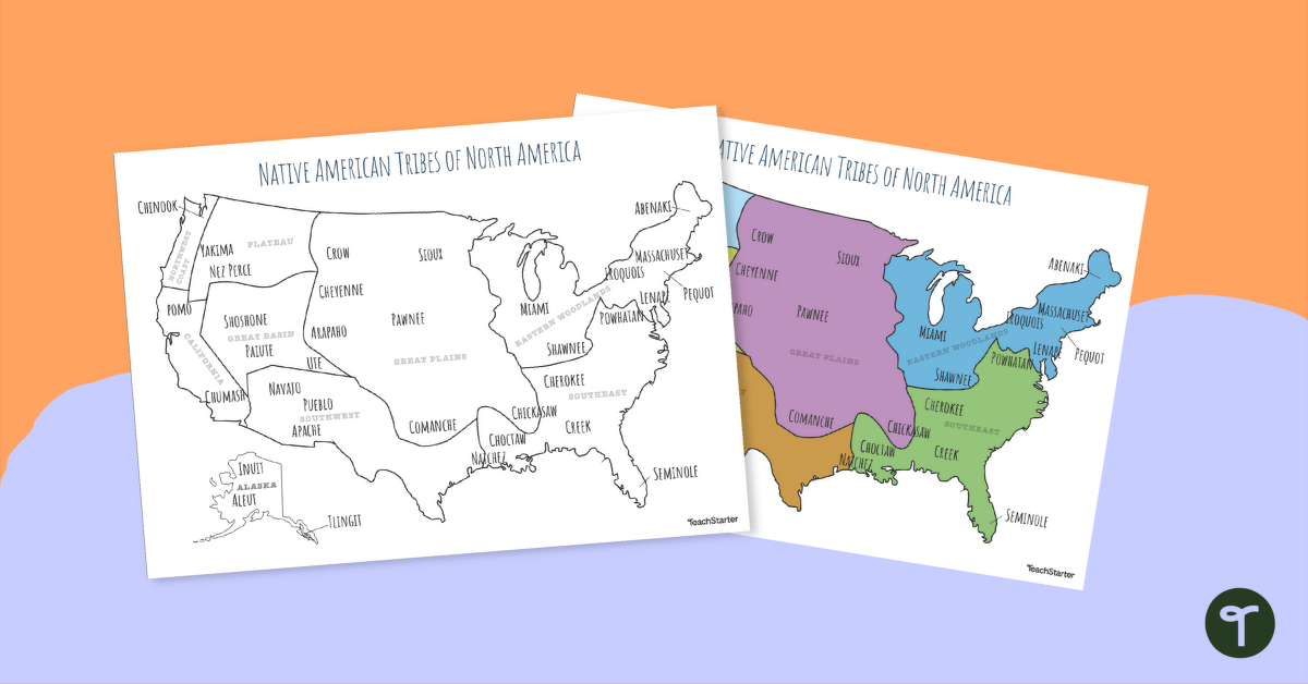
Before the lines of states and counties were drawn, North Dakota was a vast, diverse landscape – from the fertile river valleys of the Missouri and Red Rivers to the rolling prairies and rugged badlands. This land was not empty; it was a complex network of intertribal territories, hunting grounds, trade routes, and sacred sites. Unlike the rigid boundaries we understand today, pre-colonial tribal territories were often fluid, overlapping, and negotiated through diplomacy, alliance, and sometimes conflict. Seasonal migrations, resource availability, and the ebb and flow of power meant that the "map" was constantly being redrawn by the people who lived it.

Among the earliest documented residents were the Mandan, Hidatsa, and Arikara, often referred to collectively as the Three Affiliated Tribes. They were primarily sedentary, agricultural people, building permanent earthlodge villages along the Missouri River, cultivating corn, beans, and squash, and serving as central hubs for trade across the Great Plains. To their west and south roamed the nomadic Lakota and Dakota (Sioux) bands, master horsemen and buffalo hunters whose expansive territories stretched across the northern plains. In the northeast, the Ojibwe (Chippewa) and their Métis relatives, adapted to a forest and prairie lifestyle, harvested wild rice, hunted, and engaged in extensive fur trade. The Assiniboine, closely related to the Dakota, also held significant historical presence, often sharing or contesting lands with their kin. This dynamic interaction between diverse nations, each with distinct languages, spiritual beliefs, and economic practices, formed the original human geography of what would become North Dakota.
The Missouri River Nations: Mandan, Hidatsa, and Arikara (MHA Nation)
The story of the Mandan, Hidatsa, and Arikara (MHA Nation), now federally recognized as the Three Affiliated Tribes, is one of deep roots and profound resilience. For centuries, their fortified earthlodge villages along the Missouri River were beacons of civilization and trade. Sites like the Knife River Indian Villages National Historic Site offer a tangible glimpse into their sophisticated agricultural practices, intricate social structures, and pivotal role in intertribal commerce. Lewis and Clark famously wintered among the Mandan in 1804-05, a testament to their established presence and influence.
However, contact with Europeans brought devastating consequences, most notably the smallpox epidemics of the 1830s, which decimated their populations. The Mandan, Hidatsa, and Arikara, once numerous and powerful, were forced to consolidate for survival, forming the united entity known as the Three Affiliated Tribes. Their resilience is exemplified by the establishment of Like-a-Fishhook Village in 1845, a final great earthlodge community that preserved their combined cultures.

Today, the MHA Nation governs the Fort Berthold Reservation, a sprawling territory in west-central North Dakota encompassing the vast Lake Sakakawea. The construction of the Garrison Dam in the 1950s, a federal project, flooded 156,000 acres of their most fertile land, forcing the relocation of communities and severing deep cultural ties to the river bottomlands. This immense sacrifice for the national good remains a powerful reminder of the costs borne by Native nations. Despite this, the MHA Nation has emerged as an economic powerhouse, particularly due to the development of oil resources in the Bakken Formation, allowing them to invest in infrastructure, education, and cultural revitalization, asserting their sovereignty and self-determination with renewed vigor.
The Dakota and Lakota (Sioux) Nations: Guardians of the Plains
The terms "Dakota" and "Lakota" refer to distinct dialect groups within the larger Sioux Nation, encompassing numerous bands and tribes. In North Dakota, two prominent sovereign nations represent these peoples: the Spirit Lake Nation (Dakota) and the Standing Rock Sioux Tribe (Lakota and Dakota). Historically, the Dakota and Lakota were the quintessential Plains Indians, known for their nomadic lifestyle, prowess in hunting buffalo, and rich spiritual traditions centered around the Black Hills and other sacred sites. Their traditional territories were vast, extending across the Dakotas, Montana, Wyoming, and into Canada.
The Treaties of Fort Laramie (1851 and 1868) attempted to define the boundaries of the Great Sioux Reservation, a massive tract of land guaranteeing exclusive rights to the Lakota. However, the discovery of gold in the Black Hills, a sacred area to the Lakota, led to broken treaties, military conflicts, and ultimately, the reduction of their land base. The events of the Great Sioux War (1876-77) and the Wounded Knee Massacre (1890) are stark reminders of the brutal history of forced assimilation and land appropriation.

Today, the Spirit Lake Nation occupies a reservation in northeastern North Dakota, centered around the beautiful Devil’s Lake (Mni Wakan). The community works tirelessly to preserve the Dakota language (Dakota Oyate) and traditions, investing in education and economic development.
The Standing Rock Sioux Tribe straddles the North and South Dakota border, with its headquarters in Fort Yates, ND. This reservation is perhaps most recognized globally for the #NoDAPL protests of 2016-2017, where thousands gathered to oppose the Dakota Access Pipeline, which threatened their water supply and sacred sites. This stand became a powerful symbol of indigenous rights, environmental protection, and the ongoing fight for treaty rights and sovereignty, showcasing the deep spiritual and cultural connection the Lakota and Dakota people maintain with their land.
The Woodlands Meet the Plains: Ojibwe (Chippewa) and Métis
In the undulating hills and forests of north-central North Dakota lies the Turtle Mountain Indian Reservation, home to the Turtle Mountain Band of Chippewa Indians and their Métis relatives. The Ojibwe, or Anishinaabe, migrated westward from the Great Lakes region centuries ago, adapting their woodland culture to the prairie environment. They were skilled hunters, trappers, and gatherers, utilizing the abundant resources of the Turtle Mountains and the Red River Valley.
The Métis, a distinct Indigenous people of mixed Cree, Ojibwe, and European (primarily French and Scottish) ancestry, emerged as a vibrant culture in the Red River region, particularly around Pembina. They developed a unique identity, language (Michif), and way of life, playing a crucial role in the fur trade and buffalo hunt. The Métis were often skilled buffalo hunters, forming large expeditions that spanned vast territories. Their historical struggles for recognition and land rights are significant, culminating in the Riel Rebellions in Canada and subsequent dispersal. Many Métis sought refuge and ultimately found a home with the Turtle Mountain Band of Chippewa.
The Turtle Mountain Band of Chippewa is one of the largest tribes in North Dakota by population, maintaining a strong sense of cultural identity through language revitalization programs, traditional arts, and community events. Their location, nestled in the scenic Turtle Mountains, provides a rich environment for hunting, fishing, and outdoor recreation, continuing a legacy of resourcefulness and deep connection to the land.

The Modern Map: Sovereignty, Identity, and the Path Forward
The "Native American tribes map" of North Dakota today is a complex overlay of history, policy, and enduring identity. It showcases four primary sovereign nations: the Fort Berthold Reservation (MHA Nation), the Spirit Lake Nation, the Standing Rock Indian Reservation, and the Turtle Mountain Indian Reservation. These aren’t just tracts of land; they are self-governing nations with their own judicial systems, governments, and inherent sovereignty recognized by treaties and federal law.
Understanding this map means recognizing that Native American identity is not monolithic. Each tribe possesses a distinct history, language, spiritual practices, and contemporary challenges and triumphs. The checkerboard pattern of land ownership within reservations, a legacy of the Dawes Allotment Act of 1887, complicates governance and resource management but also highlights the deep attachment individuals have to their ancestral lands.
Today, these nations are at the forefront of cultural revitalization, working tirelessly to preserve their languages, ceremonies, and oral histories for future generations. They are also vital economic engines for North Dakota, operating casinos, agricultural enterprises, and energy ventures, contributing significantly to the state’s economy while striving for self-sufficiency and greater control over their destinies. Their voices are increasingly heard in state and national policy, advocating for environmental protection, social justice, and the recognition of treaty rights.
For the Traveler and Learner: Engaging with Respect
For those seeking to explore North Dakota’s rich Native American heritage, the journey offers profound rewards. When visiting reservations or tribal lands, remember that you are entering sovereign nations. Approach with respect, curiosity, and an open mind.
- Visit Cultural Centers and Museums: Many reservations host excellent museums and cultural centers that provide invaluable insights into their history, art, and contemporary life. The MHA Interpretive Center at New Town, the Standing Rock Visitor Center, and the Turtle Mountain Heritage Center are excellent starting points.
- Attend Powwows (with permission and etiquette): Powwows are vibrant celebrations of Native American culture, dance, music, and community. If you are fortunate enough to attend, observe proper etiquette: ask before taking photos, respect sacred ceremonies, and follow any instructions given by organizers.
- Support Tribal Businesses: Seek out Native-owned businesses, art, and crafts. Your patronage directly supports tribal economies and artists.
- Learn from Tribal Voices: Prioritize learning directly from tribal members, authors, and historians. Their perspectives offer the most authentic understanding.
- Acknowledge Land: A simple but powerful act is to acknowledge the traditional lands on which you stand, recognizing the Indigenous peoples who have stewarded them for millennia.
The map of North Dakota’s Native American tribes is more than just lines on paper; it is a dynamic story of survival, adaptation, and enduring identity. It challenges us to look beyond simplistic narratives and recognize the vibrant, sovereign nations that continue to shape the state’s past, present, and future. By engaging with this history and supporting these communities, travelers and learners alike can gain a deeper, more meaningful understanding of North Dakota’s true spirit.
