Navigating the Invisible: An Arctic Journey Through Inuit Ancestral Sea Mammal Hunting Maps
Forget your GPS, your satellite imagery, and your meticulously charted coastlines. To truly understand the Arctic, to grasp the profound human connection to its unforgiving yet bountiful waters, you must shed the modern cartographer’s lens and embrace a world navigated by memory, observation, and an unparalleled intimacy with the environment. This is the realm of Inuit ancestral sea mammal hunting maps, and experiencing the landscape they depict is less a trip and more a transformative pilgrimage.
This article reviews the Canadian Arctic, specifically Nunavut, not as a static geographical entity, but as a living, breathing archive of this extraordinary cartographic tradition. It is the definitive "place" where these maps come alive, where the ancient knowledge still resonates in the wind, the ice, and the very rhythm of life.
The Maps: More Than Just Lines on Paper

Before delving into the location, it’s crucial to understand what these "maps" truly represent. They are not the precise, scaled representations we associate with Western cartography. Instead, Inuit ancestral maps are multifaceted expressions of knowledge, vital for survival in one of the planet’s most dynamic and challenging environments.
Primarily, these were mental maps, passed down through generations via oral tradition, stories, and lived experience. Elders carried vast databases of information in their minds: ice patterns, currents, whale migration routes, seal breathing holes, reliable hunting grounds, dangerous shoals, and safe havens. This collective memory was the ultimate survival guide.
Beyond mental maps, there were also physical representations. Isolirijait, or carved maps, were often fashioned from driftwood or bone, depicting coastlines and islands in a tactile, three-dimensional form. These weren’t for precise navigation but rather mnemonic devices, aids for storytelling and knowledge transfer, allowing hunters to "feel" the coastline in their hands, even in the darkest of blizzards. Some were highly detailed, others more symbolic, but all were imbued with practical wisdom. They weren’t just about "where" to go, but "when" and "how" – the nuanced understanding of animal behavior, weather forecasting, and resource availability.
These maps were dynamic, constantly updated by each generation’s observations. They encoded a holistic understanding of the Arctic ecosystem, recognizing that land, sea, ice, weather, and wildlife were inextricably linked. They were maps of life, death, and sustained existence.

The Location: Nunavut – The Living Canvas
Nunavut, the vast and breathtaking Inuit territory of Canada, is the definitive "place" to encounter the legacy of these ancestral maps. Covering over two million square kilometers of land and sea, it is a landscape of monumental silence, stark beauty, and profound power. From the capital of Iqaluit on Baffin Island to remote communities like Pond Inlet, Clyde River, and Arctic Bay, Nunavut offers an unparalleled opportunity to connect with the traditions that shaped these maps.
Why Nunavut is the ultimate review destination:
- Authentic Environment: This is the exact environment that these maps describe. You stand on the shore, gazing out at the same sea ice formations, the same open leads (polynyas), the same mountainous coastlines that Inuit ancestors navigated for millennia. The scale is immense, the conditions can be extreme, and the reliance on intimate environmental knowledge becomes instantly palpable.
- Living Culture: Unlike a museum exhibit that presents a static historical artifact, Nunavut is where the culture that produced these maps continues to thrive. While modern navigation tools are ubiquitous, the underlying principles of observation, respect for the environment, and deep ecological knowledge remain central to Inuit life. You meet the descendants of the mapmakers.
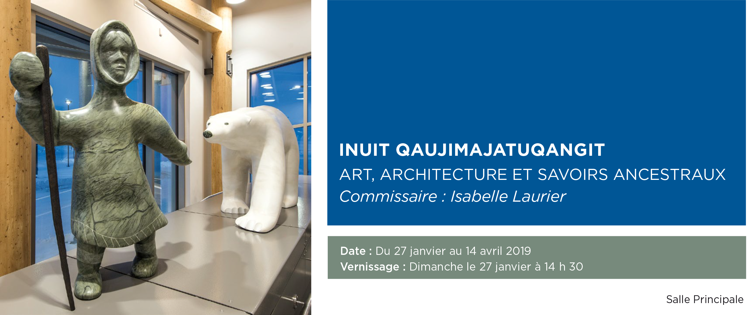
- Accessible Insights: While vast, Nunavut has communities that serve as gateways. Iqaluit, the capital, offers the Nunatta Sunakkutaangit Museum, which often features exhibits on Inuit traditional knowledge, including historical mapping practices and hunting tools. More importantly, it’s a place to connect with local guides and cultural experts.
- Immersive Experience: To truly "review" this location through the lens of ancestral maps, you must engage with it actively. This means venturing out onto the land and sea, ideally with an experienced Inuit guide.

Experiencing the Maps in Modern Nunavut

Your journey to understand these maps won’t be about finding a specific, preserved artifact on display (though museums offer valuable context). It’s about witnessing the spirit of the maps in action and feeling their enduring relevance.
1. Cultural Immersion & Storytelling:
The most profound connection comes through interacting with Inuit elders and local guides. Many communities offer cultural tours, workshops, and opportunities to share stories. Imagine sitting with an elder, listening to tales of their grandparents’ hunting expeditions, hearing how they navigated by the subtle shifts in the wind, the texture of the ice, or the flight patterns of birds. These oral histories are the direct descendants of the mental maps that sustained generations. A good guide won’t just point out landmarks; they’ll interpret the landscape, explaining why a particular bay was favored for seal hunting in spring, or how to identify safe ice for travel.
2. On the Land and Ice: A Hunter’s Perspective:
To truly appreciate the maps, you must step into the environment they depict. Depending on the season, this could involve:
- Winter/Spring Dog Sledding: Traveling by dog sled across frozen fjords and sea ice, you gain an intimate understanding of the terrain. Your guide, often an experienced hunter, will "read" the ice, identifying safe routes, potential hazards, and signs of wildlife. You’ll see how ice hummocks form, how currents create open water, and how the landscape shifts. This direct, sensory experience is a living lesson in the ancestral maps. You’re not just moving; you’re observing, learning to interpret the subtle clues of survival.
- Summer Boat Tours: As the ice recedes, boat tours reveal the open waters where whales, seals, and narwhals feed. Your guide will navigate by a deep understanding of local currents, historical animal migration routes, and a profound knowledge of the coastline. You’ll see firsthand the intricate relationship between land and sea, the choke points for marine mammals, and the strategic locations hunters would have targeted. The sheer scale of the fjords, the towering cliffs, and the vastness of the ocean become the physical representation of those ancient mental charts.
3. Wildlife Observation: The Moving Targets:
The "sea mammal hunting maps" are, by definition, about the animals. Observing polar bears, seals, whales (bowhead, narwhal, beluga), and caribou in their natural habitat offers a direct link to the knowledge embedded in the maps. You’ll learn about their behaviors, their seasonal movements, and their reliance on specific environmental conditions – all information crucial for successful hunting and, by extension, survival. This experience fosters not just awe, but a deep respect for the animals and the hunters who understood them so intimately.
4. The Landscape as a Living Text:
The Arctic itself becomes a living map. The shifting light, the monumental silence broken only by the crack of ice or the cry of a bird, the vast horizons – all contribute to a sensory experience that forces a different kind of perception. You begin to understand how every feature, every nuance of the environment, held critical information for survival. The patterns of snowdrifts, the color of the ice, the direction of a ripple on the water – these were all "data points" on an ancestral map.
The Profound Impact: Beyond Tourism
A journey to Nunavut with the lens of ancestral maps is far more than a typical travel experience. It is a lesson in:
- Sustainability and Resource Management: The maps inherently teach sustainable living. They represent generations of careful observation to ensure resources were managed for future generations, a vital lesson in today’s world.
- Resilience and Adaptability: Witnessing the environment, you gain immense respect for the resilience of Inuit culture, their ability to thrive in extreme conditions through deep knowledge and adaptability.
- Alternative Epistemologies: It challenges Western notions of knowledge and navigation, demonstrating that profound understanding can exist outside of written texts and modern technology. It highlights the power of memory, oral tradition, and embodied knowledge.
- The Fragility of Knowledge: In an era of rapid climate change, the very ice and sea that these maps describe are undergoing unprecedented transformations. This trip underscores the urgency of preserving this traditional knowledge, not just as history, but as a vital tool for understanding our changing planet.
Practicalities for Your Journey
- When to Go: The Arctic seasons dictate accessibility and activities.
- Winter/Spring (March-May): Best for dog sledding, northern lights, and experiencing the vast frozen landscape. Temperatures are cold but often sunny.
- Summer (July-August): Best for boat tours, wildlife viewing (whales, seabirds), and hiking as the ice melts.
- Logistics: Nunavut is remote and travel is expensive. Fly into Iqaluit (YFB) from Ottawa (YOW) or Montreal (YUL). From Iqaluit, smaller regional airlines connect to other communities.
- Accommodation: Hotels are available in larger communities, guesthouses and B&Bs in smaller ones. Book well in advance.
- Guides: Absolutely essential. Book local Inuit guides through reputable tour operators. Their knowledge is invaluable for safety and cultural insight. This is not a place for independent, unguided exploration.
- What to Pack: Layers, layers, layers! Extreme cold weather gear (even in summer, for boat trips), waterproof outerwear, sturdy boots, hat, gloves, and sun protection (the sun reflects intensely off snow/ice).
- Respectful Travel: Always ask permission before taking photos of people. Be open, listen, and learn. Support local businesses and artisans. Understand that you are a guest in a vibrant, living culture.
Conclusion: A Map for the Soul
A journey into Nunavut, guided by the legacy of Inuit ancestral sea mammal hunting maps, is not just a review of a place; it’s a profound exploration of human ingenuity, resilience, and an unparalleled connection to the natural world. It peels back the layers of modern convenience to reveal a deeper, more elemental way of knowing and being.
You won’t leave with a new paper map, but you will leave with a new mental map – one that charts a course not just across physical space, but through history, culture, and a revitalized understanding of our place within the delicate balance of the planet. It’s a review of an experience that will challenge your perceptions, humble your spirit, and leave an indelible mark on your soul. This is the Arctic, not as a blank space on a globe, but as a vibrant testament to the enduring wisdom of its original navigators.

