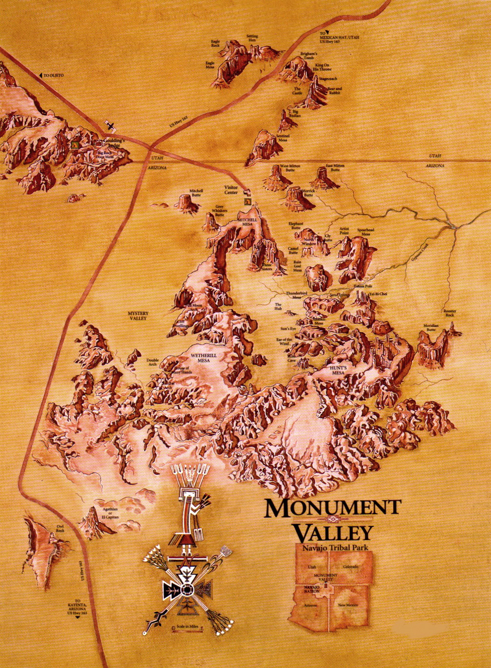
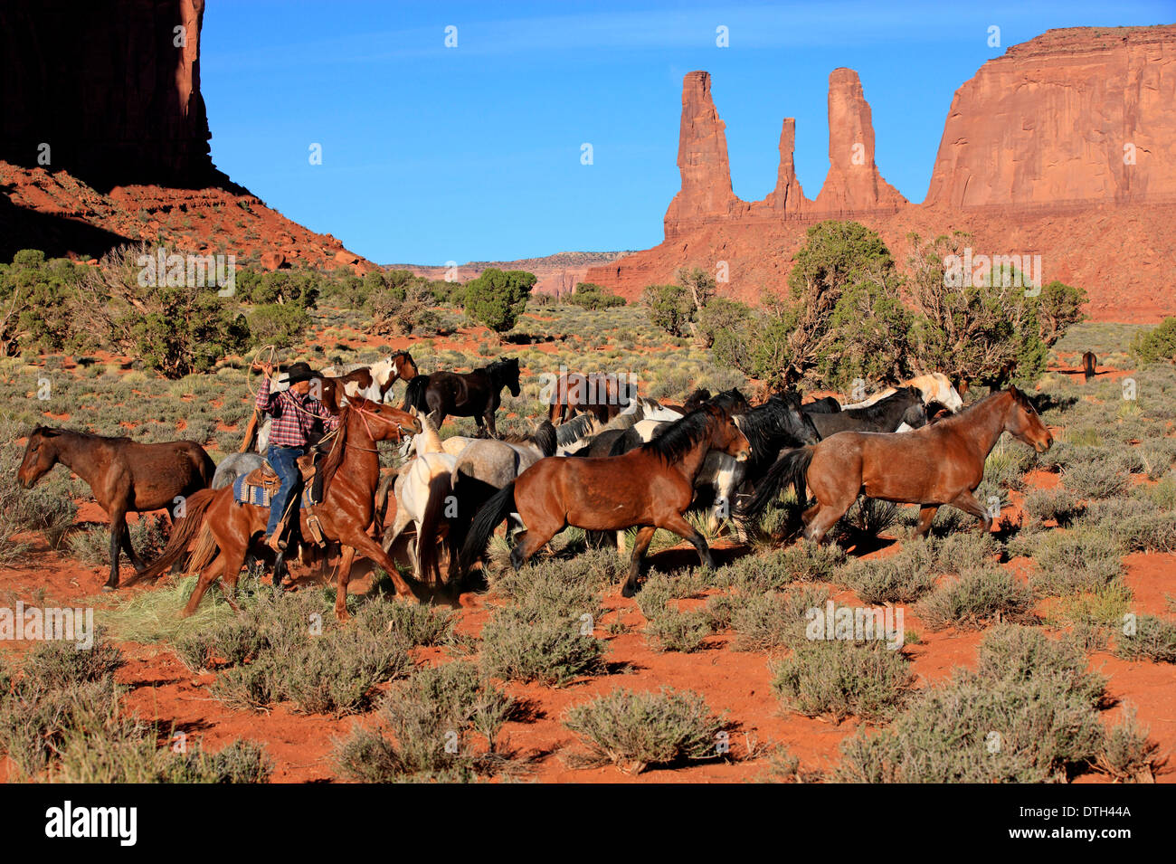
Monument Valley isn’t just a landscape; it’s a living archive, a vast, sculpted testament to millennia of human experience, etched not just in sandstone but in the collective memory of the Navajo people. To speak of "Native American maps of Monument Valley" is to move beyond the cartographic conventions of lines on paper and delve into a profound, multi-sensory understanding of place – a knowledge system passed down through oral tradition, ceremony, song, and an intimate connection with every mesa, every butte, every arroyo. Visiting Monument Valley with this understanding is not merely a sightseeing trip; it’s an immersive journey into a worldview where the land itself is the ultimate map, detailed and alive.
From the moment you enter Monument Valley Navajo Tribal Park, the sheer scale is overwhelming. Giant sandstone sentinels, painted in hues of ochre, rust, and deep vermilion, rise dramatically from the desert floor. The iconic Mittens, Merrick Butte, and Elephant Butte stand as silent, majestic guardians, instantly recognizable from countless films and photographs. But what do these formations truly mean? A modern map will tell you their names, their elevation, their position. A Native American map, however, reveals their stories, their spiritual significance, their role in survival, and their place in the ongoing narrative of the Diné (Navajo) people.
This indigenous mapping isn’t about GPS coordinates; it’s about navigating by story, by water sources remembered through generations, by star patterns observed from specific vantage points, by the migratory routes of game, and by the sacred echoes of ceremonies performed at particular sites. It’s a holistic understanding where geography, history, spirituality, and practical survival are inextricably linked. When a Navajo elder recounts a story about a specific rock formation, they are not just telling a tale; they are imparting a navigational beacon, a historical marker, a moral lesson, and a spiritual guidepost. The land itself is the mnemonic device, a vast, open-air library.
To truly access these "maps," a guided tour with a local Navajo guide is not merely recommended; it is absolutely essential. The self-guided scenic drive, while offering breathtaking vistas, only scratches the surface. It allows you to see Monument Valley, but a Navajo guide enables you to feel and understand it. Our guide, a soft-spoken woman whose family has lived in this valley for generations, transformed the landscape before our eyes. She didn’t just point out landmarks; she brought them to life.

As we ventured deeper into areas inaccessible to private vehicles, past the well-trodden loop, she spoke of the "Three Sisters" – not just a trio of spire-like formations, but three women forever watching over the valley, their presence a constant reminder of protection and resilience. She described how her ancestors would use the distinct shadow patterns cast by the towering buttes at different times of day to tell time, to predict weather, and to know when to move their sheep to different pastures. This was a living sundial, a celestial clock, an agricultural calendar – a sophisticated, integrated mapping system.
She showed us faint petroglyphs, almost invisible to the untrained eye, etched into secluded canyon walls. These weren’t just ancient art; they were records, messages, and perhaps even early forms of cartography, depicting hunting successes, celestial events, or the passage of clans through the area. Each symbol, each image, was a data point on an ancestral map. She explained how certain plants, growing in specific alcoves, were not just flora but pharmacies, their medicinal properties known and mapped out across the vast expanse of the valley. A particular shrub might grow near a seasonal spring, indicating a water source; another might signal the best route to avoid a flash flood zone. These are the details of a map that prioritizes survival and harmony.
Our guide also shared insights into the spiritual topography of the valley. Certain peaks were considered sacred places for prayer and ceremony, their locations known precisely through generations of oral tradition. She spoke of the Wind’s Eye, a natural arch where the wind whispers secrets, and the spirits of ancestors are said to reside. To approach such a place is to tread on sacred ground, and understanding its significance transforms it from a mere geological curiosity into a powerful, living entity. This is a map not just of physical space but of spiritual connection, guiding the individual to their place within the cosmos.
The concept of "Native American maps" also encompasses the migration routes and defensive strategies of the Diné. Our guide spoke of how the rugged terrain, seemingly impassable to outsiders, provided natural fortresses and hidden pathways for her people during times of conflict. She pointed out areas where water could be found even in the driest seasons – often in unexpected places, concealed from invaders but known intimately by those who called this land home. These were tactical maps, honed by necessity and intimate knowledge of every ridge and canyon.

The experience forced us to reconsider our own reliance on modern mapping technologies. While GPS can get us from point A to point B, it rarely tells us why that path is significant, what stories reside there, or what the land truly means to its original inhabitants. In Monument Valley, the native map offers a depth of understanding that no digital interface can replicate. It’s a map that requires active listening, open-hearted observation, and a willingness to learn from those who have been its custodians for millennia.
For those planning a visit, consider the following:
Best Time to Visit: Spring (April-May) and Fall (September-October) offer pleasant temperatures and stunning light for photography, especially at sunrise and sunset when the buttes glow with an ethereal warmth. Summers can be very hot, and winters cold, though less crowded.
Getting There: Monument Valley is remote, located on the border of Arizona and Utah. The nearest major airports are in Phoenix (AZ), Las Vegas (NV), or Albuquerque (NM), all requiring a several-hour drive. Many visitors combine it with a trip to other Southwestern marvels like the Grand Canyon or Arches National Park.

Accommodation: The View Hotel, located within the Tribal Park, offers unparalleled views directly facing the iconic Mittens. Book well in advance. Other options include hotels in nearby Kayenta, Arizona, or Mexican Hat, Utah, or camping within the park or surrounding areas.
Essential Experience: The Guided Tour: As reiterated, this is non-negotiable for a meaningful visit. Tours range from two-hour excursions to full-day adventures, often including traditional meals. Support local Navajo businesses by booking directly with tribal members. These guides are not just tour operators; they are storytellers, historians, and cultural ambassadors.
Respectful Tourism: Remember you are on sovereign Navajo land. Respect sacred sites, do not climb on formations, stay on marked trails (unless with a guide), and always ask permission before photographing individuals. Support local artisans by purchasing authentic crafts.
Monument Valley, when viewed through the lens of its native maps, transforms from a collection of magnificent rock formations into a vibrant, living entity. It is a place where every rock tells a story, every shadow holds a lesson, and every gust of wind carries the whispers of generations. The "maps" of the Navajo people are not static documents but dynamic, evolving knowledge systems that continue to guide and inform, offering a profound and humbling lesson in connection to land, culture, and self. To journey here with an open mind and a respectful heart is to walk not just across a landscape, but through time, guided by the wisdom of an ancient and enduring people. It is an experience that redefines what a map can be, and what a landscape can teach.

