Mapping the Soul of a Continent: A Traveler’s Deep Dive into Native American Cartography at the Smithsonian NMAI
Maps are more than lines on paper; they are narratives of connection, power, and identity. For centuries, Western cartography has dominated our understanding of the world, often flattening complex histories and erasing indigenous perspectives. But for the traveler seeking a profound educational experience, a visit to the Smithsonian National Museum of the American Indian (NMAI) in Washington, D.C., offers an unparalleled journey into the rich, nuanced, and often revolutionary world of Native American maps and indigenous geography. This isn’t just a museum visit; it’s a reorientation of how we perceive land, history, and belonging, making it an essential destination for any intellectually curious traveler.
Forget the conventional tourist traps. If your wanderlust is fueled by a desire to truly understand the places you visit, to peel back layers of colonial history and uncover indigenous epistemologies, then the NMAI is a beacon. While not a singular "map exhibit," the entire museum functions as an immersive educational resource, where every artifact, every narrative, every presented landscape functions as a form of indigenous mapping, challenging the very definition of cartography. It is here that the concept of "Native American maps" expands far beyond a two-dimensional drawing to encompass oral traditions, ceremonial practices, sacred sites, and even the very architecture of the museum itself.
Beyond the Grid: Redefining "Maps" at NMAI

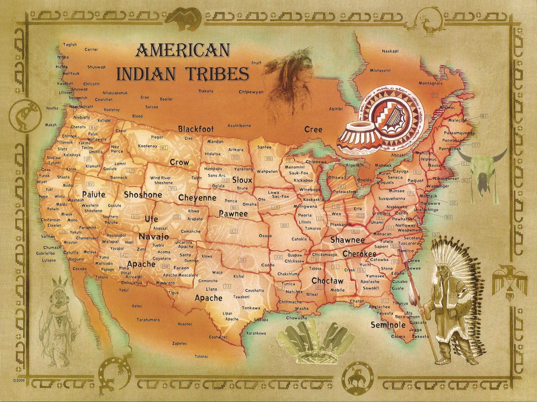
The first step in appreciating NMAI’s approach to Native American maps is to liberate oneself from the Eurocentric idea of what a map is. At NMAI, a map can be a meticulously carved wampum belt, narrating treaties and territorial agreements through symbolic bead patterns. It can be a petroglyph, etched into stone millennia ago, marking sacred sites, migration routes, and astronomical alignments. It can be a ledger drawing, depicting historical events and tribal movements, offering a visual chronicle of a people’s journey. It can even be a traditional song, carrying within its verses the precise details of a landscape, its resources, and its spiritual significance.
The museum’s permanent exhibitions, such as "Our Universes: Native Peoples’ Futures Transforming the Past" and "Nation to Nation: Treaties Between the United States and American Indian Nations," are particularly potent in this regard. These galleries don’t just display artifacts; they frame them within the context of indigenous knowledge systems. You’ll encounter stunning examples of pre-contact and early contact-era "maps" that reveal sophisticated understanding of geography, hydrology, and ecology. Unlike European maps focused on boundaries and ownership, many Native American forms of mapping emphasized relationships – relationships between people and land, between different tribes, and between the physical and spiritual worlds.
For instance, the "Our Universes" gallery often delves into creation stories and cosmological understandings that inherently define the geographic and spiritual landscape of various tribes. These aren’t just myths; they are foundational "maps" of existence, guiding peoples’ interactions with their environment and defining their territorial claims long before surveyors’ chains arrived. The "Nation to Nation" exhibit, on the other hand, starkly illustrates the clash of cartographic philosophies. Here, you see the highly detailed, often arbitrary lines drawn by colonial powers overlaid against the far more fluid, relationship-based territorial understandings of Native nations. The educational power lies in the juxtaposition, forcing visitors to critically evaluate the consequences of imposing one mapping system over another.
The Power of Place: Land, Sovereignty, and Resilience

NMAI’s strength as an educational resource lies in its unwavering commitment to presenting Native American perspectives on land and place. The museum directly addresses the profound impact of forced removals, land seizures, and the breaking of treaties, all of which are fundamentally geographic and cartographic issues. By showcasing tribal maps – both historical and contemporary – alongside colonial maps of the same regions, NMAI illuminates the ongoing struggle for land rights, cultural preservation, and sovereignty.
You’ll find meticulously researched displays that explain how Native peoples navigated vast territories using constellations, geological formations, animal migration patterns, and oral histories. These are not merely survival techniques; they are sophisticated mapping systems, often more accurate and environmentally sensitive than early European attempts. The museum demonstrates how this deep, embodied knowledge of the land is intrinsically linked to cultural identity, spiritual practices, and political autonomy.
Furthermore, NMAI highlights contemporary Native American mapping initiatives. Many tribes today are leveraging modern GIS (Geographic Information Systems) technology to reclaim and remap their ancestral lands, documenting sacred sites, traditional place names, and environmental knowledge. These modern "Native American maps" are powerful tools for asserting sovereignty, negotiating land use, and protecting natural resources. The museum often features temporary exhibits or digital installations that showcase these contemporary efforts, providing a vital link between historical cartography and ongoing indigenous resilience. This illustrates that Native American mapping is not a relic of the past, but a living, evolving practice central to indigenous futures.
Curatorial Excellence and Educational Resources

The educational value of NMAI extends beyond its physical exhibits. The museum employs a unique curatorial approach, working directly with Native communities to ensure authenticity and respect in representation. This collaborative model means that the narratives you encounter are not filtered through a colonial lens but are presented directly from indigenous voices, often through text, video, and audio recordings of community members. This is a crucial "educational resource" in itself – learning from rather than about Native peoples.
For the serious researcher or deeply interested traveler, NMAI also provides access to extensive digital resources. While the library and archives are primarily for scholars, the museum’s website is a treasure trove of information, offering detailed descriptions of collections, online exhibitions, educational guides, and even digitized historical maps and documents. This allows visitors to extend their learning long after their physical visit, delving deeper into specific tribal histories, cartographic techniques, or land-related issues.
The museum also frequently hosts public programs, lectures, film screenings, and workshops led by Native scholars, artists, and community leaders. These events provide dynamic, interactive opportunities to engage with the concepts of indigenous geography and mapping in a live setting, offering perspectives that cannot be fully captured in static displays. Check the NMAI calendar before your visit to see if any such enriching programs coincide with your travel dates.
The Mitsitam Cafe: A Culinary Map
No review of NMAI would be complete without mentioning the Mitsitam Cafe. "Mitsitam" means "Let’s Eat!" in the Piscataway and Delaware languages, and the cafe itself is an extension of the museum’s educational mission. It’s not just a place to grab a bite; it’s a culinary map of the Americas. The cafe features five stations representing different indigenous regions – Northern Woodlands, South America, Northwest Coast, Mesoamerica, and Great Plains – each offering traditional foods and contemporary dishes inspired by indigenous ingredients and cooking techniques.
Eating at Mitsitam is an educational experience in itself. It demonstrates how food systems are intrinsically linked to geography, climate, and cultural practices, offering a tangible connection to the land and its resources that further reinforces the museum’s themes of indigenous knowledge and place. It’s a delicious and authentic way to taste the diversity of Native American cultures across the continent.

Practicalities for the Traveling Scholar
Visiting the Smithsonian National Museum of the American Indian is straightforward. Located prominently on the National Mall in Washington, D.C., it’s easily accessible by public transport (the L’Enfant Plaza Metro station is a short walk away). Admission is free, like all Smithsonian museums. Plan to spend at least 3-4 hours to properly absorb the main exhibitions, and longer if you wish to attend a program or simply linger in contemplation.
The museum’s architecture, designed by Douglas Cardinal (Blackfoot), is itself a nod to indigenous sensibilities, mimicking natural rock formations and oriented to cardinal directions and celestial events. This thoughtful design immediately sets a tone of respect and connection to the land.
For travelers specifically interested in Native American maps, I recommend approaching your visit with an open mind and a critical eye. Don’t just look for literal paper maps. Instead, seek out how different forms of indigenous expression convey geographical knowledge, how they mark territory, and how they narrate journeys and relationships with the land. Engage with the detailed interpretive panels, watch the documentary segments, and listen to the oral histories.
Conclusion: A Transformative Understanding of Place
The Smithsonian National Museum of the American Indian stands as a vital educational resource for anyone seeking to understand Native American maps and the profound indigenous relationship with land. It is a place where cartography is decolonized, expanded, and rehumanized. It challenges the visitor to look beyond arbitrary lines and to see the deep, living connections that have always existed between people and place.
For the discerning traveler, NMAI offers more than just sightseeing; it offers a paradigm shift. It equips you with a new lens through which to view the landscapes you traverse, fostering a deeper appreciation for the complex histories embedded in every inch of land. Visiting NMAI is not merely reviewing a location; it is reviewing, and ultimately transforming, your understanding of the world itself, one indigenous map at a time. It’s an essential pilgrimage for the culturally conscious adventurer.
