The Enduring Tapestry: A Journey Through the Muscogee (Creek) Nation’s Ancestral Lands Map
For the intrepid traveler and the curious historian alike, a map is far more than a mere guide to geography; it is a living document, a repository of stories, struggles, and enduring identity. When we gaze upon a map depicting the ancestral lands of the Muscogee (Creek) Nation, we are not just seeing lines on paper; we are witnessing the contours of a vibrant civilization, a testament to resilience, and a poignant reminder of profound loss and remarkable survival. This article invites you to embark on a journey across that map, exploring the deep history and rich identity woven into every river, forest, and sacred site of the Muscogee homelands.
Beyond the Borders: Who Are the Muscogee (Creek) People?
Before we delve into the geographical specifics, it’s crucial to understand who the Muscogee (Creek) people are. Often referred to simply as "Creek," this term itself is a colonial invention, derived from the Ochese Creek, near which early British traders established their presence. The people themselves are a confederacy, a dynamic alliance of various distinct but related Indigenous groups, primarily speaking Muskogean languages, alongside Hitchiti-speakers and others. Their self-designation, Mvskoke, is the most accurate and respectful term.

The Muscogee Confederacy was not a monolithic entity but a sophisticated political and cultural alliance of independent "talwas" (towns or communities), each with its own leadership, traditions, and ceremonial grounds. These towns were broadly divided into two major groups: the "Upper Towns" (located along the Coosa and Tallapoosa Rivers in what is now central Alabama) and the "Lower Towns" (situated along the Chattahoochee and Flint Rivers in what is now Georgia). This division, while geographic, also reflected subtle cultural and political differences, which would later play a significant role in their interactions with European powers and the United States.
Their origins are rooted in the Mississippian culture, a complex civilization that flourished across the Southeastern Woodlands for centuries before European contact. Evidence of this legacy is seen in the monumental earth mounds they constructed, serving as platforms for temples, residences, and burial sites. These mounds, scattered across their ancestral territory, are silent sentinels that speak to a profound connection to the land and a highly organized society. The Muscogee people trace their lineage through sophisticated clan systems, primarily matrilineal, meaning descent and identity are passed through the mother’s line. This deep-rooted social structure, combined with their intricate spiritual beliefs and agricultural practices centered around corn, beans, and squash, formed the bedrock of their identity long before the arrival of outsiders.
The Ancestral Domain: A Vast and Verdant Tapestry
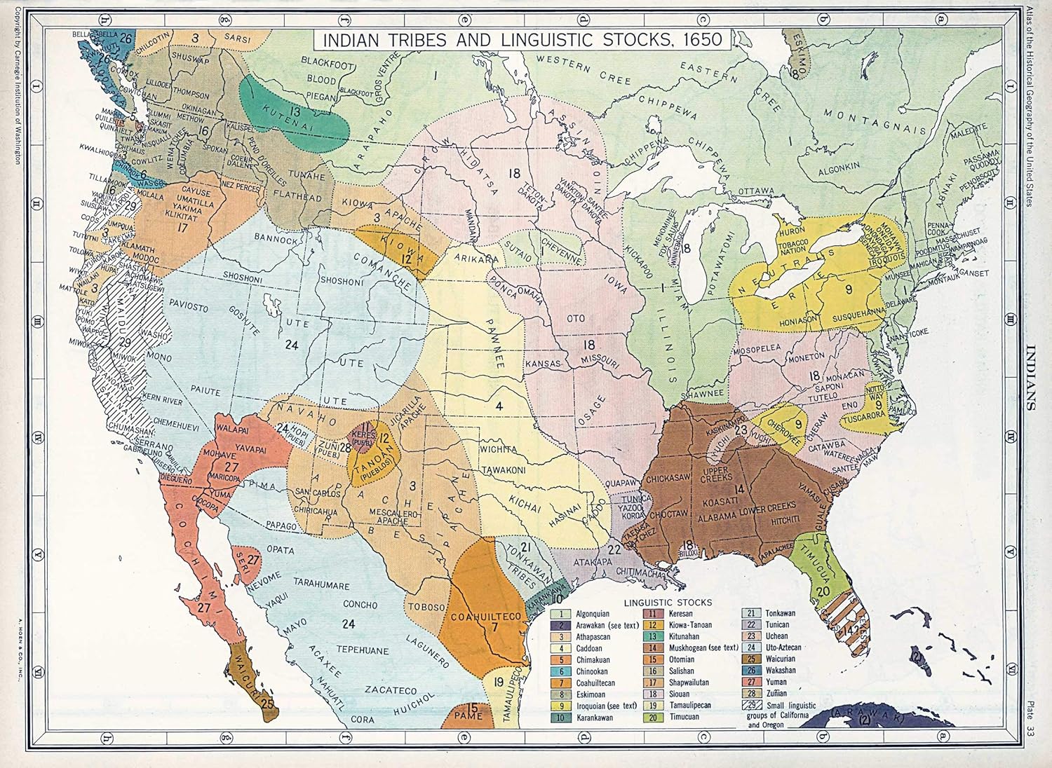
Now, let us turn to the map itself. The ancestral lands of the Muscogee (Creek) Nation encompassed a vast and fertile territory stretching across what is now Georgia, Alabama, parts of Florida, Tennessee, and the Carolinas. This expansive domain was a rich mosaic of ecological diversity, from the Appalachian foothills to the coastal plains, threaded by a network of life-giving rivers.

Key rivers like the Coosa, Tallapoosa, Alabama, Chattahoochee, Flint, and Ocmulgee were not merely geographical features; they were the arteries of Muscogee life. They provided sustenance through abundant fish, pathways for travel and trade, and fertile floodplains for their extensive agricultural fields. The forests, teeming with game like deer, bear, and turkey, offered further sustenance and materials for shelter and tools. Swamps and wetlands yielded unique resources and provided strategic defensive positions.
This map, therefore, illustrates a self-sufficient and thriving society perfectly attuned to its environment. The "Upper Towns" clustered around the Coosa and Tallapoosa rivers, while the "Lower Towns" flourished along the Chattahoochee and Flint. These geographical distinctions also reflected political relationships, ceremonial practices, and even dialectal variations within the broader Muscogee Confederacy. The map shows not just territory, but a living landscape where every hill, valley, and water source held cultural significance, tied to origin stories, ceremonial cycles, and the daily rhythms of life. It was a land intimately known, deeply revered, and fiercely defended.
The Age of Contact and Colonial Intrigue: Navigating a Shifting World
The arrival of Europeans dramatically altered the Muscogee world, but it did not immediately shatter their sovereignty. The first significant contact came with Hernando de Soto’s expedition in the 16th century, bringing devastation through disease and violence. However, the true period of intense colonial engagement began in the late 17th and 18th centuries with the encroachment of the English from the east, the French from the west (via Louisiana), and the Spanish from the south (Florida).

The Muscogee Confederacy proved to be master diplomats and strategic players in this complex geopolitical landscape. Their ancestral map became a contested zone, yet they often leveraged the rivalries between the colonial powers to their advantage, maintaining a delicate balance of power and preserving their independence for generations. They engaged in extensive trade, exchanging deerskins, furs, and sometimes even enslaved people captured from rival tribes for European goods like guns, tools, textiles, and rum. This trade, while bringing new technologies, also introduced dependencies and fueled internal conflicts.
The map from this era would show not just Muscogee towns, but also the encroaching lines of colonial claims, trading paths, and strategic forts established by the Europeans, often with Muscogee consent or as part of complex alliances. The Muscogee people, through their intricate diplomacy and formidable military prowess, largely controlled access to their interior lands, making them a dominant force in the Southeast. They understood the value of their territory and sought to protect it from outright seizure, often ceding small portions of land in exchange for continued peace and trade.
The American Republic and the Erosion of Sovereignty
The formation of the United States brought a new, more relentless pressure. The young republic, fueled by "Manifest Destiny" and a burgeoning population, viewed Muscogee lands as ripe for expansion. The map began to shrink. The period following the American Revolution saw increasing demands for land cessions. Treaties were signed, often under duress, and frequently violated by American settlers and state governments.
Internal divisions within the Muscogee Confederacy, exacerbated by the pressures of American expansion, came to a head in the early 19th century. The "Red Stick" War (1813-1814), also known as the Creek War, was a complex internal conflict between factions who sought to preserve traditional ways ("Red Sticks") and those who advocated for greater accommodation with American culture and policies (Lower Towns). This internal struggle was brutally exploited by the United States, with General Andrew Jackson leading American forces against the Red Sticks. The decisive Battle of Horseshoe Bend in 1814 resulted in a devastating defeat for the Red Sticks and a massive loss of Muscogee territory. The subsequent Treaty of Fort Jackson forced the Muscogee Nation to cede 23 million acres of land – more than half of their remaining ancestral domain – to the United States. The map dramatically illustrates this immense loss, particularly in central Alabama and Georgia.
The Trail of Tears: A Forced Relocation

The final, tragic chapter of land loss culminated in the Indian Removal Act of 1830. Despite their attempts to adopt elements of American culture, establish written laws, and operate as a sovereign nation, the Muscogee people, along with the Cherokee, Choctaw, Chickasaw, and Seminole (collectively known as the "Five Civilized Tribes"), were targeted for forced removal from their homelands. The prospect of gold in Georgia and the insatiable demand for cotton lands drove this policy.
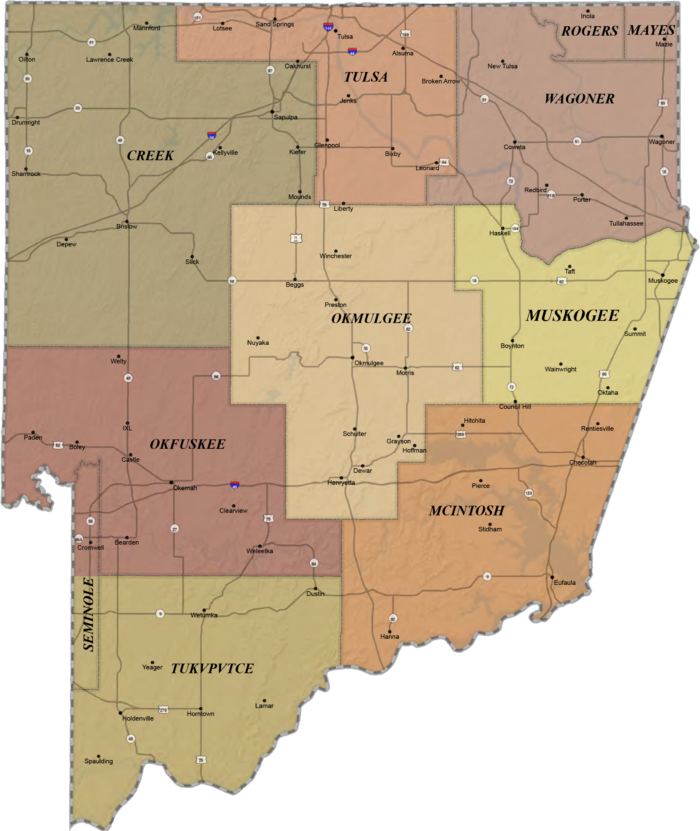
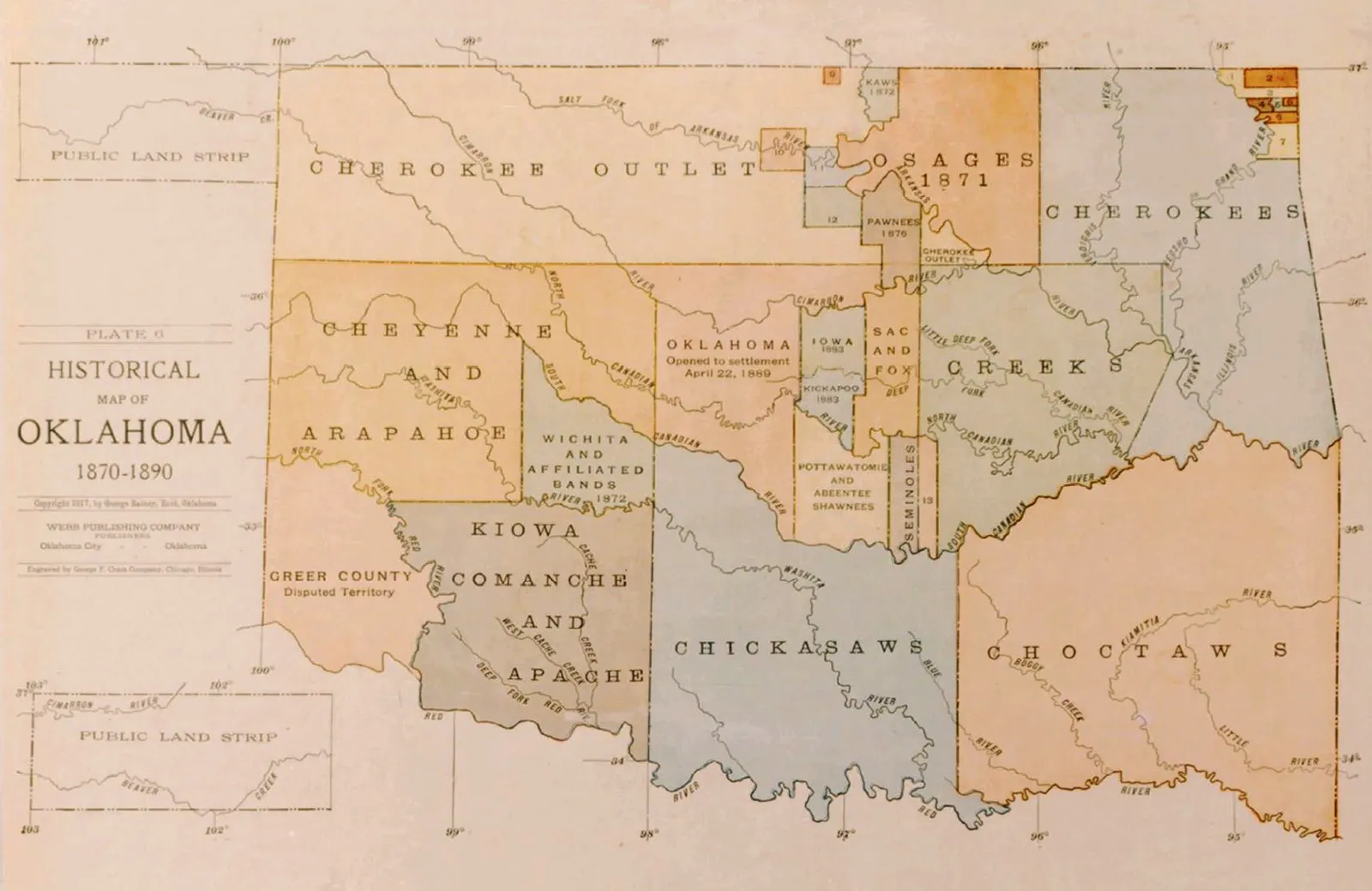
Between 1834 and 1837, the Muscogee people were forcibly rounded up by the U.S. military and marched westward to Indian Territory (present-day Oklahoma). This brutal exodus, part of what became known as the "Trail of Tears," resulted in the deaths of thousands from disease, starvation, and exposure. The map of their ancestral lands now stood starkly against a new map of their forced destination. The lines of their original territory, once vibrant with life, were now rendered as historical markers, replaced by the grim reality of exile. The identity of the Muscogee, inextricably linked to their ancestral rivers and forests, was severed by force.
Resilience and Rebirth: The Muscogee Nation Today
Yet, the story does not end with removal. It is a testament to the extraordinary resilience of the Muscogee people that they survived, rebuilt, and thrived in Indian Territory. In Oklahoma, they re-established their government, adapted their traditional practices, and continued their cultural heritage. Today, the Muscogee (Creek) Nation is one of the largest and most influential tribal nations in the United States, with a robust government, economic enterprises, and a profound commitment to preserving their language (Mvskoke), ceremonies, and traditions.
The map of their ancestral lands remains a powerful symbol of their enduring identity and connection to their heritage. It serves as a visual anchor to their history, a reminder of what was lost, but also of what continues to inspire. Furthermore, it’s important to acknowledge that not all Muscogee people were removed. The Poarch Band of Creek Indians in Alabama represents a community that managed to remain on a portion of their ancestral lands, demonstrating another facet of Muscogee resilience and adaptation. Other Muscogee communities also exist, both federally recognized and unrecognized, scattered across their original homelands and beyond.
Interpreting the Map for Travelers and Educators
For those who travel through the Southeastern United States, particularly Georgia and Alabama, an understanding of the Muscogee ancestral lands map transforms the landscape. Every river, every patch of forest, every mound, and every place name takes on new meaning.
- Visit Historical Sites: Seek out places like Ocmulgee Mounds National Historical Park in Georgia, which preserves a major Mississippian-era Muscogee site. Battlefields like Horseshoe Bend offer somber reflections on a pivotal moment. Many state parks and natural areas were once integral parts of Muscogee territory.
- Acknowledge and Learn: When visiting these areas, take time to acknowledge the original inhabitants. Seek out information from Muscogee sources and learn about their perspective. Support Native American cultural centers and businesses.
- Understand the Ongoing Legacy: The map helps us understand the profound and ongoing impact of land dispossession and forced removal. It’s not just ancient history; it shapes contemporary issues of land rights, sovereignty, and cultural preservation.
- Respect the Land: The Muscogee people hold a deep reverence for the land. Approaching these ancestral territories with respect for their historical and cultural significance enriches any travel experience.
Conclusion: The Living Legacy
The ancestral lands map of the Muscogee (Creek) Nation is more than just a historical artifact; it is a vibrant narrative. It tells a story of origin and prosperity, of sophisticated societies and astute diplomacy. It chronicles the devastating impacts of colonialism and the heart-wrenching trauma of forced removal. Most importantly, it stands as an enduring testament to the unwavering spirit, resilience, and cultural continuity of the Muscogee people.
To truly understand this map is to appreciate that the land itself remembers. The rivers still flow with the echoes of their canoes, the forests still hold the whispers of their ancestors, and the earth still cradles the memories of their towns and ceremonial grounds. As we navigate the physical landscape of the Southeast, let us remember the human stories etched into its very fabric, honoring the Muscogee (Creek) Nation’s profound and ongoing connection to their ancestral lands.
