Embarking on a journey through the Salish Sea region is to step onto a living map, not of paper and lines, but of ancient pathways, ancestral knowledge, and deep cultural memory. These are the Coast Salish ancestral maps of cultural sites – intricate tapestries woven from generations of observation, oral tradition, and profound connection to land and water. For the discerning traveler, understanding these "maps" transforms a scenic trip into an immersive experience, revealing layers of history and meaning invisible to the uninitiated eye. This isn’t just about visiting a place; it’s about learning to read the landscape as the Coast Salish peoples have for millennia, discerning the stories embedded in every cove, mountain, and salmon run.
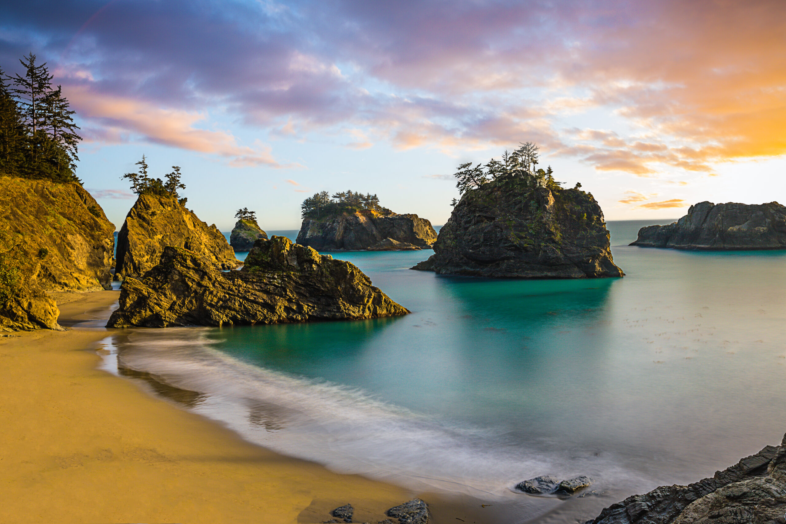
Our exploration begins not with a single point on a modern GPS, but with the very essence of the Coast Salish world: the water. The Salish Sea, a complex network of inland waterways including Puget Sound, the Strait of Georgia, and the Strait of Juan de Fuca, was and remains the primary highway. Ancestral maps depict not just coastlines, but canoe routes, portages, fishing grounds, and safe havens. Imagine the sophisticated knowledge required to navigate these often-treacherous waters, reading currents, tides, weather patterns, and the movements of marine life. Each island, each point, each sheltered bay held a name, a story, and a purpose. For instance, the San Juan Islands and Gulf Islands, a popular modern boating destination, were a vibrant hub of inter-tribal trade and resource gathering. Specific channels were known for their rich salmon runs, others for halibut, and certain beaches for clams and oysters – all marked implicitly on these ancestral maps.
To experience this today, rent a kayak or join a guided canoe tour with an Indigenous operator if available. Paddle through the calm waters of protected bays, and suddenly, the landscape shifts. What appears as a random rock formation to a casual observer might have been a marker for a rich clam bed, a spiritual site, or a territorial boundary. The sense of scale, of self-reliance, and of deep connection to the environment that comes from traveling by human power on the water offers a profound glimpse into ancestral lifeways. Look out for the distinctive dark lines on shorelines – shell middens, vast accumulations of clam and oyster shells, marking ancient village sites that thrived for thousands of years. These are not just archaeological curiosities; they are direct physical evidence of continuous human presence and sustainable resource management, speaking volumes about the abundance of the Salish Sea and the ingenuity of its first peoples.
Moving from the waterways to the land, Coast Salish ancestral maps extend to terrestrial resource gathering sites. One of the most vital examples is the camas prairies. Camas (Camassia quamash) is a native lily with an edible bulb, a staple food for many Coast Salish nations. These prairies, often managed through controlled burns to enhance yields, were meticulously mapped and stewarded. Imagine the knowledge required to identify optimal growing conditions, harvesting times, and sustainable practices. Sites like those found on parts of Whidbey Island or in the Cowichan Valley on Vancouver Island, now often protected areas or farmlands, were once meticulously tended "gardens" that fed entire communities.

Visiting a modern-day camas prairie, perhaps at a nature preserve or state park, allows for a tangible connection. In late spring, when the fields burst into a vibrant blue-purple bloom, one can almost sense the generations of women who gathered here, their songs echoing across the land. Interpretive signs often describe the plant’s significance and traditional harvesting methods. While modern visitors cannot harvest, understanding the historical importance of such sites reveals a sophisticated agricultural system that predates European contact by millennia. It shifts our perspective from viewing the landscape as "wild" to understanding it as a carefully managed and culturally significant food basket, meticulously mapped in the minds and traditions of its inhabitants.
Beyond sustenance, ancestral maps also delineate sacred and ceremonial sites. These locations, often distinctive natural features, were imbued with spiritual power and were central to Coast Salish cosmology. Petroglyph sites, such as those found on Galiano Island in British Columbia or along certain stretches of the Olympic Peninsula, are direct visual records from ancestral maps, communicating stories, spirits, and significant events across time. These rock carvings are not just ancient art; they are sacred texts etched into the landscape, offering glimpses into spiritual journeys, guardian spirits, and ceremonial practices.
Approaching such a site requires reverence and respect. Often located in secluded areas, their power is palpable. The silence, broken only by the rustling of leaves or the lapping of waves, amplifies the sense of ancient presence. When viewing petroglyphs, consider the hands that carved them, the intentions behind each mark, and the stories they were meant to tell. These are not just pictures; they are mnemonic devices, reminders of profound spiritual knowledge and ancestral connections to the land. While some sites are publicly accessible, others are protected or on private land, requiring permission or a guided tour from local Indigenous communities. Always prioritize respectful engagement, remembering that these are living sacred sites, not mere tourist attractions. Supporting Indigenous-led tours directly contributes to the preservation and interpretation of these invaluable cultural treasures.
Another crucial aspect of ancestral maps is the identification of village sites and winter encampments. These were not random settlements but strategically chosen locations, often at river mouths or protected inlets, offering access to resources, defensible positions, and social gathering spaces. Many modern towns and cities in the Salish Sea region, from Seattle (Duwamish territory) to Vancouver (Musqueam, Squamish, Tsleil-Waututh territories) to Victoria (Lekwungen territory), are built directly atop or adjacent to thriving ancestral villages. The very ground beneath our feet often holds layers of Indigenous history.

To truly appreciate this, seek out local tribal museums and cultural centers. The Hibulb Cultural Center (Tulalip Tribes), the Squaxin Island Museum (Squaxin Island Tribe), and the Suquamish Museum (Suquamish Tribe) are excellent examples. These institutions offer invaluable insights into traditional lifeways, languages, and the enduring cultural resilience of Coast Salish peoples. They provide the context and narratives that bring ancestral maps to life, often displaying artifacts, oral histories, and detailed maps of traditional territories. Engaging with these resources helps travelers understand the continuity of Coast Salish presence, acknowledging that these lands and waters have never been empty, but rather have been meticulously cared for and inhabited for thousands of years.
The ancestral maps also charted intricate trade routes, connecting diverse communities. The Fraser River, for instance, was a vital artery for salmon, connecting inland Nlaka’pamux and Stó:lō peoples with Coast Salish communities on the sea. Trade goods, including eulachon oil, dried fish, berries, and tools, moved along these established networks. Today, a drive along the Fraser River or a ferry ride through the islands can evoke the spirit of these ancient exchanges. While the canoes are gone, the underlying geographical logic of connection and resource sharing remains.
For the modern traveler, interpreting Coast Salish ancestral maps means cultivating a new way of seeing. It’s about slowing down, observing, and listening – not just to the sounds of nature, but to the echoes of human history. It means recognizing that every bend in a river, every stand of old-growth forest, every tidal flat holds a story, a purpose, and a deep cultural significance. It’s about moving beyond the superficial beauty of a landscape to appreciate its profound cultural depth.
Practicalities for the Respectful Traveler:

- Acknowledge the Land: Before visiting any area, take a moment to learn whose traditional territory you are on. Many websites and local signage provide this information. A simple acknowledgment, even silently, is a powerful act of respect.
- Support Indigenous Tourism: Prioritize tours, accommodations, and businesses that are Indigenous-owned and operated. This directly supports the communities whose heritage you are exploring.
- Visit Cultural Centers and Museums: These are invaluable resources for understanding local history and culture from an Indigenous perspective.
- Educate Yourself: Read books, articles, and tribal websites to deepen your understanding of Coast Salish cultures, histories, and contemporary issues.
- Respect Sacred Sites: If visiting a site known to be sacred, act with reverence. Follow all posted rules, do not disturb anything, and always ask permission if you are unsure.
- Leave No Trace: Practice responsible tourism, packing out everything you pack in, and minimizing your environmental impact.
- Engage with Openness: Approach your journey with an open mind and a willingness to learn from different worldviews.

Traveling the Salish Sea region with Coast Salish ancestral maps as your guide is an unparalleled experience. It’s an invitation to connect with a landscape that pulsates with thousands of years of human ingenuity, resilience, and spiritual depth. It transforms a simple vacation into a profound educational journey, fostering a deeper appreciation for the land, its original caretakers, and the enduring power of cultural memory. By learning to see the world through the lens of these ancient maps, we not only honor the past but also enrich our present and contribute to a more respectful and understanding future. So, pack your bags, open your mind, and prepare to embark on a journey guided by the wisdom of the ages, exploring a landscape not just as a tourist, but as a student of its deepest stories.
