>
Mapping Resilience: The Enduring Spirit of the Chickasaw Nation
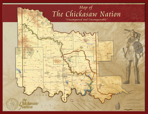
A map is rarely just lines on paper. For the Chickasaw Nation, its historical lands map is a vibrant, intricate narrative – a testament to millennia of presence, formidable resilience, strategic prowess, and an enduring identity forged in connection to a vast, ancestral domain. This isn’t merely a static representation of lost territory; it is a living document that speaks to the heart of who the Chickasaw people are, where they came from, and how they continue to thrive.
To understand the Chickasaw Nation today is to embark on a journey across this historical map, tracing a path from the southeastern woodlands of North America to their vibrant modern nation in Oklahoma. It’s a journey through sovereignty, conflict, adaptation, and an unwavering spirit.

The Ancestral Domain: Before the Lines Were Drawn
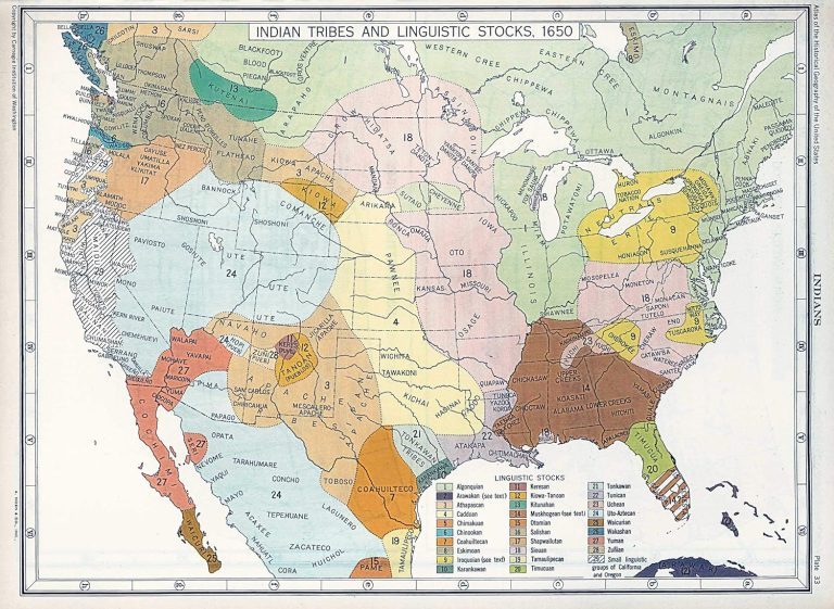
Long before European explorers charted the "New World," the Chickasaw people had established a sophisticated society across a significant swath of what is now the southeastern United States. Their ancestral domain spanned parts of present-day Mississippi, Alabama, Tennessee, and Kentucky. While the precise boundaries fluctuated over centuries, their core territory was centered around what is now northern Mississippi, particularly the area around Tupelo.
This was a land of rich bottomlands, fertile fields, dense forests, and abundant game – a perfect environment for their agrarian lifestyle, supplemented by hunting and fishing. The Chickasaw were expert farmers, cultivating maize, beans, squash, and other crops, which formed the bedrock of their economy and sustenance. Their villages were well-organized, connected by intricate trade routes, and their society was structured with a strong sense of community, governance, and spiritual connection to the land.
The land wasn’t just a resource; it was the cradle of their culture, their spirituality, and their very identity. Every river, every hill, every forest held stories, ancestral memories, and spiritual significance. Their language, Chickasaw, was interwoven with the landscape, and their ceremonies and traditions were deeply rooted in the cycles of nature that governed their homeland. This profound connection to place fostered a fiercely independent spirit and a deep sense of belonging that would prove crucial in the challenging centuries to come.

European Encounters: Strategic Alliances and Shifting Tides (16th-18th Century)
The arrival of Hernando de Soto and his Spanish expedition in 1540 marked the first significant European contact, bringing both disease and conflict. De Soto’s forces met fierce resistance from the Chickasaw, who ultimately drove them out of their territory. This early encounter set a precedent: the Chickasaw were a formidable military power, respected and feared.
As European colonial powers – particularly the French and British – vied for control of North America in the 17th and 18th centuries, the Chickasaw found themselves in a highly strategic position. Their lands lay directly between French Louisiana and British colonies, making their allegiance highly coveted. Unlike many other tribes, the Chickasaw largely maintained their independence, skillfully navigating these complex geopolitical currents. They often allied with the British, seeing them as less of a threat to their sovereignty and more reliable trading partners for manufactured goods like firearms, which further enhanced their military capabilities.
This era cemented their reputation as skilled warriors and shrewd diplomats. They successfully defended their borders against French incursions, notably during the Chickasaw Wars, and refused to be subjugated. This period of strategic engagement, while introducing new technologies and trade, also began to subtly alter their landscape through increased hunting for furs and the gradual encroachment of European settlements. Yet, through it all, the Chickasaw remained masters of their domain, their identity as an independent, powerful nation intact.

The American Republic and the Era of Cession (Late 18th – Early 19th Century)
Following the American Revolution, the newly formed United States quickly turned its expansionist gaze westward. The Chickasaw Nation, like other Southeastern tribes, faced immense pressure to cede their lands. The concept of individual land ownership, so central to American ideology, clashed fundamentally with the Chickasaw’s communal understanding of land.
Despite their earlier military prowess, the Chickasaw found themselves increasingly outmatched by the sheer demographic and military might of the burgeoning American republic. A series of treaties, often negotiated under duress and filled with broken promises, gradually chipped away at their ancestral territory. Each treaty line drawn on a map represented not just a loss of acreage, but a profound severing of cultural ties, a diminishment of sovereignty, and a step closer to the unthinkable.
During this period, the Chickasaw, known for their adaptability, also engaged in what was termed "civilization" programs, encouraged by the US government. They adopted elements of American farming techniques, built log cabins, established a written constitution, and even developed their own written language (though Sequoyah, a Cherokee, developed the syllabary often associated with the Five Civilized Tribes). These adaptations were not an abandonment of their identity but rather a pragmatic strategy to survive and thrive in a rapidly changing world, hoping to prove their capability for self-governance and thus retain their lands.
However, the insatiable demand for cotton land in the South, fueled by the expansion of slavery, ultimately overshadowed any such efforts. The presence of sovereign Native nations on fertile land was seen as an impediment to "progress" and economic gain.
The Trail of Tears: Forced Removal and a New Beginning (1830s-1840s)

The culmination of this pressure was the Indian Removal Act of 1830, championed by President Andrew Jackson. This act authorized the forced relocation of Native American tribes from their ancestral lands in the Southeast to Indian Territory (present-day Oklahoma) west of the Mississippi River.
For the Chickasaw, this period was particularly tragic. Unlike some other tribes who were forcibly marched by the military, the Chickasaw initially attempted to negotiate their removal terms. They eventually signed the Treaty of Doaksville in 1837, agreeing to purchase land from their Choctaw brethren in Indian Territory, making them the only one of the Five Civilized Tribes to pay for their new homeland. This act of self-reliance, even in the face of immense injustice, speaks volumes about their enduring spirit and determination to maintain their nationhood.
The journey, however, was no less devastating. Known as the "Trail of Tears," the forced migration from 1837 to 1838 was fraught with disease, starvation, and exposure. Thousands perished along the way, leaving an indelible scar on the collective memory of the Chickasaw people. The map of their historical lands now had a new, painful extension – the trail itself, a winding path of sorrow and resilience connecting their old world to their new one.
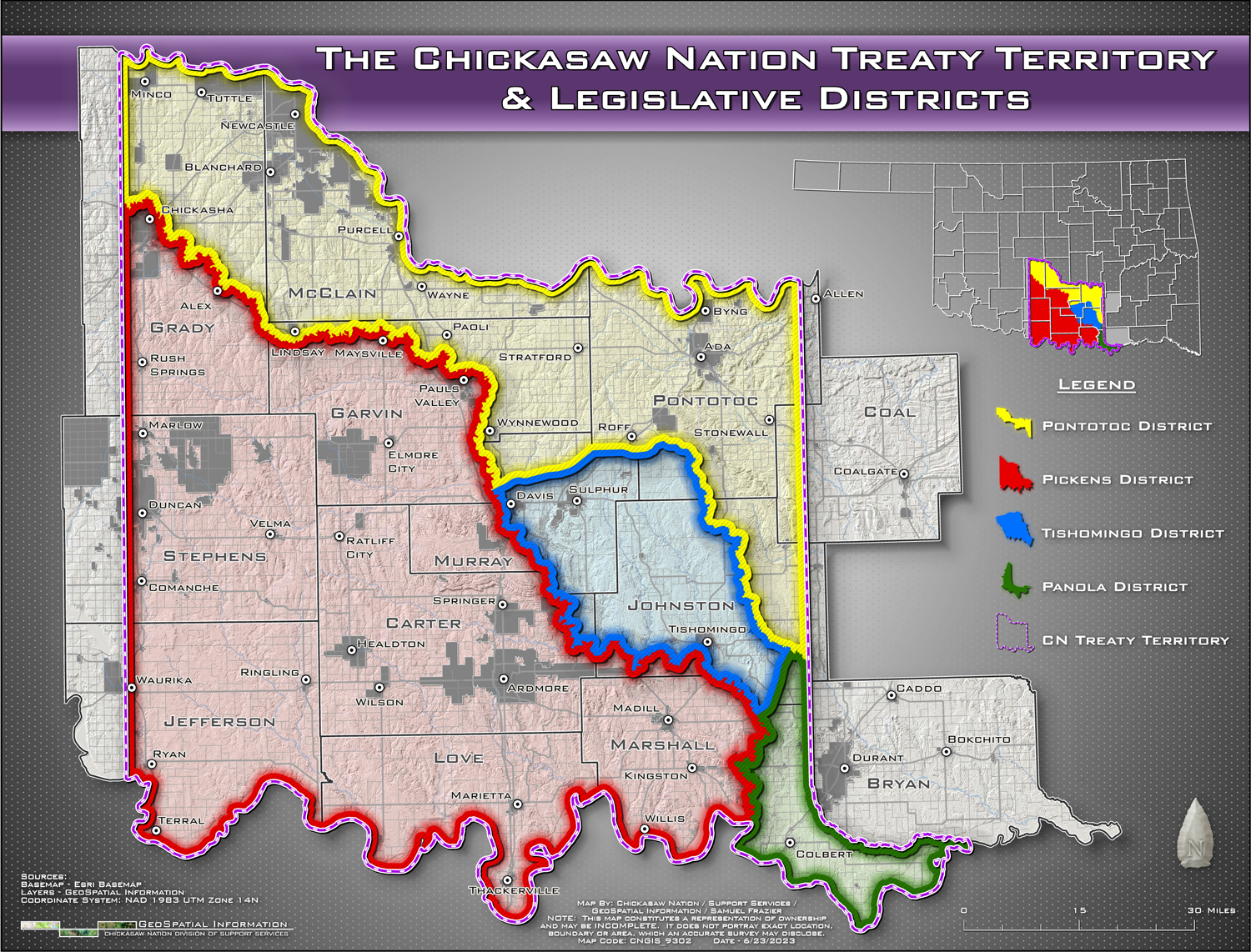
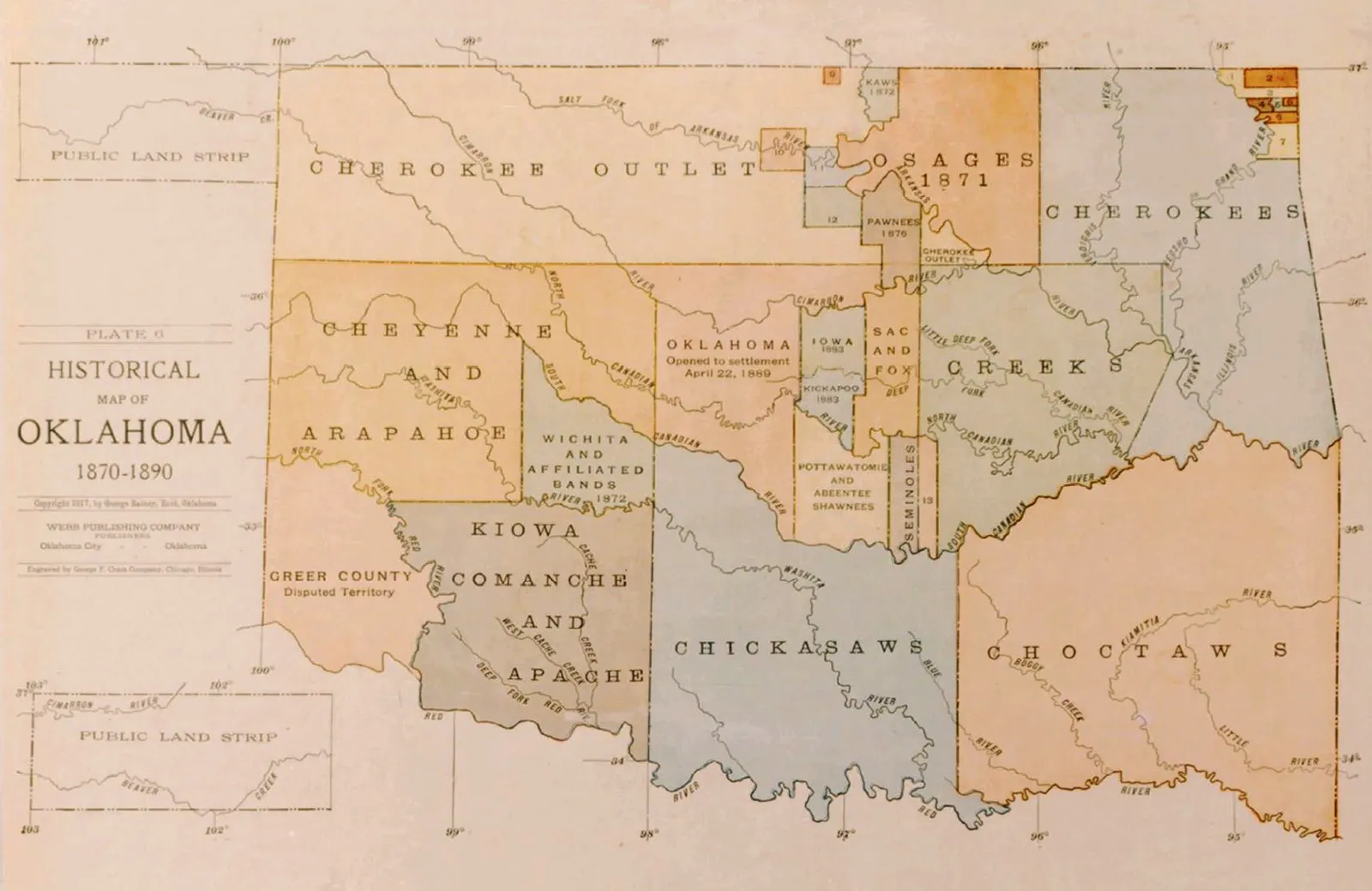
Arriving in Indian Territory, the Chickasaw faced the immense challenge of rebuilding their nation from scratch. They established new towns, schools, and a governmental structure, adapting their traditional ways to a new landscape. The new map of their lands in Oklahoma became a symbol of a fresh start, albeit one born of profound loss.
Rebuilding and Resurgence: From Adversity to Prosperity (Late 19th Century – Present)
The Chickasaw Nation in Indian Territory quickly re-established itself, developing a thriving agricultural economy and a robust government. However, new challenges arose. The American Civil War divided loyalties and devastated their lands. Later, the Dawes Act of 1887 and the Curtis Act of 1898 led to the allotment of communal tribal lands into individual plots, effectively dissolving their tribal government and opening the door for further land loss and non-Native settlement. When Oklahoma became a state in 1907, the Chickasaw Nation’s sovereignty was severely curtailed.
Despite these setbacks, the Chickasaw people persevered. The mid-20th century saw a revitalization of tribal governments across the United States, and the Chickasaw Nation was at the forefront of this movement. Under visionary leadership, particularly in recent decades, the Nation has experienced an extraordinary resurgence.
Today, the Chickasaw Nation is a powerful, self-governing entity, a testament to its people’s enduring strength. They operate a diverse portfolio of businesses, including casinos, resorts, healthcare facilities, and media companies, generating billions in economic impact. They invest heavily in their people through education, cultural preservation, healthcare, and elder care programs. Their cultural centers, museums, and language programs are vibrant hubs for maintaining and transmitting their heritage to future generations.
The Map as a Living Legacy: Travel and Education
For the modern traveler or history enthusiast, the Chickasaw Nation historical lands map offers profound lessons. It is not merely a record of what was lost, but a powerful reminder of what endures.
- Understanding Place: When you visit the rolling hills of northern Mississippi or the plains of Oklahoma, knowing the Chickasaw history transforms the landscape. You see not just natural beauty, but a tapestry woven with human endeavor, struggle, and triumph.
- Respect for Sovereignty: The map highlights the long history of self-governance and the ongoing fight for sovereignty. It encourages visitors to understand and respect the distinct political and cultural identity of Native Nations.
- Resilience and Identity: The Chickasaw story, etched onto this map, is one of unparalleled resilience. Their identity, deeply rooted in their ancestral lands, adapted and persisted through forced removal and assimilation policies. Today’s thriving Chickasaw Nation demonstrates that identity is not solely tied to a geographical location but also to a people’s spirit, culture, and collective memory.
- Education and Engagement: Visiting the Chickasaw Cultural Center in Ada, Oklahoma, or exploring historical markers in their original homelands offers invaluable educational opportunities. It allows for a deeper understanding of American history, often told from a marginalized perspective, and fosters appreciation for the rich diversity of indigenous cultures.
The Chickasaw Nation historical lands map, therefore, is far more than an academic tool. It is a portal to a profound human story – a story of ancient roots, strategic brilliance, immense loss, and an extraordinary journey of resurgence. It compels us to look beyond the lines and see the enduring spirit of a people who, against all odds, continue to define themselves by their history, their culture, and their unwavering connection to the land, both past and present.
