The Acoma Pueblo Historical Lands Map: A Palimpsest of Time, Identity, and Unyielding Spirit
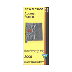
More than just lines on paper, a map of the Acoma Pueblo’s historical lands is a profound narrative, unfurling millennia of history, cultural identity, and an unyielding connection to the earth. For the Acoma people, their lands are not merely territory; they are the repository of memory, the sacred stage for ceremonies, and the physical manifestation of their very being. This article delves into the layers of history etched onto such a map, exploring how geography intertwines with identity, resilience, and the enduring spirit of "Sky City."
I. Unveiling the Ancestral Domain: Before European Contact
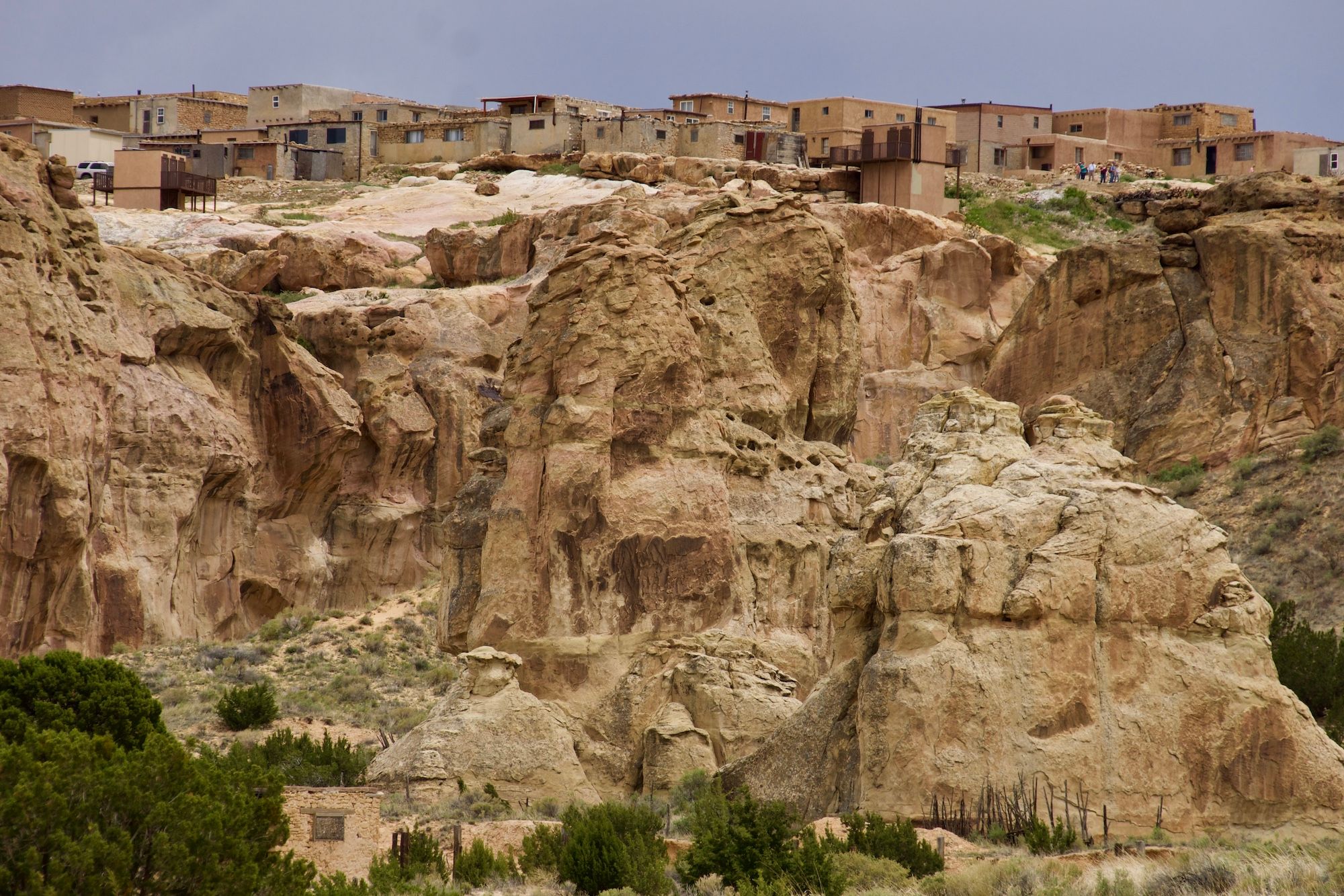
To understand the Acoma Pueblo historical lands map, one must first envision the landscape before European intrusion. For over a thousand years, Acoma Pueblo, often hailed as "Sky City," has stood atop its magnificent mesa, a natural fortress dominating the New Mexico desert. The pre-colonial map would illustrate a vast ancestral domain, far exceeding the boundaries of the present-day reservation.

This expansive territory was defined by vital resources and cultural significance. It encompassed not just the central mesa, but also a network of satellite villages, seasonal hunting grounds, agricultural fields along arroyos and rivers, and vital trade routes connecting Acoma with other Pueblo communities and nomadic tribes. The Keresan-speaking Acoma people were expert dryland farmers, cultivating corn, beans, and squash in the semi-arid environment, their knowledge of water conservation and land management honed over centuries.
The map would show crucial landmarks: the sacred mountain of Mount Taylor (Tsi-pi-na), a focal point of their cosmology; specific mesas and canyons where ceremonial gatherings took place; and sources of the distinctive clay used for their world-renowned pottery. These lands were not randomly chosen; they were integral to Acoma’s origin stories, their spiritual beliefs, and their sustainable way of life. Every arroyo, every rock formation, every stand of piñon and juniper held a name, a story, and a purpose within their intricate worldview. This vast, interconnected landscape was the cradle of Acoma identity, a living entity that nurtured and defined its people.
II. The Collision of Worlds: Spanish Arrival and Contraction
The arrival of the Spanish in the late 16th century marked a cataclysmic shift in the story of Acoma’s lands. Explorers like Francisco Vásquez de Coronado (1540) first encountered Acoma, marveling at its impregnable position. However, it was Juan de Oñate’s entrada in 1598 that brought the full force of colonial ambition. The Acoma Massacre of January 1599, a brutal reprisal for an earlier Acoma victory over Spanish soldiers, stands as a stark and tragic turning point. The event, which resulted in hundreds of Acoma deaths and severe retributions, irrevocably altered the power dynamics and initiated a long period of territorial contraction.

The Spanish colonial government, driven by a desire for resources, labor, and souls, began to impose its own system of land ownership. While the Spanish Crown recognized some indigenous land rights through "Pueblo Land Grants," these grants were often smaller than the traditional ancestral domain and were granted according to Spanish legal principles, not indigenous ones. The land grants, typically square or rectangular, enclosed the central village and immediate agricultural lands, effectively ignoring the vast hunting, gathering, and ceremonial areas that formed the true extent of Acoma’s historical territory.
A map from this era would show the ancestral lands beginning to shrink, encircled by Spanish encomiendas and later, private land claims. The Spanish introduced new crops, livestock, and most significantly, the concept of individual land ownership and taxation, alien to the communal stewardship practiced by the Acoma. Despite these pressures, Acoma Pueblo endured, often resisting covertly or overtly, maintaining their cultural practices and sacred connection to their broader ancestral lands even as their legal title diminished. The map here becomes a visual representation of this struggle: a small, legally recognized island surrounded by encroaching foreign claims.
III. Eras of Erosion: Mexican and American Annexation
The transition from Spanish to Mexican rule (1821) brought little change to Acoma’s land situation. The Mexican government largely inherited and continued Spanish land policies, and the remote Pueblo communities remained under pressure.

However, the U.S. annexation of New Mexico following the Treaty of Guadalupe Hidalgo in 1848 introduced a new, formidable wave of land challenges. The treaty promised to honor existing land grants, including those of the Pueblos. Yet, the American legal system, based on English common law, struggled to understand and validate Spanish and indigenous land titles. The influx of American settlers, miners, and ranchers, fueled by the concept of Manifest Destiny, put immense pressure on Pueblo lands.
A map of this period would dramatically illustrate the continued erosion. Homesteaders, often unaware or disregardful of Pueblo claims, settled on traditional lands. The development of railroads and towns further fragmented the landscape. The U.S. government established a "Pueblo Lands Board" in the early 20th century to adjudicate land claims, ostensibly to protect Pueblo interests. However, in many cases, the Board’s decisions resulted in significant land losses for the Pueblos, as they often failed to recognize the full extent of aboriginal title and communal ownership. Lands that had been part of Acoma’s sphere for millennia, but which lay outside the narrow Spanish land grant, were increasingly deemed "public domain" or granted to non-Native settlers.
This era was marked by complex legal battles, appeals, and a desperate fight to retain what little remained. The map becomes a testament to this legal and territorial struggle, highlighting the dwindling "Pueblo Grant" amidst a sea of newly surveyed and privately owned parcels.
IV. The Modern Map: Resilience, Reclamation, and Self-Determination
The map of Acoma’s lands today is a complex tapestry woven from these historical threads. While the federally recognized Acoma Indian Reservation is significantly smaller than their ancestral domain, it represents a hard-won victory of resilience and ongoing efforts at reclamation.
The current map shows the original Acoma Pueblo Grant (often called the "Acoma Grant") as the core. Surrounding this are various parcels acquired over time: trust lands, land purchased by the Pueblo, and land returned through legislative action or land claims. These additions reflect decades of advocacy, legal battles, and the Pueblo’s own economic efforts to buy back portions of their ancestral territory. Each acquired parcel is a story of determination, a small victory in a long war for land.

Despite these efforts, vast portions of Acoma’s aboriginal lands remain outside their direct control. These areas, though legally "off-reservation," still hold profound cultural and spiritual significance. Sacred sites, ancestral trails, traditional hunting and gathering areas, and sources of ceremonial materials often lie within national forests, Bureau of Land Management lands, or private ranches. The modern map, therefore, is not just about what is owned, but also about what is remembered and revered. It guides the Acoma people to places of spiritual power and historical importance, even if they require permits or permissions to access.
Water rights, intrinsically linked to land, also define the modern map. Control over water sources, crucial for agriculture and life in the desert, has been a constant struggle. The map shows the Puerco River and other ephemeral waterways as lifelines, and the ongoing legal battles over their allocation are as much about sovereignty as they are about sustenance.
V. Identity Forged in Land: Beyond Cartography
For the Acoma people, the map is far more than a geographical representation; it is a spiritual blueprint and a cultural anchor. Their Keresan language, oral traditions, ceremonies, and social structures are inextricably tied to the land. The mesa itself, the "Sky City," is seen not just as a defensive stronghold but as a living ancestor, a mother from whom the people draw strength and identity.
Loss of land, therefore, is not merely economic; it is a profound assault on identity, a severing of spiritual ties. Conversely, the struggle for land reclamation is a reaffirmation of identity, a healing of historical wounds. When a parcel of ancestral land is returned to the Pueblo, it is not just real estate; it is a piece of their soul restored, a place where their children can learn the stories and practices of their forebears without external interference.
The map serves as an educational tool for future generations of Acoma youth, reminding them of the vastness of their heritage and the sacrifices made to preserve it. For outsiders, it serves as a powerful reminder of the deep and enduring connection between indigenous peoples and their ancestral territories, challenging simplistic notions of ownership and land use.
VI. Experiencing Acoma’s Legacy: For the Traveler and History Enthusiast
For those traveling through New Mexico, a visit to Acoma Pueblo offers an unparalleled opportunity to engage with this living history. Guided tours of "Sky City" provide direct insight into the daily lives, traditions, and resilience of the Acoma people. When you stand on the mesa, looking out over the vast landscape, imagine the layers of history: the ancient pathways, the Spanish conquistadors, the American homesteaders, and the continuous presence of the Acoma people.
Understanding the historical lands map encourages a deeper appreciation. It helps visitors comprehend why cultural preservation is so vital, why issues of sovereignty and land rights remain central, and why every rock and vista holds profound meaning. Supporting Acoma Pueblo through respectful tourism, purchasing their exquisite pottery, and learning about their history contributes directly to their ongoing efforts to preserve their culture and sustain their connection to their ancestral lands.
Conclusion: An Enduring Narrative
The Acoma Pueblo historical lands map is a dynamic document, a testament to continuity and change. It traces a journey from a vast, unblemished ancestral domain to a contracted, yet resilient, modern reservation. Each line, each boundary, each name on the map tells a story of survival, adaptation, and an unwavering commitment to identity. It is a powerful reminder that history is not static, and that the relationship between a people and their land is a living, breathing narrative, constantly being written by the enduring spirit of places like Acoma Pueblo. As we contemplate this map, we are invited to look beyond the surface and recognize the deep, spiritual, and historical roots that define one of North America’s most ancient and resilient cultures.
