![]()
Navigating the Invisible Paths: Unearthing Native American Maps of the Cascade Range
Forget your GPS. Discard your topographical maps for a moment. To truly experience the Cascade Range – that majestic spine of mountains, volcanoes, and ancient forests stretching across the Pacific Northwest – one must learn to read a different kind of map. Not one printed on paper, but etched into memory, woven into stories, and sung into existence across countless generations. These are the Native American maps of the Cascades, profound systems of knowledge that offer a far richer, deeper, and more respectful way to traverse this breathtaking landscape.
For the modern traveler, accustomed to digital wayfinding, the concept of a "map" often conjures images of lines, symbols, and coordinates. But Indigenous cartography transcends these static representations. Native American maps of the Cascade Range were, and in many ways still are, dynamic, living entities. They are not merely about where things are, but what they are, why they matter, and how one relates to them. These "maps" are embodied in oral histories, songlines, sacred sites, seasonal migration routes, resource management strategies, and the very names given to peaks, rivers, and valleys. They are blueprints for survival, spiritual guides, and encyclopedias of ecological wisdom.
Beyond the Paper: The Living Map of the Cascades

Imagine a map that tells you not just the elevation of Mount Hood, but the story of its creation, its spiritual significance, and the proper way to approach it. A map that guides you to a hidden berry patch, not with a pin, but with the knowledge of when the berries ripen and which families traditionally harvested them. This is the essence of Indigenous mapping.
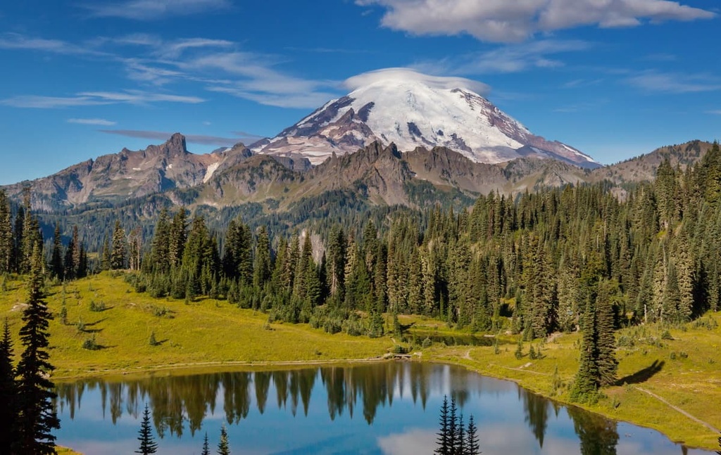
The Cascade Range, with its dramatic peaks like Tahoma (Mount Rainier), Wy’east (Mount Hood), Pahto (Mount Adams), and Loowit (Mount St. Helens), was and remains the ancestral homeland of numerous Indigenous nations. Tribes such as the Yakama, Warm Springs, Nez Perce, Klickitat, Cowlitz, Chinook, and many others, lived in profound relationship with this land. Their "maps" reflected this intimacy:
- Oral Traditions and Place Names: Every prominent peak, every winding river, every significant rock formation had a name, and with that name came a story. These narratives often described the formation of the land, the spirits residing there, the resources found, or historical events. For instance, the legend of the Bridge of the Gods, spanning the Columbia River, explains the origins of Loowit (St. Helens), Pahto (Adams), and Wy’east (Hood) as powerful beings. These stories are not just folklore; they are mnemonic devices, guiding principles, and a deep understanding of geological processes and spiritual forces.
- Seasonal Cycles and Migration Routes: The "maps" were intrinsically tied to the rhythm of the seasons. They charted the annual migrations for salmon fishing along the Columbia River, the best times and locations for huckleberry picking in high mountain meadows, the optimal hunting grounds for deer and elk, and the safest passes through the mountains. These routes were not arbitrary lines but carefully observed paths, often marked by cairns, petroglyphs, or specific natural features recognized across vast territories.
- Resource Management and Sustainability: Indigenous "maps" were sophisticated systems of land management. They indicated areas where specific plants grew, where certain animals could be found, and how to harvest resources sustainably to ensure future abundance. This knowledge was passed down through generations, ensuring the health and productivity of the land.
- Spiritual Geography: Unlike modern maps that often flatten the spiritual dimension, Indigenous maps are imbued with it. Certain peaks are sacred, rivers are lifeblood, and specific sites are places of vision quests or ceremonial gatherings. Understanding these spiritual layers transforms a hike into a pilgrimage, a viewing point into a place of reverence.


Reading the Indigenous Landscape Today: A Traveler’s Guide
How can a modern traveler, armed with GORE-TEX and granola bars, begin to "read" these invisible maps and connect with the Indigenous legacy of the Cascades? It begins with intention, respect, and a willingness to learn.
- Seek Out Original Place Names and Their Stories: Start by researching the Indigenous names for the places you plan to visit. Websites of local tribal nations, cultural centers, and museums are invaluable resources. For example, instead of just "Mount Hood," learn about "Wy’east" and the stories associated with it. What does the name mean? What does it reveal about the mountain’s character or significance? This simple act of acknowledging the original name is a powerful step towards decolonizing your perspective and deepening your connection.
- Visit Tribal Cultural Centers and Museums: Many tribal nations in the Pacific Northwest operate cultural centers and museums (e.g., Yakama Nation Museum, Confederated Tribes of Warm Springs Museum). These institutions are curated by the descendants of the land’s original inhabitants and offer authentic insights into their history, culture, and relationship with the Cascade landscape. They are often the best places to learn about specific oral histories and traditional ecological knowledge.
- Recognize Ancient Trails: Many modern hiking trails, particularly those through mountain passes or along river corridors, follow paths trod by Indigenous peoples for millennia. As you walk these trails, consider their original purpose. Were they trade routes, hunting paths, or migration corridors? Imagining the footsteps of those who came before you adds a profound layer to your journey.
- Observe the Land with Indigenous Eyes: Pay attention to the details Indigenous peoples would have noted. Where are the water sources? Where are the sheltered spots? What plants are growing, and what might they have been used for (food, medicine, tools)? What animals are present, and what is their role in the ecosystem? This mindful observation moves beyond superficial sightseeing to a deeper understanding of the land’s interconnectedness.
- Understand the Flow of Water: The Columbia River and its tributaries are the lifeblood of the Cascades, a central feature in Indigenous life and mapping. Consider the salmon, whose annual migrations were a cornerstone of tribal economies and spiritual practices. Understanding the river’s role as a highway, a provider, and a sacred entity is key to appreciating the Indigenous perspective.
- Acknowledge the Volcanic Heart: The Cascade volcanoes are not just geological features; they are powerful beings in Indigenous cosmology. Learn about the stories associated with them – their eruptions, their temperaments, and their significance. Approaching them with a sense of awe and respect, rather than merely as a summit to conquer, aligns more closely with traditional views.

Ethical Engagement and Responsible Travel
Engaging with Native American maps and knowledge is not just about enriching your travel experience; it’s about respectful and ethical engagement with the living history of the land.
- Land Acknowledgement: Before embarking on your journey, take a moment to acknowledge the Indigenous peoples whose ancestral lands you are visiting. This can be a silent reflection or a spoken acknowledgment.
- Support Indigenous Businesses and Tourism: Seek out opportunities to support local tribal economies, whether it’s through purchasing goods, visiting tribal-run businesses, or engaging with Indigenous-led tourism initiatives.
- Respect Sacred Sites: If you learn about a sacred site, approach it with utmost respect. Follow any guidelines provided by tribal nations, and if a site is not open to the public, honor that boundary.
- Be a Learner, Not an Extractor: Approach Indigenous knowledge with humility. You are there to learn and appreciate, not to appropriate or exploit. Understand that much knowledge is sacred and not for public consumption; respect these boundaries.
- Understand Ongoing Land Rights and Sovereignty: Recognize that Indigenous peoples are not just figures of the past but vibrant, sovereign nations today, often still fighting for their rights and the protection of their ancestral lands. Your awareness and respect contribute to a more just future.
Journeying with Deeper Meaning
The Cascade Range, with its soaring peaks, ancient forests, and rushing rivers, offers an unparalleled adventure for any traveler. But by embracing the concept of Native American maps – the oral traditions, the place names, the seasonal wisdom, and the spiritual connections – you can transform your journey from a mere physical traversal into a profound exploration of history, culture, and deep ecological understanding.
When you stand at a mountain pass, imagine the generations who walked that same path, guided by stories and knowledge that transcended any lines on a paper map. When you gaze upon a majestic volcano, hear the whispers of ancient legends that explain its power and presence. When you walk along a river, feel the enduring spirit of the salmon and the peoples who depended on them.
This is the true potential of Native American maps: to guide us not just across the landscape, but into it, connecting us to its soul, its past, and its enduring Indigenous legacy. So, next time you plan your Cascade adventure, pack your sense of wonder, your respect, and an open heart, ready to discover the invisible paths that have shaped this incredible land for millennia. Your journey will be immeasurably richer for it.


