The Sierra Nevada: Navigating a Landscape Etched in Indigenous Memory
Forget the topographic lines, the paved roads, and the neatly labeled peaks of your modern map. To truly understand the Sierra Nevada, to experience its profound depths and whispers of ancient wisdom, you must learn to navigate it as its first inhabitants did. This isn’t about discarding your GPS; it’s about layering a different kind of map over the familiar, one woven from seasonal migrations, sacred stories, resource knowledge, and an intimate connection to every granite slab, every rushing river, every whispering pine. My journey into the Sierra Nevada became transformative when I began to seek out the echoes of Native American maps, a cartography far richer and more alive than any paper printout.
The Sierra Nevada, the "Range of Light," has been home to diverse indigenous groups for thousands of years. The Washoe, Miwok, Paiute, Yokuts, and others didn’t just pass through this majestic range; they lived within it, their lives intrinsically linked to its rhythms. Their "maps" were not static documents but dynamic, multi-sensory repositories of knowledge, passed down through generations via oral traditions, songs, ceremonies, rock art, and the very act of living on the land. These weren’t maps of mere routes; they were maps of existence, revealing where to find food, water, shelter, sacred sites, and safe passage across formidable terrain.
Imagine a map that tells you not just where a river is, but when its waters are safest to cross, what fish run in its currents, and which plants grow on its banks. A map that doesn’t just show a mountain pass but recounts the story of its creation, the spirits that reside there, and the best time of year to traverse it for trade or ceremony. This is the essence of Native American cartography in the Sierra. It’s an immersive, holistic understanding that sees the landscape not as a collection of inanimate features but as a living entity, imbued with history, spirit, and purpose.

My exploration began in the Mono Lake Basin, a starkly beautiful, almost otherworldly landscape on the eastern edge of the Sierra. Modern maps show the lake, the Mono Craters, Highway 395. But through the lens of the Mono Lake Paiute (Kutzadika’a), this basin becomes a bustling hub of life. Their traditional maps, primarily oral and memory-based, charted the annual cycle of hunting, gathering, and trade. Mono Lake itself was a vital source of kutsavi, the brine fly pupae, a highly nutritious food staple. Imagine mapping not just the lake, but the precise seasonal locations for harvesting these flies, the techniques, and the stories associated with their abundance.
Further west, as I ascended into the high country towards Yosemite, the traditional maps of the Ahwahneechee and other Southern Miwok groups came into focus. Yosemite Valley, known to them as Ahwahnee, was far from a pristine wilderness to be merely admired; it was a home, a garden, a sacred space. Their maps detailed the locations of acorn groves in the lower valleys, crucial winter food sources, and the routes to higher elevations for summer hunting and gathering. Every waterfall, every granite dome, every meadow held a name, a story, a spiritual significance. El Capitan, Half Dome – these were not just geological formations but living entities within their cosmology. To navigate Yosemite with an indigenous mindset is to see the intricate web of trails not just as paths, but as ancestral highways connecting seasonal camps, ceremonial sites, and trade partners over millennia.
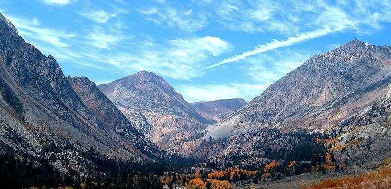
Consider the vast network of trans-Sierra passes. Modern hikers see them as challenges, points of achievement. Native Americans saw them as vital arteries connecting the Great Basin tribes with those in the Central Valley. Obsidian, a prized volcanic glass, was a key trade commodity, sourced from places like the Mono Craters and Glass Mountain. Indigenous maps meticulously detailed the safest, most efficient routes over passes like Tioga, Sonora, and Kearsarge, marking not just the physical path but also the reliable water sources, sheltered campsites, and potential dangers. These were maps born of necessity, survival, and a deep understanding of the land’s temperament. They charted not just elevation, but elevation in relation to snowmelt, grazing animals, and the presence of medicinal plants.
So, how does a modern traveler engage with this ancient cartography? It requires a shift in perspective, a conscious effort to slow down and observe.

-
Seek out Water Sources: Indigenous life revolved around water. Instead of merely noting a creek on a map, observe its flow, the vegetation around it, the animal tracks. Is it a reliable year-round source? Does it swell seasonally? This observational skill was fundamental to ancient mapping. Look for springs, seeps, and reliable streams – these were the vital nodes on any indigenous map.
-
Understand Seasonal Rhythms: Plan your trip not just for good weather, but for understanding the land’s annual cycle. Visit lower elevations in spring when wildflowers bloom and acorns ripen. Ascend to the high country in summer to appreciate the alpine meadows as traditional hunting grounds. How would a family have moved through this landscape throughout the year, following resources? This seasonal movement is a core element of Native American maps.
-
Identify Resource Zones: While we don’t forage as our ancestors did, understanding where resources like acorns (oak woodlands), obsidian (volcanic areas), or specific medicinal plants might have been found helps you see the land as a larder and pharmacy. These areas were critical "points of interest" on indigenous maps.
-
Look for Signs of Human Presence: Rock art (petroglyphs and pictographs) is perhaps the most tangible surviving form of indigenous mapping and storytelling. Sites like the Volcanic Tablelands near Bishop, or specific areas within National Parks (where access is permitted and respectful), offer glimpses into ancient narratives and sacred geographies. These aren’t just pretty pictures; they are historical records, warnings, ceremonial instructions, and reflections of a deeply spiritual landscape.
-
Connect with Local Tribal Communities: Where possible and appropriate, seek out cultural centers, museums, or tribal programs that share indigenous perspectives. Learning from the descendants of the land’s original mappers is invaluable. Understand that the Sierra Nevada is not just a backdrop for recreation, but a living ancestral homeland.
-
Practice Deep Observation: Indigenous mapping wasn’t just about landmarks; it was about the subtle cues. The direction of the wind, the type of soil, the call of a specific bird, the scent of certain plants – all these were part of the navigational system. Try to engage all your senses as you move through the landscape. What stories does the land itself tell you?


Traveling the Sierra Nevada with this mindset transforms a hike into a historical expedition, a scenic drive into a journey through ancestral memory. You begin to see the interconnectedness of all things: the granite peaks providing meltwater to the valleys, the forests sustaining game, the meadows yielding plants for food and medicine. The "wilderness" becomes a living, storied landscape, deeply humanized by millennia of habitation.
The Sierra Nevada, then, is not just a collection of stunning vistas, but a grand, open-air archive. The trails you walk often follow ancient footpaths. The valleys you admire were once vibrant communities. The passes you traverse were vital corridors of trade and cultural exchange. By seeking to understand the Sierra through the lens of Native American maps – those intricate, living tapestries of knowledge, spirit, and survival – we don’t just explore a place; we connect with its very soul, honoring the enduring legacy of those who knew it best. It is a journey that enriches not only your understanding of the landscape but also your place within its timeless narrative.
