Mapping Ancient Futures: Unearthing Indigenous Histories at The Newberry Library, Chicago
For the discerning traveler, the quest often extends beyond picturesque vistas and bustling markets. It delves into the very bedrock of history, seeking narratives that challenge preconceived notions and illuminate forgotten truths. Few journeys offer such profound revelations as an exploration of historical maps, especially those charting the territories of Native American nations. These aren’t just lines on parchment; they are stories of sovereignty, resilience, displacement, and the enduring connection between people and place. And for a truly transformative encounter with this cartographic legacy, one must journey to the heart of Chicago, to the venerable halls of The Newberry Library.
Forget the usual tourist traps for a moment. Imagine a place where the past isn’t merely preserved but actively interrogated, where every document whispers tales of empires clashing with ancient lifeways. The Newberry Library is precisely such a crucible of history. While renowned globally for its vast collections in the humanities, it holds a particularly vital place in the study of Indigenous North America, boasting an unparalleled collection of maps that trace the contours of Native nations from pre-contact to the modern era. This isn’t just a research institution; it’s a portal to understanding the foundational narratives of a continent, viewed through the most potent lens of all: the map.
The Cartographic Canvas: More Than Just Geography

Why maps? Because they are inherently political, cultural, and profoundly human documents. A map is never neutral; it reflects the worldview, intentions, and power dynamics of its creator. When we speak of historical maps of Native American nations, we are often talking about European-drawn maps attempting to delineate territories they barely understood, or, more poignantly, maps created by Indigenous peoples themselves, reflecting a deep, holistic knowledge of their homelands. These maps tell a dual story: the audacious claims of colonial powers carving up lands they considered terra nullius (empty land), and the persistent, often invisible, presence of nations who had lived on those lands for millennia.
At The Newberry, this duality is on full display. Visitors are confronted with a breathtaking array of cartographic artifacts. Here you might find a 17th-century French map attempting to chart the vastness of "Louisiana," showing the approximate locations of the Illinois, Sioux, and Osage, often based on rudimentary exploration and Indigenous accounts filtered through European interpreters. Next to it, you might encounter a 19th-century U.S. government survey map, coldly delineating "Indian Reservations" – precise, geometric boundaries drawn with the explicit purpose of containing and dispossessing. The contrast is stark, visceral, and utterly essential to grasp.
The Newberry Library: A Sanctuary of Indigenous Knowledge
Nestled in Chicago’s Near North Side, The Newberry Library itself is a marvel. An independent research library founded in 1887, its Gothic Revival architecture exudes an aura of quiet scholarship. But step inside, and you’ll find an institution anything but static. It is a dynamic hub, particularly through its D’Arcy McNickle Center for American Indian and Indigenous Studies, which actively promotes scholarly research, public programs, and critical engagement with Indigenous histories. This commitment elevates the Newberry beyond a mere repository of old documents; it is a living center for dialogue and reinterpretation.

For the traveler eager to delve into the cartographic history of Native America, the Newberry offers a unique, immersive experience. You don’t just see maps; you begin to understand the stories they tell, and the stories they deliberately omit. The library’s collections include thousands of maps, atlases, and geographic manuscripts, many of which directly pertain to Indigenous lands. These range from early European exploratory maps, which often depicted Native communities and their resources, to detailed 19th and 20th-century maps illustrating treaty boundaries, land cessions, and the ever-shrinking territories of Native nations.
Beyond the Lines: What the Maps Reveal
The maps housed at The Newberry are windows into a complex, often tragic, history. They reveal:
-
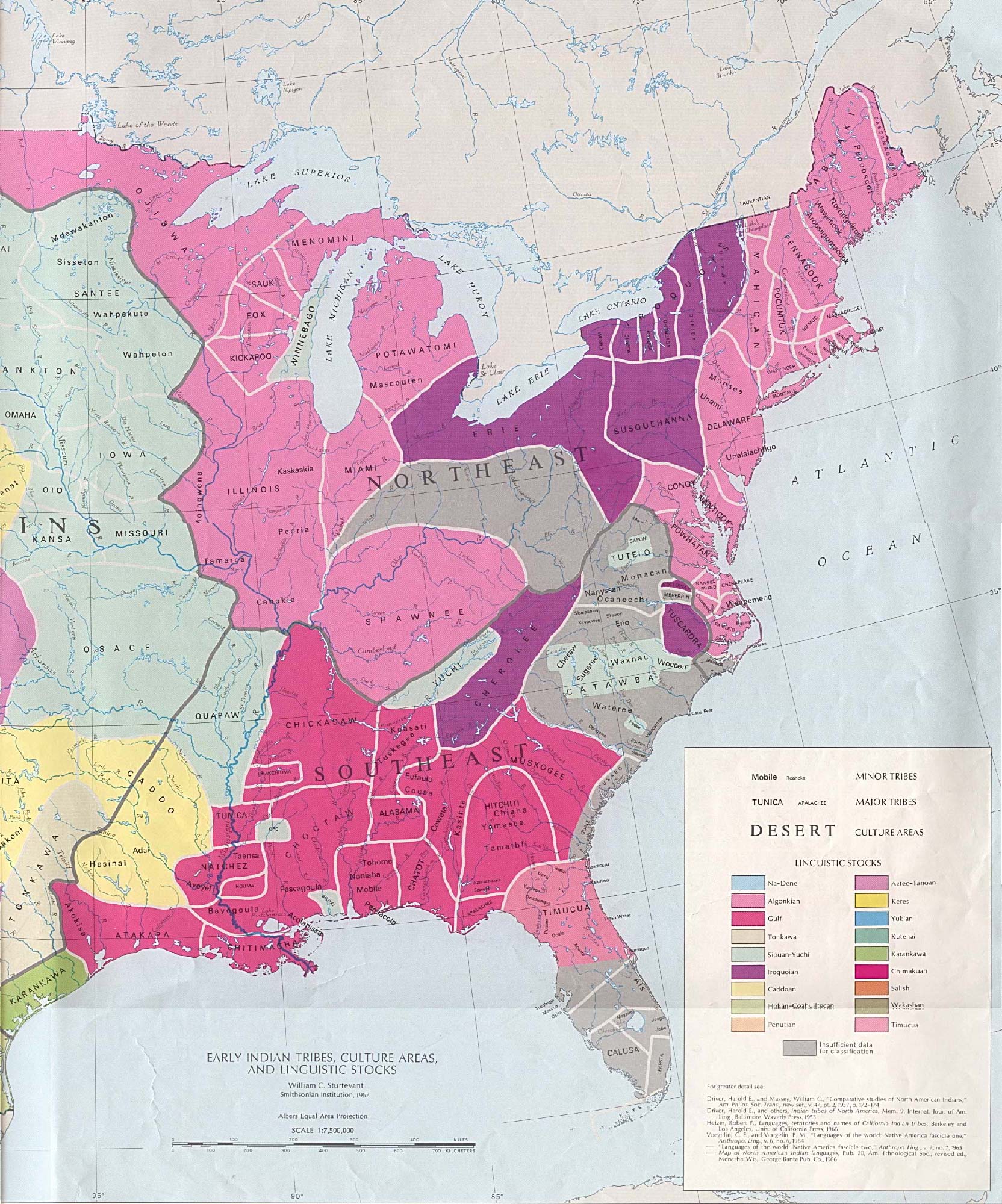
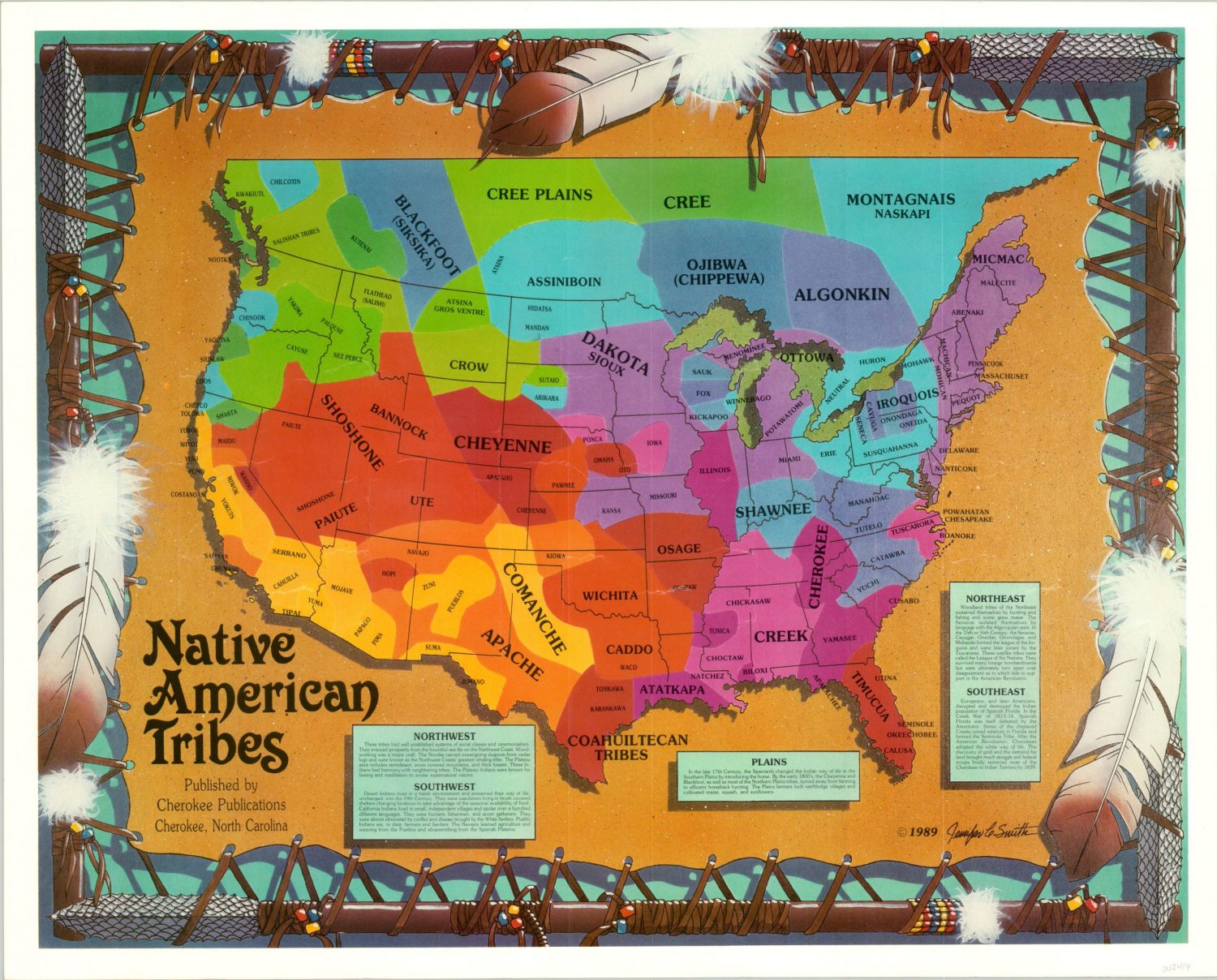
Ancient Territories and Lifeways: Early European maps, despite their inaccuracies, often provide glimpses into the vastness of Indigenous territories before widespread colonial encroachment. They sometimes depict Native villages, hunting grounds, trade routes, and even early European-Indigenous encounters, offering invaluable clues to pre-contact and early-contact lifeways. These maps, viewed critically, help us visualize the rich tapestry of Native nations that once flourished across the continent.
-
The Impact of Treaties and Land Cessions: The Newberry’s collection is particularly strong in maps related to treaties between Native nations and European powers, and later, the United States. These documents are heartbreakingly precise in their depiction of how millions of acres of ancestral lands were ceded, often under duress, through a series of treaties that were frequently violated. To trace these boundaries on a map is to witness the slow, deliberate erosion of Indigenous sovereignty, leading to the forced removal of nations like the Cherokee, Choctaw, and Muscogee along the Trail of Tears.
-
Resistance and Resilience: While many maps are tools of colonial power, they also inadvertently document Native resistance. The very act of a nation holding onto a specific territory, even if reduced, is a form of defiance. Furthermore, some maps, particularly those incorporating Indigenous place names, speak to the deep cultural connection to land that persisted despite all attempts at eradication. The Newberry encourages researchers to "read against the grain" of these colonial documents, seeking the Indigenous narratives embedded within or implicitly challenging the dominant story.
-
Indigenous Cartographic Traditions: It’s crucial to remember that Native peoples had their own sophisticated systems of mapping long before Europeans arrived. These might not have been on paper but etched into bark, painted on hides, woven into textiles, or remembered through oral traditions and songlines. While such artifacts are rarer in colonial collections, The Newberry’s research initiatives and partnerships strive to incorporate and highlight these Indigenous perspectives, recognizing that maps are not just visual; they are experiential and cultural. The library’s exhibitions and digital resources often feature essays and analyses that interpret European maps through an Indigenous lens, pointing out where traditional knowledge diverges or conflicts with colonial representations.


A Traveler’s Engagement: How to Experience the Newberry
For the travel blogger or curious adventurer, engaging with The Newberry Library’s collections is surprisingly accessible. You don’t need to be a tenured historian to appreciate the profound stories held within its walls.
-
Exhibitions: The Newberry regularly hosts public exhibitions, many of which draw from its map collections. These curated displays offer an excellent entry point, presenting key maps with contextual information that makes complex histories understandable and engaging. Check their website for current and upcoming exhibitions.
-
Digital Resources: Before or after your visit, explore The Newberry’s extensive online digital collections. Many of their maps, including those related to Native American nations, have been digitized and are available for free viewing. This allows for a deeper dive and pre-visualization of what you might encounter in person. The McNickle Center’s resources are particularly valuable here.
-
Public Programs: The library hosts numerous lectures, workshops, and public programs throughout the year, often featuring Indigenous scholars and artists. These events provide invaluable context and allow for direct engagement with experts in the field. Attending one can profoundly enrich your understanding of the maps and the histories they represent.
-
The Reading Rooms: For the truly intrepid, consider obtaining a reader’s card (it’s free and easy for anyone over 14). This grants you access to the reading rooms, where you can request to view original maps and documents. Holding a 300-year-old map in your hands, knowing the history it encapsulates, is an experience unlike any other. The Newberry’s staff are incredibly helpful and will guide you through the process of requesting and handling these precious materials.
Beyond the Lines: The Enduring Power of Place
Visiting The Newberry Library to engage with historical maps of Native American nations is more than just a sightseeing activity; it’s an act of historical empathy. It challenges us to look at the land we inhabit with new eyes, to recognize the layers of history beneath our feet, and to acknowledge the enduring presence and sovereignty of Indigenous peoples. These maps are not relics of a bygone era; they are living documents that inform contemporary struggles for land rights, cultural preservation, and self-determination.
As you stand before these cartographic masterpieces, whether through a glass case in an exhibition or carefully laid out in a reading room, you don’t just see boundaries. You see the echoes of ancient hunting grounds, the paths of ancestors, the sites of sacred ceremonies, and the indelible marks of colonial ambition. You begin to understand that the lines on a map are never just lines; they are narratives of power, culture, and the unwavering spirit of nations. The Newberry Library offers a unique opportunity to truly see this, to listen to the silent stories of the land, and to emerge with a richer, more nuanced understanding of the continent’s complex and profound history. It is a journey not just through geography, but through the very soul of America.
