Unearthing Ancestral Echoes: A Journey into Wampanoag Shell Midden Maps
Forget the typical postcard views. True travel often means stepping off the beaten path, not just geographically, but historically and culturally. For those seeking a profound connection to North America’s ancient past, a journey into the world of Wampanoag ancestral shell midden maps offers an unparalleled, deeply moving experience. This isn’t about reviewing a single picturesque destination, but rather the experience of engaging with a powerful, living history, often centered around a cultural institution like the Mashpee Wampanoag Cultural Center or through educational programs dedicated to Indigenous land knowledge. It’s a review of a perspective, a technology, and a heritage that redefines what it means to "see" a landscape.
Beyond the Beach: What Are Shell Middens?
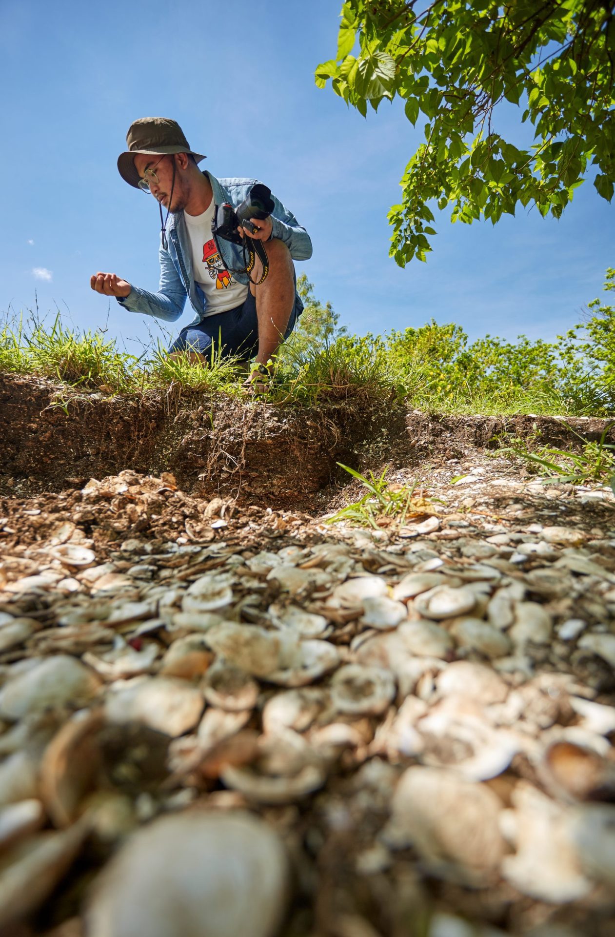
To truly appreciate the significance of Wampanoag ancestral shell midden maps, we first need to understand what shell middens are. Far from being mere "trash heaps," these archaeological sites are monumental accumulations of discarded shells (clams, oysters, quahogs, scallops), fish bones, animal bones, stone tools, pottery shards, and other remnants of daily life, meticulously deposited over thousands of years by Indigenous peoples. For the Wampanoag, whose ancestral lands span southeastern Massachusetts and eastern Rhode Island, these middens are vivid, tangible libraries of their past – chronicling diets, seasonal movements, technological innovations, social structures, and an intimate, sustainable relationship with the coastal environment.

These aren’t random piles. Middens often reflect deliberate choices about resource management and waste disposal, some growing to immense sizes, forming artificial hills or terraces. They offer invaluable insights into how the Wampanoag sustained thriving communities for millennia, long before European contact, living in harmony with the abundant marine resources of their homelands. Each layer tells a story: a changing climate, a new tool, a shift in diet, or the enduring presence of a people.
The Power of Maps: Reclaiming and Revealing History
For centuries, these vital historical markers were often overlooked, misunderstood, or even actively destroyed by colonial expansion and modern development. Many were seen as obstacles or sources of free fill, their cultural significance erased or ignored. However, in recent decades, Wampanoag communities, often in collaboration with sympathetic archaeologists and geographers, have embarked on a critical mission: to identify, document, and map these ancestral shell middens using cutting-edge Geographic Information Systems (GIS) technology.
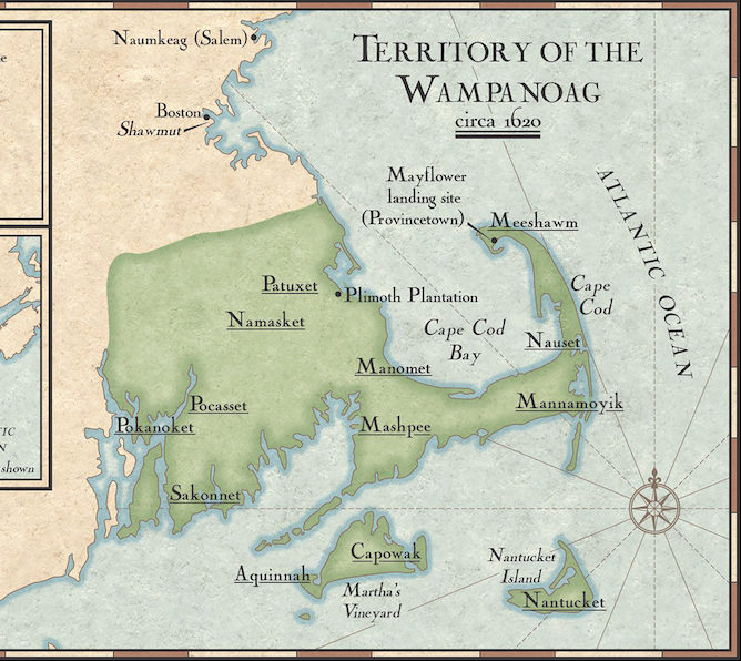
This isn’t just an academic exercise; it’s an act of cultural reclamation, a profound assertion of sovereignty, and a vital tool for preservation. These "Wampanoag ancestral shell midden maps" are complex, multi-layered digital landscapes that integrate historical data, oral traditions, archaeological surveys, remote sensing, and community knowledge. They pinpoint known midden locations, model areas of high probability for undiscovered sites, and help visualize the ancient Wampanoag footprint across the land and seascape.

The significance of these maps is multi-fold:
- Preservation and Protection: By accurately mapping midden locations, Wampanoag communities can advocate for their protection against development, erosion due to climate change, and looting. These maps become powerful legal and advocacy tools.
- Cultural Revitalization and Education: For Wampanoag youth, these maps offer a tangible connection to their ancestors, illustrating the vastness and longevity of their cultural heritage. They are used in educational programs to teach about traditional ecological knowledge, sustainable practices, and the deep history of their people.
- Reclaiming Narrative: These maps allow the Wampanoag to tell their own story, on their own terms, counteracting centuries of often biased or incomplete historical accounts. They powerfully demonstrate a continuous presence and sophisticated cultural development that predates colonization.
- Scientific Research: While community-led, these maps also provide invaluable data for archaeologists, environmental scientists, and climate change researchers, offering unique long-term ecological baselines and insights into human adaptation.
- Informing Land Management: For both tribal and non-tribal entities, these maps are crucial for responsible land use planning, ensuring that development avoids or mitigates impact on sacred ancestral sites.

The Travel Experience: Engaging with the Maps and the Culture
So, how does a traveler "review" this? The review isn’t of a physical map you hold in your hand, but of the experience of learning about, seeing, and understanding the implications of these maps within a Wampanoag cultural context.

My Recommended "Location": The Mashpee Wampanoag Cultural Center (or similar Indigenous-led institution)
Visiting the Mashpee Wampanoag Cultural Center on Cape Cod offers a uniquely immersive and respectful entry point into this world. While not every exhibit might explicitly feature large-scale GIS maps, the entire ethos of the center is built upon the very history and ancestral presence these maps document.
The Atmosphere and Initial Impression:
Upon entering the Mashpee Wampanoag Cultural Center, you immediately feel a sense of reverence and pride. It’s not a sterile museum; it’s a living space. The air often carries the faint scent of cedar or sage, and the sounds of traditional music might subtly fill the background. The staff, often tribal members, greet you with warmth and an eagerness to share their heritage. This initial impression sets the tone: you are a guest in a place dedicated to the enduring spirit of the Wampanoag people.
Exhibits and Storytelling:
The center’s exhibits artfully weave together thousands of years of Wampanoag history. While specific digital shell midden maps might be shown on interactive displays or during presentations, their essence permeates everything. You’ll see artifacts unearthed from midden sites – tools crafted from shell and bone, fragments of ancient pottery, remnants of marine life – all telling stories of a vibrant, resourceful past.
What struck me most was how the exhibits moved beyond mere display to storytelling. Through photographs, narratives, and carefully curated artifacts, the center vividly illustrates the Wampanoag’s deep connection to the land and sea. You learn about the seasonal rounds, the importance of the Three Sisters (corn, beans, squash), and the incredible ingenuity required to thrive in this coastal environment. When you see a display on traditional foods, you’re implicitly learning about what sustained the communities whose refuse created those middens.
The "Map Experience" – A Shift in Perspective:
My most profound experience came during a guided discussion led by a tribal elder and a community liaison, where they showcased examples of these ancestral shell midden maps. Seeing the overlaid GIS data – points marking known middens, shaded areas indicating high-probability zones, ancient waterways reconstructed – was transformative. It wasn’t just abstract data; it was a digital ghost of generations past, layered onto the familiar landscape of Cape Cod.
The elder spoke of specific middens not as archaeological sites, but as "grandparents’ dinner tables," "sacred family albums." She explained how the maps help them visualize where their ancestors fished, feasted, and lived, giving them a deeper understanding of traditional territories and the impact of modern development. The maps became a bridge across time, connecting their present advocacy efforts to the footsteps of their ancestors. This is where the true "review" lies: in the impact of this knowledge.
Suddenly, the familiar beaches and estuaries of Cape Cod were imbued with new meaning. I began to see the landscape not as an empty space, but as a palimpsest, bearing the indelible marks of continuous Wampanoag presence. The maps aren’t just about where things are; they’re about who was there, what they did, and why it matters now.
Engaging with Wampanoag Voices:
Crucially, the Mashpee Wampanoag Cultural Center provides a platform for Wampanoag voices to tell their own story. This is paramount. The maps are created and interpreted through an Indigenous lens, ensuring that the narrative of these ancestral sites is rooted in Wampanoag values, oral traditions, and ongoing cultural practices. The opportunity to listen directly to tribal members, ask questions, and engage in respectful dialogue is the most enriching part of the experience. It moves beyond passive observation to active learning and empathy.
Responsible Travel and Ethical Engagement
For any traveler inspired by this review, ethical engagement is key.
- Support Indigenous-led Institutions: Prioritize visiting and supporting cultural centers, museums, and organizations that are directly managed and operated by Wampanoag or other Indigenous communities. Your entrance fees and purchases directly support their cultural preservation efforts.
- Respect Sacred Sites: Never attempt to visit or disturb specific midden sites without explicit Wampanoag guidance and permission. Many are fragile, sacred, and often on private or sensitive lands. The maps are for understanding, not for unsupervised exploration.
- Educate Yourself: Before and after your visit, delve deeper into Wampanoag history, culture, and current issues. Resources are abundant online, in libraries, and through tribal websites.
- Listen Actively: When interacting with tribal members, listen more than you speak. Be open to new perspectives and challenge any preconceived notions you may have.
- Acknowledge the Land: Practice land acknowledgment. Recognize that you are on ancestral Wampanoag land, and reflect on the history and ongoing presence of the Wampanoag people.
Conclusion: A Deeper Map of Humanity
The Wampanoag ancestral shell midden maps are more than just archaeological tools; they are powerful statements of identity, resilience, and an enduring connection to the land. Experiencing them, particularly within the context of a vibrant cultural center like the Mashpee Wampanoag Cultural Center, is not merely a historical lesson; it is a profound journey into the heart of Indigenous sovereignty and environmental wisdom.
This "review" isn’t about the comfort of a hotel or the beauty of a vista, but the intellectual and emotional resonance of a place that reorients your understanding of history, land, and culture. It challenges you to look beneath the surface, to recognize the deep layers of human presence that define every landscape. By engaging with these maps and the Wampanoag voices that interpret them, you don’t just see a place; you see a people, a history, and a future, all intricately mapped out for those willing to truly look and learn. This is travel that leaves an indelible mark, broadening not just your horizons, but your very understanding of humanity’s long and complex story. It’s an essential journey for anyone seeking meaningful, impactful travel.
