Exploring the Sacred Waters: A Journey Through Anishinaabe Manoomin Harvesting Landscapes
For the discerning traveler seeking more than just a scenic vista, but a profound connection to land, culture, and history, few experiences resonate as deeply as exploring the traditional territories where Anishinaabe historical wild rice harvesting maps once guided generations. This isn’t about tracing lines on a colonial parchment; it’s about immersing oneself in a living landscape, understanding the intricate knowledge systems that have sustained the Anishinaabe people for millennia, and witnessing the enduring legacy of Manoomin—wild rice, the sacred food that grows on water.
Our destination is not a single point on a modern map, but rather a conceptual journey into the heart of the Great Lakes region, specifically the vast network of lakes and wetlands across what is now northern Minnesota, Wisconsin, and Ontario. This expansive territory, the ancestral homeland of the Anishinaabe (Ojibwe, Odawa, Potawatomi, Algonquin, Saulteaux, Nipissing, Oji-Cree), is a living archive where the historical "maps" of wild rice harvesting are etched into the very hydrology, ecology, and cultural memory of the land.
The Landscape of Sustenance: Where Manoomin Flourishes

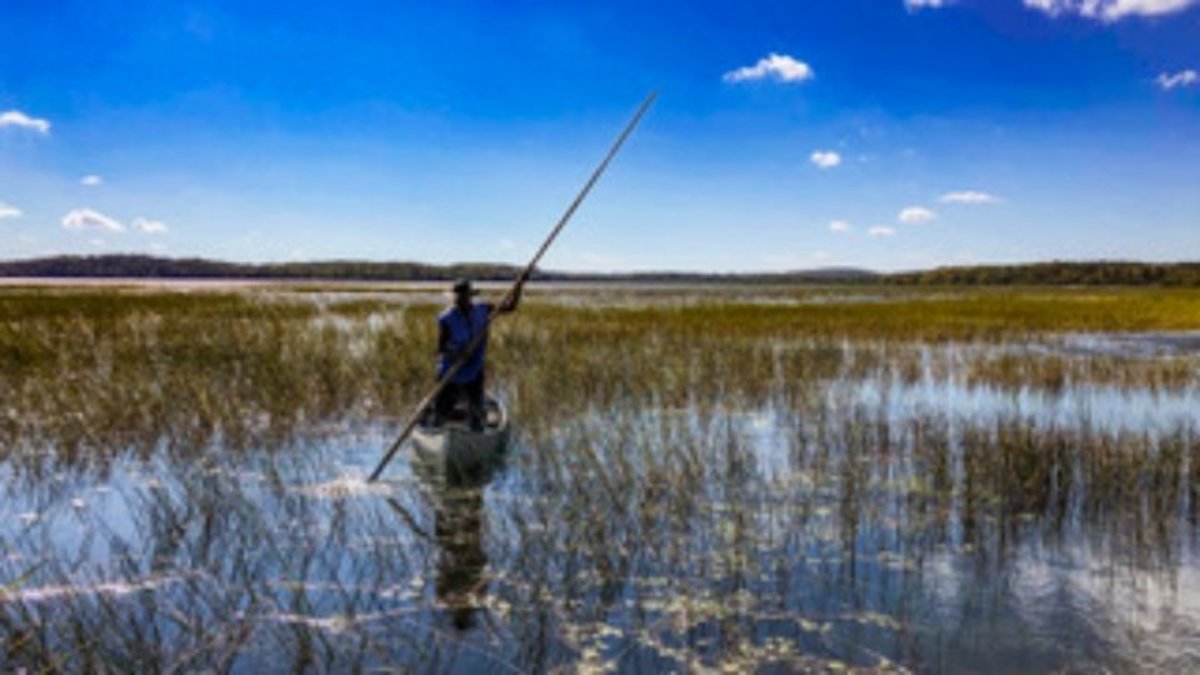
Imagine vast expanses of clear, shallow water, edged by dense forests of pine and birch. Below the surface, the lakebed is soft, rich silt—the ideal cradle for Zizania palustris, wild rice. As late summer approaches, these shallow bays and slow-moving river sections transform into verdant fields, the tall, slender stalks of Manoomin rising majestically above the waterline, their delicate florets heavy with ripening grains. This is the visual manifestation of Anishinaabe prosperity, a landscape meticulously understood and managed long before European arrival.
To visit these areas is to enter a dynamic ecosystem that has been cultivated and revered for countless generations. The traditional Anishinaabe understanding of these environments wasn’t merely observational; it was symbiotic. They understood the precise water levels, the flow of nutrients, the impact of weather patterns, and the lifecycle of the rice itself. Their "maps" were not static drawings but comprehensive, multi-layered bodies of knowledge encompassing ecological cycles, spiritual significance, family territories, and sustainable harvesting practices.
Beyond Cartography: Anishinaabe "Maps" of Manoomin
When we speak of Anishinaabe historical wild rice harvesting maps, we are not referring to paper maps in the Western sense. Instead, we are delving into a sophisticated system of oral traditions, mnemonic devices, astronomical observations, seasonal calendars, and intimate knowledge of specific waterways. These "maps" were embedded in stories, songs, ceremonies, and the very names given to lakes, bays, and rivers—names that often described the quality or abundance of rice found there, or the families who traditionally harvested them.

Each family or clan had designated harvesting areas, passed down through generations. These were not rigid property lines, but understood stewardship zones, managed with a profound sense of responsibility to ensure the continued abundance of Manoomin for all. The "map" was also a temporal one: knowing precisely when the rice in a particular bay would be ready for harvesting, factoring in ripening stages, weather conditions, and the need to leave enough seed for the following year. This sophisticated understanding prevented over-harvesting and ensured the long-term health of the rice beds.
The very act of traveling to these locations, often by birchbark canoe, was part of enacting the map. The turns of a river, the shape of an island, the presence of a specific tree—these were all landmarks within a larger navigational and ecological matrix. The knowledge of currents, portages, and safe passage was intertwined with the knowledge of where the best rice grew. These were dynamic, living maps, constantly updated through observation and shared experience, embodying a relationship with the land that prioritized sustainability and reverence.
Experiencing the Living Map Today: A Traveler’s Immersion
For the modern traveler, engaging with this living map requires a respectful and open-minded approach. It’s about more than just seeing; it’s about learning, listening, and understanding.

One of the most impactful ways to connect is by visiting a community or cultural center within Anishinaabe territory that offers programs related to Manoomin. Many First Nations and Tribal communities are actively involved in preserving and revitalizing wild rice harvesting traditions. Here, you might find exhibits detailing the history, ecological importance, and cultural significance of Manoomin. More importantly, you might have the opportunity to hear directly from Anishinaabe elders and knowledge keepers, whose stories carry the weight of generations of wisdom. They are the living "maps," their memories and experiences connecting past, present, and future.
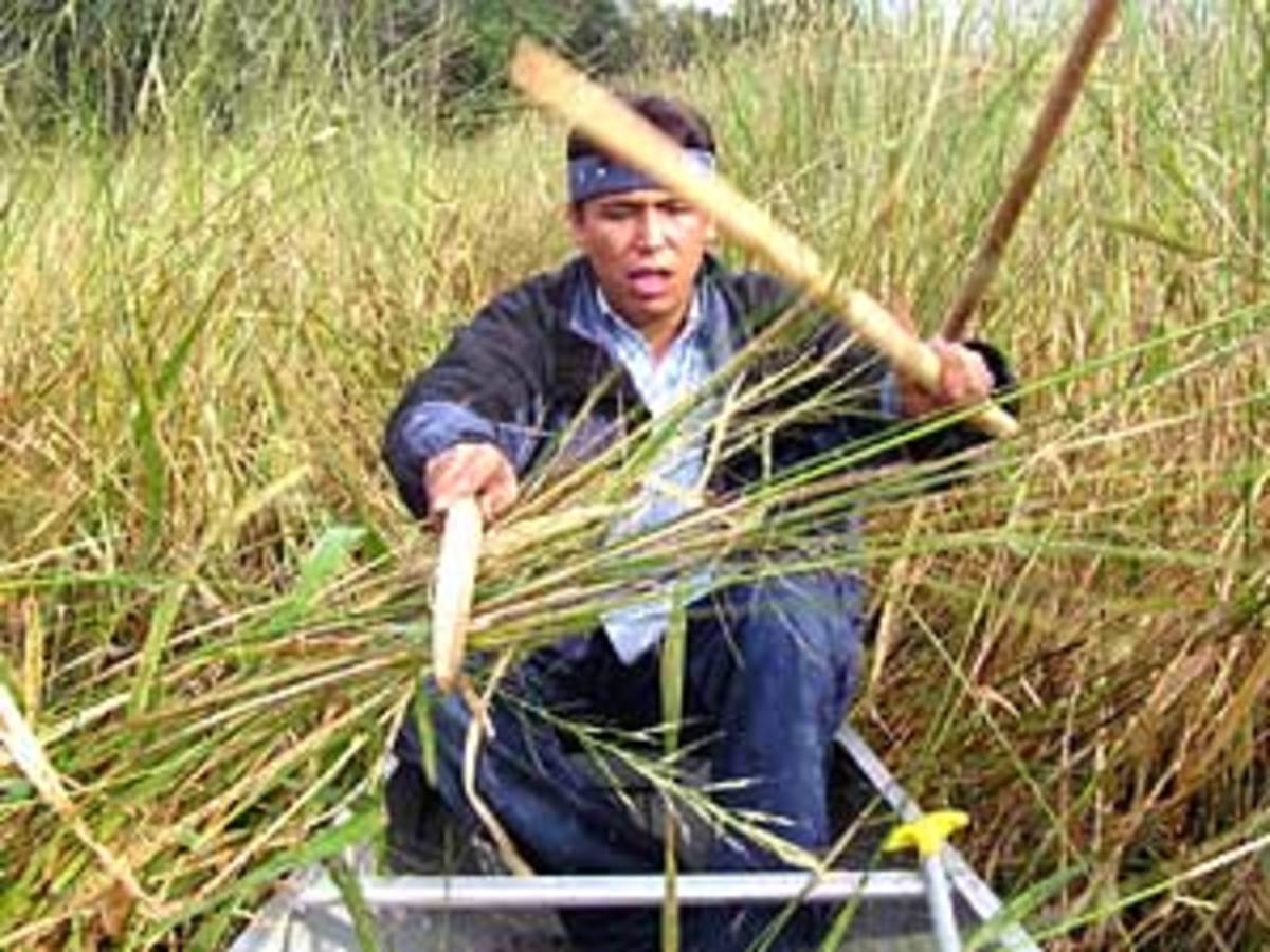
During late August and early September, the traditional harvesting season, some communities offer interpretive programs or even opportunities for visitors to observe the process (always with permission and under guidance). To witness the rhythmic "knocking" of the rice—two harvesters in a canoe, one gently bending the stalks over the canoe with a cedar "knocking" stick, the other lightly tapping the grains into the bottom of the boat—is to see a tradition alive. It’s a slow, deliberate dance, respectful of the plant and the water, far removed from industrial agriculture. This visual experience is a direct link to the historical practices guided by those ancient "maps."
Beyond observation, consider paddling a canoe through the wild rice beds yourself. While not harvesting (which is typically reserved for Anishinaabe citizens or those with specific permits and training), simply moving through the towering stalks offers a visceral understanding of the environment. The rustle of the leaves, the subtle movement of the water, the feeling of being enveloped by this sacred plant—it’s an intimate encounter with the very landscape that sustained the Anishinaabe. This journey, however, must be undertaken with extreme care, ensuring you do not disturb active harvesting areas or damage the delicate ecosystem. Seeking local Indigenous-led tour operators or guides is highly recommended to ensure a respectful and educational experience.
Furthermore, look for opportunities to taste Manoomin. Many Indigenous restaurants, cafes, or community events in the region feature wild rice prominently in their cuisine. Purchasing wild rice directly from Indigenous harvesters or community enterprises not only supports local economies but also ensures you are partaking in a culturally significant food product, often harvested and processed using traditional methods. This act of consumption becomes a tangible link to the historical sustenance and ongoing resilience of the Anishinaabe.
The Journey of Understanding: More Than a Travelogue
A trip to these Manoomin harvesting landscapes is more than just a travel experience; it’s an educational and spiritual journey. It challenges Western notions of land ownership and resource management, revealing a sophisticated Indigenous worldview centered on stewardship, reciprocity, and deep ecological knowledge. The "maps" of Manoomin harvesting are not merely guides to finding food; they are blueprints for a sustainable way of life, a testament to the Anishinaabe’s enduring relationship with their homeland.

It’s an opportunity to reflect on the impact of colonization, which often disrupted these traditional practices and dispossessed Indigenous peoples of their ancestral territories. Yet, despite these challenges, the Anishinaabe continue to practice, protect, and revitalize Manoomin harvesting, demonstrating incredible resilience and cultural strength. By engaging with these traditions respectfully, travelers become allies in this ongoing effort.
The modern traveler leaves these sacred waters not just with photographs, but with a deeper understanding of Indigenous sovereignty, environmental stewardship, and the profound wisdom contained within traditional knowledge systems. The "maps" that guided Anishinaabe ancestors are still present, not on paper, but in the vibrant green of the wild rice, the murmur of the waters, the stories of the elders, and the continuing traditions of a resilient people. This journey into the heart of Manoomin country is an invitation to witness, learn, and honor a living history that continues to shape the land and its people. It is a powerful reminder that some of the most profound travel experiences are found not in grand monuments, but in the subtle, enduring connections between people, place, and purpose.
