>
Mapping the Soul of the Land: A Journey Through the Ancestral Lands Cultural Heritage Center
Forget the sterile white walls and glass cases of typical museums. The Ancestral Lands Cultural Heritage Center, nestled within the breathtaking red rock canyons and vast, whispering plains of the American Southwest, isn’t just a place to see maps; it’s where maps breathe life into stories, where lines on parchment trace not just geography, but the very soul of nations. This isn’t a passive viewing experience; it’s an immersive journey into the Indigenous understanding of land, sovereignty, and identity, presented through the unparalleled lens of custom Native American territory maps.
From the moment you step into the center’s striking, earth-toned architecture – designed in collaboration with local tribal architects to blend seamlessly with the landscape – you understand this place is different. The air hums with a quiet reverence, a sense of deep history interwoven with vibrant contemporary culture. My visit here was less a tour and more a profound re-education, fundamentally altering my perception of maps, land ownership, and the enduring resilience of Native American peoples.

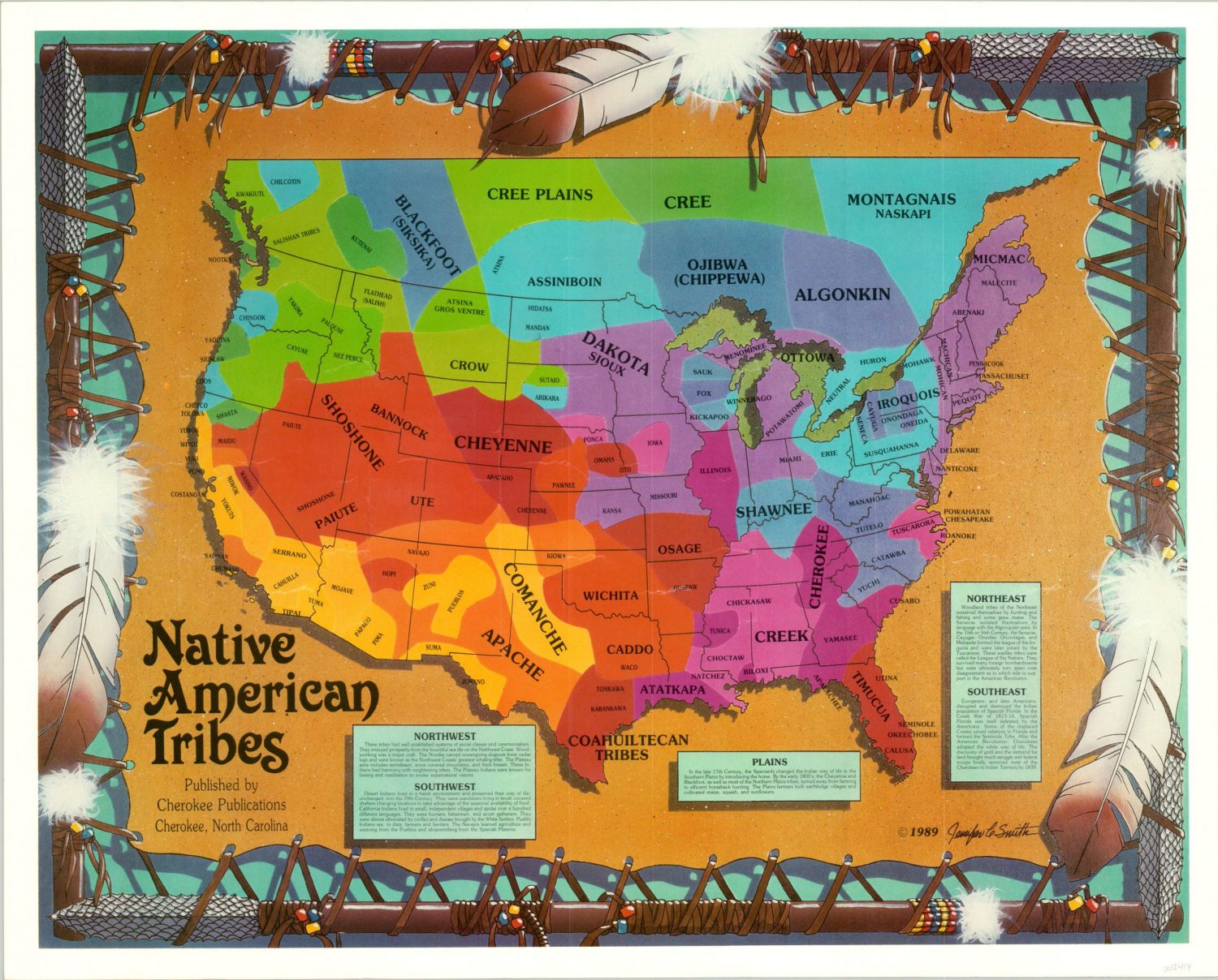
The core of the center’s mission, and its most compelling feature for any traveler interested in Indigenous cultures, is its sprawling, multi-faceted exhibition dedicated to custom Native American territory maps. These aren’t the static, often Eurocentric maps found in history books, delineating boundaries drawn by colonial powers. Instead, they are dynamic, deeply personal, and often revolutionary representations of land as understood and utilized by Indigenous communities for millennia, and importantly, in the present day.
One of the most powerful initial exhibits, "Before the Lines Were Drawn," transports visitors to a time predating European contact. Here, the concept of "map" expands dramatically. You’ll find intricately crafted hide paintings depicting hunting routes, seasonal migration patterns, and sacred sites, not with rigid cardinal directions, but with an intuitive understanding of landscape features, astronomical alignments, and oral histories. There are cedar bark scrolls from coastal tribes illustrating fishing territories and trade routes, their lines fluid, almost lyrical. Petroglyphs from nearby canyons are reproduced, revealing ancient territorial markers and cosmological maps etched into stone. This section challenges the very notion of what a map is, inviting you to see it as a living document, a narrative, rather than just a scientific diagram. It’s a powerful reminder that Indigenous peoples possessed sophisticated systems of navigation and territorial understanding long before the advent of European cartography.
The exhibit then transitions to the tumultuous era of contact and colonization, showcasing early treaty maps. This segment is particularly poignant. You’ll see original, faded treaties – some with meticulously drawn lines by European surveyors, often bearing the "X" marks of tribal leaders who likely didn’t fully comprehend the colonial legal framework of land ownership. The accompanying interpretative panels, often featuring direct quotes from tribal elders and historians, highlight the devastating disparity between the European concept of land as property to be bought and sold, and the Indigenous understanding of land as a sacred relative, to be stewarded and shared. These maps are stark reminders of promises made and broken, of vast territories reduced to reservations through the stroke of a pen. It’s a gut-wrenching, yet vital, historical lesson presented with unflinching honesty and profound respect for the Indigenous perspective.
However, the Ancestral Lands Cultural Heritage Center doesn’t dwell solely on past injustices. Its true brilliance lies in its forward-looking perspective, particularly in the "Reclaiming the Map: Indigenous Cartography in the 21st Century" wing. This is where the "custom" aspect truly shines. Here, you witness how contemporary Native American nations are actively creating their own maps, leveraging modern technology like GIS (Geographic Information Systems) to assert sovereignty, manage resources, and preserve cultural heritage.

Imagine an interactive display where you can explore a tribal nation’s custom GIS map. On one layer, you see the official, state-recognized boundaries of their reservation. But on subsequent layers, revealed with a touch, you uncover a richly detailed, Indigenous-centric map: traditional hunting grounds extending far beyond the reservation borders, sacred ceremonial sites, ancestral village locations, historical trails, areas of traditional plant gathering, and even places where specific oral histories are tied to the landscape. These maps are custom-built by tribal members – cartographers, elders, youth – reflecting their inherent knowledge and deep connection to the land. They are living documents, constantly updated, serving as powerful tools for legal battles over land and water rights, for environmental protection, and for transmitting cultural knowledge to younger generations.
One particularly moving exhibit showcases "Story Maps" – multimedia presentations that weave together traditional narratives, contemporary photographs, video interviews with elders, and interactive maps. I spent a long time at one such station, listening to a grandmother recount a creation story tied to a specific mountain range, while the digital map highlighted the peaks and valleys she spoke of, overlaid with photos of her family gathering traditional medicines there. It was a powerful fusion of ancient wisdom and modern technology, demonstrating how maps can be repositories of not just geographical data, but also cultural memory and spiritual connection.
Beyond the maps themselves, the center offers a holistic cultural experience. There are daily storytelling sessions led by tribal elders, traditional craft demonstrations (basket weaving, pottery, jewelry making), and a vibrant contemporary art gallery featuring Indigenous artists whose work often incorporates themes of land, territory, and identity. The outdoor spaces are equally engaging, with carefully curated native plant gardens, interpretive trails leading to recreated traditional dwellings, and observation points offering breathtaking views of the ancestral lands stretching into the horizon. These elements aren’t just supplementary; they are integral to understanding the context and profound significance of the maps within. They make the abstract concept of "territory" tangible and deeply personal.
My visit culminated in a powerful workshop on "Decolonizing Your Map," where participants were encouraged to sketch their own personal maps of significant places, not based on Google Maps, but on sensory memory, emotional connection, and personal history. It was a profound exercise in understanding how our own biases and perspectives shape our understanding of space, and how Indigenous maps offer a radically different, and arguably more holistic, way of relating to the land.

For the intrepid traveler, the Ancestral Lands Cultural Heritage Center is more than just a stop on a journey; it’s a destination that promises deep cultural immersion and intellectual stimulation. Plan to spend at least a full day, if not two, to fully absorb the wealth of information and experiences.
Practical Travel Tips:
- Location: The center is strategically located near a major tribal reservation, roughly a 2-hour drive from . A rental car is essential for independent travel.
- Best Time to Visit: Spring (April-May) and Fall (September-October) offer the most pleasant weather for exploring the outdoor exhibits and surrounding landscape. Summers can be intensely hot, and winters can bring occasional snow.
- Admission: Fees are reasonable, with discounts for seniors, students, and tribal members. Your contribution directly supports the center’s educational programs and cultural preservation efforts.
- Amenities: A well-stocked gift shop features authentic Native American arts, crafts, books, and educational materials. There’s also a café serving delicious, locally sourced meals and traditional Indigenous foods.
- Respectful Engagement: The center emphasizes respectful engagement. Photography is generally permitted in designated areas, but always ask before taking pictures of individuals or sacred objects. Participate actively in discussions and workshops, and approach the experience with an open mind and heart.
- Nearby Attractions: Consider extending your stay to explore nearby National Parks (e.g., Petrified Forest National Park, Canyon de Chelly National Monument) or other tribal cultural sites, many of which have direct historical and cultural ties to the narratives presented at the center.

The Ancestral Lands Cultural Heritage Center is a testament to the enduring power of Indigenous knowledge and the vital role that custom maps play in the ongoing fight for sovereignty and cultural survival. It’s a place that will challenge your assumptions, broaden your horizons, and leave you with a profound appreciation for the intricate, living relationship between people and their ancestral lands. It’s not just a review of a place; it’s a call to experience a different way of seeing the world. Go, and let the maps guide you to a deeper understanding.
