Beyond the Brochure: Navigating Ancestral Lands with Downloadable Native American Territory Maps
Forget generic road maps and tourist brochures. To truly unlock the profound history and vibrant contemporary cultures of places like the American Southwest, your essential travel companion isn’t a guide book, but a collection of downloadable Native American territory maps. These aren’t just lines on a digital canvas; they are keys to understanding the land you traverse, offering layers of context, respect, and immersion that transform a casual trip into a deeply meaningful journey. This isn’t a review of a single site, but an exploration of how these invaluable digital resources redefine travel across an entire, historically rich region.
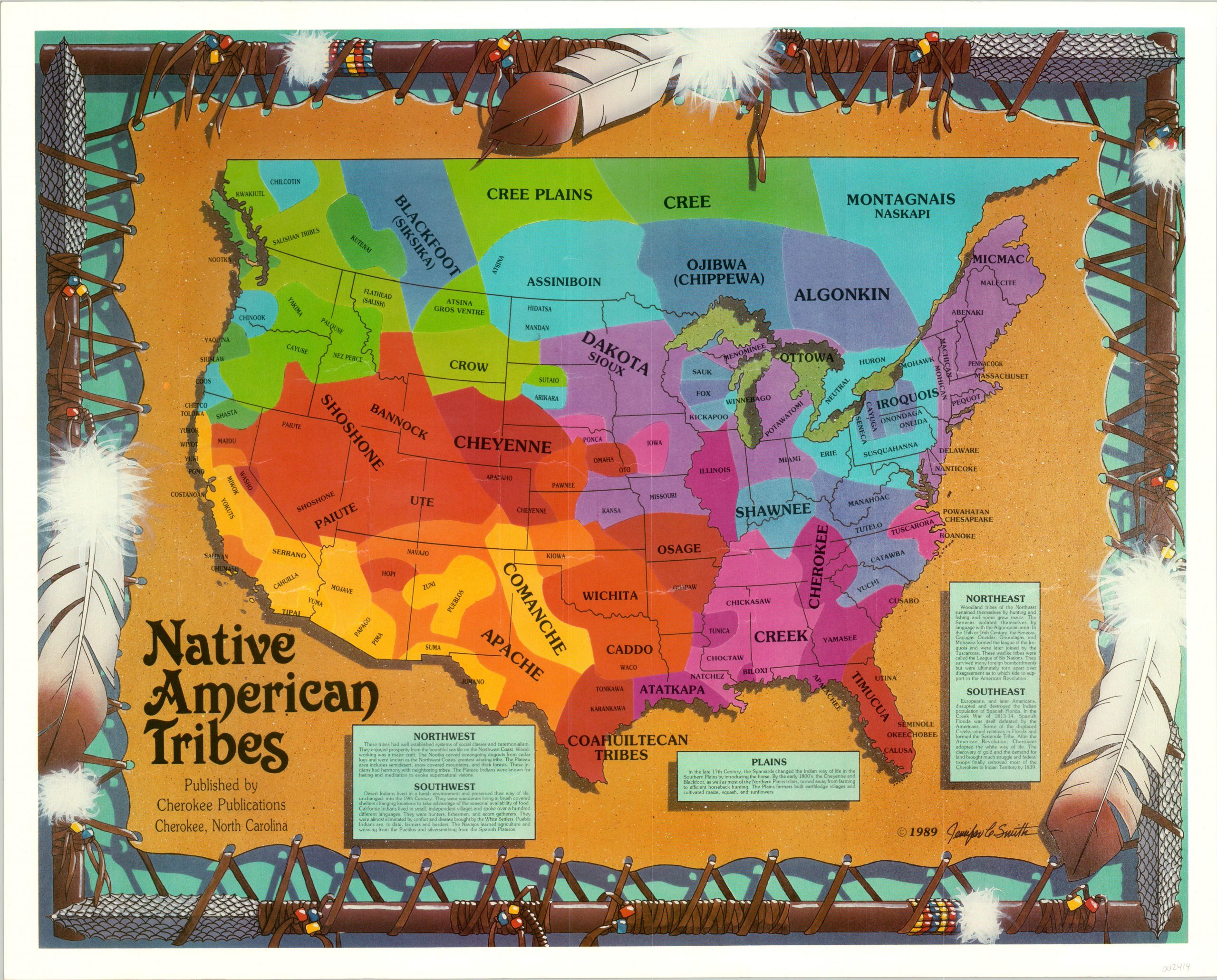
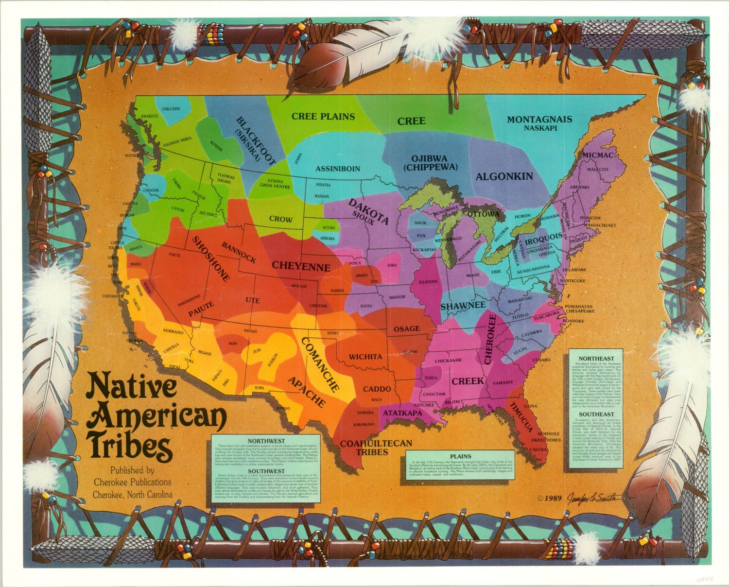
The focus here is on the American Southwest – a vast, stunning, and culturally dense landscape encompassing Arizona, New Mexico, Utah, Colorado, and parts of California, Nevada, and Texas. This region, often romanticized for its red rock canyons and desert expanses, is first and foremost ancestral land, home to countless Indigenous nations since time immemorial. From the expansive Navajo Nation to the ancient Pueblo communities, the resilient Apache, the Hopi mesas, the Zuni, Ute, and countless others, their stories are etched into every canyon wall and mesa top. Standard maps only show current political boundaries; downloadable Native American territory maps, however, illuminate the historical and contemporary Indigenous presence, revealing the true narrative of the land.
What exactly are these maps? They are a diverse digital archive. You’ll find historical maps illustrating vast ancestral hunting grounds, intricate trade routes, and pre-colonial territorial claims. There are detailed treaty maps, outlining land cessions and the shrinking boundaries of reservations over centuries. Crucially, contemporary maps show current tribal land boundaries, trust lands, and culturally significant sites. Some delve into linguistic territories, while others overlay traditional ecological knowledge (TEK) onto modern topographical data, pinpointing sacred places, traditional plant gathering areas, or migration routes. These are available from academic institutions, tribal cultural centers, non-profit organizations like Native Land Digital, and government archives, often as high-resolution PDFs, GIS data, or interactive web applications, making them perfectly suited for offline use on a tablet or smartphone in remote areas.

The value of these digital resources for a traveler in the Southwest cannot be overstated. Firstly, they provide crucial context. Imagine driving through Monument Valley, an iconic symbol of the American West. Without an understanding of it as Diné Bikéyah, the heartland of the Navajo Nation, you’re missing the profound spiritual and cultural significance. A map showing the historical and current Navajo boundaries, alongside clan territories, instantly transforms a scenic drive into a journey through a living cultural landscape. You begin to see the land not just as geology, but as a repository of stories, traditions, and sovereignty.
Secondly, these maps foster respect. Acknowledging Indigenous presence is a fundamental aspect of responsible travel. When you understand that the hiking trail you’re on, the ancient ruins you’re admiring, or the national park you’re visiting lies on unceded ancestral lands, your perspective shifts. These maps are powerful tools for performing a personal land acknowledgment, guiding you to understand whose traditional territory you are occupying. This awareness encourages a deeper reverence for the land and its stewards, promoting mindful interaction rather than passive consumption of scenery.
Consider exploring the Ancestral Puebloan sites, such as Chaco Canyon, Mesa Verde, or Hovenweep. Standard park maps guide you through the designated archaeological zones. However, downloadable maps that overlay the vast historical territories of the Ancestral Puebloans reveal a sprawling network of communities, trade routes, and astronomical observatories that extended far beyond modern park boundaries. They illustrate the interconnectedness of these ancient cultures and the immense scale of their societal structures, giving you a richer appreciation for the ruins you see and the people who built them. You start to grasp that these are not isolated ruins, but fragments of a massive, sophisticated civilization.
Take the example of navigating the Navajo Nation. Covering over 27,000 square miles across Arizona, New Mexico, and Utah, it’s the largest Native American reservation in the United States. While GPS will get you to Monument Valley or Canyon de Chelly, a detailed downloadable map from the Navajo Nation Parks & Recreation or a historical archive provides critical insights. It shows not just the reservation boundaries but also adjacent tribal lands (like the Hopi Reservation, an island within Navajo territory), highlighting the complex political geography. It can point to community chapters, trading posts, and cultural centers often missed by mainstream tourist guides. Understanding these boundaries is crucial for respecting local customs, photography policies, and knowing where services are available, especially when venturing off paved roads into areas where cell service is non-existent.

Another compelling application is in understanding sacred landscapes. Places like Bears Ears National Monument in Utah, or even sections of the Grand Canyon, are not merely geological wonders; they are profoundly sacred to numerous Indigenous nations, including the Ute, Navajo, Hopi, Zuni, and Pueblo peoples. Maps that document traditional use areas, ceremonial sites, and migration corridors reveal layers of meaning invisible to the casual observer. These maps might highlight petroglyph panels not marked on tourist routes, or ancient resource gathering areas. While discretion and respect are paramount (never share specific locations of sensitive sites publicly), having this knowledge internally transforms your experience. You move through the landscape with heightened awareness, understanding the deep spiritual connection Indigenous peoples have to every rock formation and water source. This awareness guides respectful behavior, like staying on marked trails, leaving no trace, and refraining from disturbing any natural or cultural features.
These maps also become invaluable for engaging with contemporary Indigenous culture. Planning to visit a Pueblo feast day, attend a powwow, or seek out authentic Indigenous art? Downloadable maps can pinpoint the locations of specific pueblos, tribal museums, cultural centers, and artisan markets within their respective tribal lands. This helps you identify opportunities to directly support Indigenous economies and engage with living cultures. For instance, knowing the precise location of the Zuni Pueblo or the Hopi villages, and understanding their historical significance through mapping, allows for more informed and respectful interaction, rather than simply passing through as a tourist. It encourages seeking out local guides or tribal enterprises, ensuring your tourism dollars benefit the community directly.
The practicalities of using these maps are straightforward. Many tribal nations and organizations offer their own mapping resources online. Universities with strong Native American studies programs often host digital archives. Non-profits like Native Land Digital provide an excellent interactive web map that shows traditional territories, treaties, and languages across the globe, which can then lead you to more detailed regional resources. Always prioritize downloading these maps, especially those in PDF or geo-referenced formats, before heading into remote areas where internet connectivity is unreliable. Many modern GPS apps allow you to import custom map layers or KML files, integrating historical and cultural data directly into your navigation. Layering these maps with satellite imagery and topographical data provides an unparalleled understanding of the terrain and its hidden stories.
Ethical considerations are paramount when utilizing these resources. Firstly, use these maps as a tool for learning and respect, not for seeking out "secret" or restricted sites. Many areas on tribal lands require permits or guides, and some places are sacred and off-limits to non-Natives. These maps help you identify those boundaries and respect them. Secondly, understand that land acknowledgments are more than just words; they are calls to action. By using these maps, you are actively acknowledging the historical and ongoing presence of Indigenous peoples and their enduring connection to the land. This understanding should translate into supporting Indigenous businesses, respecting cultural protocols, and advocating for Indigenous rights and sovereignty. Avoid any behavior that could be perceived as "pothunting" or disturbing archaeological sites; the maps are for education, not exploitation.

In essence, downloadable Native American territory maps transform the American Southwest from a mere collection of scenic vistas into a living, breathing historical and cultural landscape. They are not just navigational aids but educational tools, ethical compasses, and cultural interpreters. They empower you to travel with a deeper sense of purpose, to move beyond the surface-level beauty and engage with the profound human story embedded in every canyon, mesa, and river. So, before you pack your bags for your next Southwestern adventure, ensure these maps are the first thing you download. Your journey will be immeasurably richer, more respectful, and far more memorable. They are the ultimate review, not of a single place, but of an entire perspective, urging you to see the land not just as it is, but as it has always been: ancestral and sovereign.

