Tracing Ancestral Echoes: A Journey Through Caddo Nation Lands Guided by History’s Maps
Forget the glossy brochures and the well-trodden paths. Imagine a different kind of travel, one where your guide isn’t a GPS but a whisper from the past, etched onto ancient cartographies. This is the journey we embark on, a profound exploration of the ancestral lands of the Caddo Nation, using their historical maps – in all their diverse forms – as our compass. This isn’t just about visiting a place; it’s about seeing the land through the eyes of its original stewards, understanding the profound connection between culture, territory, and identity that these maps reveal.
The "place" we’re reviewing here isn’t a single museum or an archive; it’s the sprawling, verdant, and historically rich territory that encompasses parts of what are now Louisiana, Arkansas, Texas, and Oklahoma – the heartland of the Caddo Confederacy. To travel through these lands, actively seeking out the echoes of Caddo presence and understanding their historical mapping, transforms a simple road trip into a pilgrimage.
The Maps: More Than Just Lines on Paper

Before we hit the road, let’s understand what we mean by "Caddo Nation historical maps." These aren’t always traditional European-style surveys. They are a mosaic of understanding:
- Oral Cartographies: Stories, songs, and traditions that describe boundaries, significant sites, trade routes, and spiritual landscapes, passed down through generations. These are the living maps.
- Drawn Representations: Early sketches by Caddo individuals or European observers attempting to capture Caddo territorial claims, village locations, and resource areas. These often prioritize cultural significance over precise scale.
- Colonial Interpretations: European maps that, while often biased, nonetheless depict Caddo settlements, hunting grounds, and trade networks, offering glimpses into their territorial reach from an external perspective. These become invaluable when cross-referenced with Caddo oral histories.

These maps, whether spoken, drawn, or observed, are vital documents of sovereignty, cultural identity, and profound land stewardship. They are not merely navigational tools; they are historical narratives, spiritual blueprints, and testament to a resilient people. To "review" a location related to these maps means to review the very act of engaging with the landscape they depict, seeking out the tangible and intangible markers of Caddo civilization.
Louisiana: The Eastern Gateway to Caddo History

Our journey begins in Louisiana, a land woven with the intricate waterways that were once the lifeblood of Caddo communities. Here, the humid air hangs heavy with history, and the landscape itself feels like a living map.
Caddo Lake – A Spiritual Nexus: No journey into Caddo lands is complete without experiencing Caddo Lake, straddling the Louisiana-Texas border. This ethereal, moss-draped cypress swamp is less a lake and more a labyrinth of interconnected bayous, islands, and channels. Historical accounts and oral traditions speak of its immense spiritual significance to the Caddo people, a place of abundant resources and deep cultural meaning. As you paddle a kayak through its silent, shadowy waters, the Caddo maps of ancient waterways, fishing grounds, and sacred spots come alive. You’re not just observing nature; you’re tracing paths used for millennia, understanding why such a unique ecosystem would be central to a culture’s identity. The very act of navigating its complex beauty gives you a visceral appreciation for the indigenous knowledge required to thrive here – knowledge inherently mapped in their minds and stories.
Natchitoches – A Point of Intersection: Further east lies Natchitoches, Louisiana’s oldest permanent settlement. While often celebrated for its French colonial heritage, Natchitoches was built on the doorstep of Caddo territory and became a crucial hub for trade and interaction, sometimes peaceful, sometimes contentious, with the various Caddo groups. Early European maps of the region invariably mark Caddo villages in the vicinity. Walking the historic streets of Natchitoches, it’s essential to remember it as a place where Caddo and European worlds collided, negotiated, and influenced each other. The Red River, a major artery depicted on many historical maps, connects Natchitoches directly to the deeper Caddo heartland, underscoring its strategic importance.
Poverty Point World Heritage Site (While Pre-Caddo, it Resonates): Though Poverty Point’s monumental earthworks date back 3,700 to 3,100 years ago, long before the emergence of the Caddo culture as we know it, its sheer scale and sophisticated planning offer profound insight into the ancient indigenous engineering and communal organization of the lower Mississippi Valley. The Caddo, as descendants of the broader Caddoan Mississippian culture, inherited and evolved within a tradition of complex societies that built monumental earthworks. Visiting Poverty Point provides a powerful prelude, a sense of the deep ancestral roots that underpin the Caddo’s own sophisticated mound-building and societal structures, implicitly mapped in their understanding of sacred geometry and landscape transformation.
Texas and Arkansas: The Core of the Confederacy
Moving west into East Texas and north into Arkansas, we enter what was undeniably the heartland of the Caddo Confederacy, where the physical manifestations of their historical maps become even more tangible.

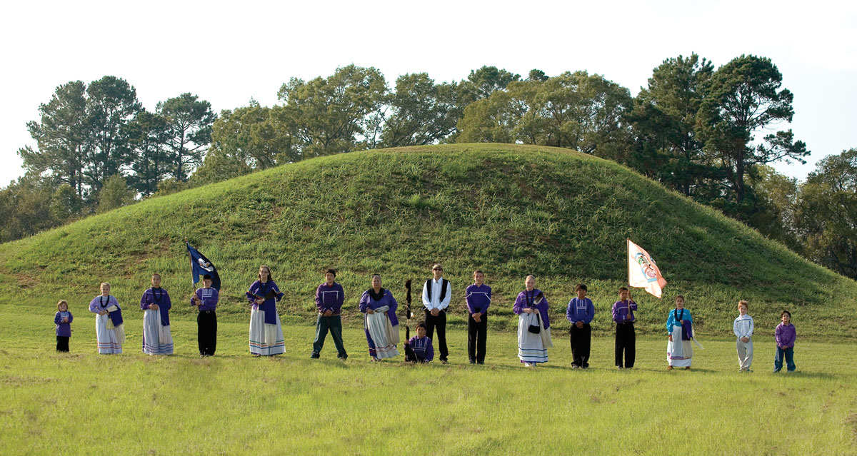
Caddo Mounds State Historic Site, Texas – A Direct Link: This site near Alto, Texas, is perhaps the most direct and poignant place to connect with Caddo historical maps. Here, three ceremonial mounds and a Caddo village site offer an unparalleled window into their daily lives and spiritual practices. The interpretive center eloquently tells the story of the Hasinai Caddo, a significant group within the Confederacy. Walking among the mounds, which stand as monumental markers of Caddo presence, you can almost overlay them with the mental maps of ancient Caddo leaders, who understood these structures not just as buildings, but as anchors of their cosmos and community. This place directly reflects the spatial organization and sacred geography that would have been central to Caddo cartography. It’s a powerful experience to stand on these ancient earthworks, understanding them as direct manifestations of a mapped cultural landscape.
Toltec Mounds Archeological State Park, Arkansas – Echoes of a Shared Heritage: Similar to Poverty Point, Toltec Mounds represents a Mississippian culture site (Plum Bayou culture, c. AD 600–1050) that predates the historically known Caddo. However, it’s located within the broader Caddoan sphere of influence and illustrates the deep, continuous tradition of mound building and complex societies in the region that ultimately gave rise to the Caddo. The precise alignment of these mounds with solstices and equinoxes speaks to an advanced understanding of the cosmos and its integration into daily life – a form of celestial mapping that would have been integral to Caddo worldview and potentially their own territorial definitions. The Arkansas River, a major artery for trade and movement, would have been a crucial feature on any Caddo map of the region.
Oklahoma: The Modern Home, Echoes of Resilience
Our journey culminates in Oklahoma, where the Caddo Nation of Oklahoma is headquartered. While much of their ancestral land was lost through forced removal and assimilation policies, their spirit and culture endure, keeping the maps of their heritage alive.
Binger, Oklahoma – The Caddo Nation Headquarters: Visiting the Caddo Nation’s tribal complex near Binger offers a vital contemporary perspective. While public access may vary, understanding its existence as the center of modern Caddo governance, cultural preservation, and community life is crucial. Here, cultural programs, language revitalization efforts, and historical research continue to interpret and honor the ancestral maps. It’s a place where the living history of the Caddo is actively being shaped, informed by the wisdom of those ancient cartographies. Supporting tribal initiatives, attending public events (like dances or cultural festivals if available and open to the public), and learning directly from Caddo citizens transforms the historical maps from static documents into living, breathing culture.
The Landscape of Western Oklahoma: While far removed from the cypress swamps of Louisiana or the dense forests of East Texas, the plains of Oklahoma hold a different kind of Caddo map. It’s a map of resilience, adaptation, and a continued connection to the earth, even in a forcibly relocated context. Here, the maps are less about ancient village sites and more about the enduring spirit of a people who have maintained their identity against incredible odds.
The Deeper Meaning: Why This Journey Matters
To travel through Caddo Nation lands, guided by the concept of their historical maps, is to undertake more than a scenic drive. It’s an exercise in deep historical empathy and cultural understanding.
Unveiling Resilience: These maps, whether tangible or oral, tell a story of incredible resilience. They show a people who thrived for millennia, understood their environment intimately, and adapted to immense changes, including European contact and forced removals. The gaps on modern maps where Caddo villages once stood are a stark reminder of displacement, but the enduring Caddo culture is a testament to their strength.
A New Perspective on Land: This journey reorients our understanding of "land." For the Caddo, land was not merely property to be bought and sold, but a sacred entity, a provider, a home, and an integral part of their identity. Their maps reflect this holistic view, where every stream, hill, and forest held meaning beyond its physical form. This perspective encourages a more mindful and respectful engagement with the natural world.
Beyond the Tourist Gaze: This isn’t about ticking off landmarks. It’s about listening to the land, seeking out the stories it tells, and acknowledging the original voices that named its features and understood its rhythms. It’s about moving beyond the "tourist gaze" to a posture of learning and respect.
Supporting Living Cultures: Finally, this "review" of a place related to Caddo maps is an invitation to support the living Caddo Nation. By visiting sites, learning their history, respecting their cultural heritage, and engaging with their contemporary presence, travelers contribute to the ongoing vitality of a culture that has preserved its maps, both literal and metaphorical, through centuries of change.
In essence, the Caddo Nation historical maps are not just artifacts; they are invitations. They invite us to slow down, look deeper, and understand the profound layers of history and culture that lie beneath the surface of the modern landscape. To journey through these ancestral lands with these maps in mind is to embark on an unforgettable exploration of identity, resilience, and the enduring spirit of a truly remarkable people. It’s a travel experience that will forever alter how you see the world, connecting you to the ancient heart of North America.
