Haida Gwaii: Navigating a Living Map of Ancient Lands
Forget the static, two-dimensional grids we typically consult for travel. In Haida Gwaii, the remote archipelago off British Columbia’s coast, a map isn’t merely a guide to physical locations; it’s a living, breathing tapestry woven from ancient stories, spiritual pathways, ecological knowledge, and a profound, unbroken connection between people and place. To review Haida Gwaii isn’t just to describe its breathtaking landscapes; it’s to journey into the heart of the Haida Nation’s traditional lands, understanding them through the lens of their unique, deeply embedded cartography. This isn’t just a trip; it’s an immersion into a map that speaks.
From the moment your ferry glides through the mist-shrouded inlets or your small plane descends over the emerald islands, you begin to grasp that Haida Gwaii is different. Known as "Xhaaidlagha Gwaayaai" – "Islands at the Boundary of the World" – by the Haida people, this isolated paradise comprises over 150 islands, dominated by the two largest: Graham Island to the north and Moresby Island to the south. But these aren’t just geographical features; they are markers on a map whose coordinates are measured in generations, cultural protocols, and the very pulse of the land and sea.
More Than Lines on Paper: The Haida Concept of Territory

The "traditional lands maps" of the Haida Nation are not museum artifacts. They are foundational to the Haida worldview, encompassing not just physical boundaries but a holistic understanding of their ancestral territory – Haida Gwaii itself. This mapping system predates colonial surveys by millennia and is intricately tied to oral histories, place names (each telling a story of use, spiritual significance, or historical event), kinship ties, resource management, and a deep spiritual reverence. When you travel here, you are not just visiting a place; you are stepping into a complex, multi-layered map that is continuously being read and interpreted by its original inhabitants.
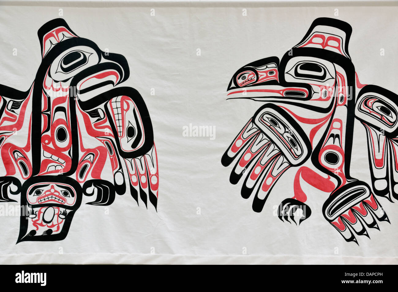
This concept of a living map immediately shapes your experience. Unlike typical tourist destinations where points of interest are neatly signposted, here, understanding comes through engagement. It means listening to Haida voices, observing the intricate carving of a totem pole, feeling the damp moss underfoot in an ancient cedar forest, and comprehending that every stream, every bay, every cluster of trees holds a name and a narrative that is integral to the Haida story. The maps are not drawn; they are lived.
Gateway to the Map: Skidegate and Old Massett
Your journey into this living map typically begins in one of the two main Haida communities: Skidegate on Graham Island or Old Massett to the north. These vibrant villages serve as crucial contemporary markers on the traditional map, representing the resilience and ongoing presence of the Haida people.

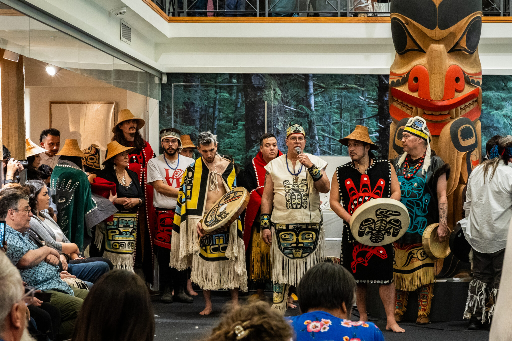
In Skidegate, the Haida Heritage Centre at Kay Llnagaay is an essential first stop, acting as a profound orientation point for the map you are about to explore. More than a museum, it’s a living cultural institution designed to tell the Haida story from their own perspective. The architecture itself echoes traditional longhouses, and the surrounding totem poles, each with its unique narrative, are like three-dimensional annotations on the Haida map, marking clan histories, significant events, and ancestral connections to specific territories. Here, you learn about the Haida’s deep legal and spiritual relationship to their lands, their history of stewardship, and their ongoing fight for self-determination. The exhibits, the art, the canoes, and the shared stories illustrate how every element of Haida life is interwoven with the land and sea. This center doesn’t just display culture; it explains the underlying cartography.
Old Massett, equally rich in culture, presents another crucial contemporary node. Its stunning array of poles, some historic and weathered, others vibrant and newly carved, line the village, forming a visual representation of clan lineages and territories. Engaging with local artists, weavers, and carvers provides insight into how traditional knowledge – the essence of the Haida map – is passed down and reinterpreted in the modern era. These communities are not just towns; they are thriving cultural anchors, proving that the traditional maps are not historical relics but dynamic frameworks for modern life.
Gwaii Haanas: The Sacred Heart of the Map
For many, the true pilgrimage into the heart of the Haida map lies in Gwaii Haanas National Park Reserve, National Marine Conservation Area Reserve, and Haida Heritage Site. This protected area, encompassing the southern third of Haida Gwaii, is jointly managed by the Haida Nation and Parks Canada, a groundbreaking model of co-governance. To enter Gwaii Haanas is to step back in time, into a landscape where the ancient maps are most vividly preserved.

Access to Gwaii Haanas is highly regulated, often by chartered boat or floatplane, and visitors are strongly encouraged, if not required, to travel with a Haida guide or approved tour operator. This isn’t merely for safety; it’s a fundamental aspect of understanding the traditional map. Your Haida guide becomes your interpreter, not just of the landscape but of its profound cultural significance. They unlock the layers of the map, pointing out ancestral village sites, traditional fishing grounds, sacred places, and the subtle signs of Haida resource management that have sustained their people for millennia.
The highlight for many is SGang Gwaay (Ninstints), a UNESCO World Heritage Site. As your boat approaches the remote island, the sight of towering, moss-covered mortuary poles standing sentinel against the dense rainforest and churning Pacific is nothing short of awe-inspiring. These poles, weathered by centuries, are not merely art; they are powerful markers on the Haida map, identifying clan lineage, commemorating ancestors, and asserting territorial claims. They are the physical embodiment of the Haida story, etched onto the very landscape.
Walking through the remains of this ancient village, you are accompanied by Haida Watchmen, guardians who live on-site during the summer months. These Watchmen, direct descendants of the people who once inhabited these villages, are living libraries. They share stories, explain the significance of the poles, point out archaeological remnants, and offer a deep, personal connection to the land. Their presence transforms a historical site into a living experience, where the past is palpably present, and the traditional map is actively being read and explained. They are not just guides; they are stewards and storytellers, bringing the map to life.
Other ancient village sites within Gwaii Haanas, such as Tanu and K’uuna (Skedans), offer similar, deeply moving experiences, each with its own set of stories and unique poles. Each village is a specific, sacred coordinate on the Haida map, representing a particular clan’s history, resource base, and spiritual connection to that place. The journey between these sites, often by sea kayak or zodiac, reinforces the Haida’s historical reliance on the ocean as their highway, further illustrating their marine-focused cartography.
Nature as a Map Feature: Forests, Oceans, and Wildlife
Beyond the cultural sites, the natural environment of Haida Gwaii itself forms an integral part of the traditional map. The ancient temperate rainforests, dominated by towering Sitka spruce and western red cedar, are not just beautiful; they are resource maps. The cedar, revered as the "Tree of Life," provided material for canoes, longhouses, clothing, and spiritual objects. Every old-growth grove, every mossy creek, every hidden cave held significance – as a hunting ground, a sacred site, or a source of sustenance. The Haida managed these forests sustainably for thousands of years, a testament to their deep understanding of the land’s interconnectedness.

The surrounding ocean is an equally vital component of the Haida map. It’s a vast larder, teeming with salmon, halibut, shellfish, and marine mammals. Traditional fishing grounds, seal rookeries, and whale migration routes are all meticulously documented in Haida oral tradition and continue to be understood and respected. Kayaking through the calm, protected waters of the east coast, or experiencing the raw power of the west coast, you feel the profound connection between the Haida and their marine environment. The ebb and flow of tides, the migration of species, the locations of reefs and rich fishing banks – these are all critical features on the Haida’s ocean map.
Wildlife, too, plays a symbolic and practical role. The Haida Gwaii black bear, a genetically distinct subspecies, roams the islands, often sighted foraging along the shore. Eagles soar overhead, and humpback whales breach offshore. These creatures are not just part of the ecosystem; they are characters in Haida stories, clan crests, and indicators of the health of the land – all elements within the traditional map.
The Enduring Map: Sovereignty and Stewardship
The Haida Nation’s traditional lands maps are not merely historical curiosities. They are living documents that underpin the Haida’s ongoing assertion of sovereignty and their commitment to sustainable stewardship. The landmark 2004 Gwaii Haanas Agreement and the subsequent Haida Gwaii Strategic Land Use Plan are modern manifestations of these ancient maps, demonstrating how traditional knowledge and contemporary governance can intertwine. The Haida Nation continues to lead efforts in conservation, ensuring that their territory remains pristine for future generations, directly informed by the understanding gleaned over millennia.
Visiting Haida Gwaii is, therefore, more than a vacation; it’s an educational pilgrimage. It challenges your preconceived notions of what a "map" is, inviting you to see the world through a different, far richer lens. You leave not just with photographs of stunning scenery, but with a deeper appreciation for Indigenous knowledge, the power of oral tradition, and the profound, living connection between a people and their land.
Practicalities for Navigating the Living Map
- When to Go: Late spring to early fall offers the best weather and access to Gwaii Haanas.
- Access: BC Ferries from Prince Rupert or flights from Vancouver (to Sandspit or Masset).
- Gwaii Haanas: Book well in advance with a Haida-owned or approved tour operator. This is not a self-guided experience. Respect the protocols and the Watchmen.
- Accommodation: Options range from hotels and B&Bs in Skidegate, Queen Charlotte, and Masset to remote lodges and campsites.
- Respect: Haida Gwaii is Haida territory. Travel with an open mind, a willingness to learn, and profound respect for the culture, the land, and the people. Support local Haida businesses and artists.
Haida Gwaii is a place where the past walks hand-in-hand with the present, where every tree, every wave, every ancient pole whispers a story. It’s an invitation to navigate a world where the map isn’t something you hold in your hand, but something you experience with your entire being – a living, breathing testament to the enduring spirit of the Haida Nation and their sacred lands. It’s a journey that will forever change how you see the world, and how you understand the true meaning of a map.
