Mapping Resilience: The Pequot Tribe’s Traditional Lands and the Enduring Spirit of Connecticut’s First People
To truly understand Connecticut, one must look beyond its colonial-era charming towns and picturesque landscapes to the foundational layers of its history – layers etched deep by the Pequot Tribe. A traditional lands map of the Pequot is far more than a geographical delineation; it is a profound historical document, a testament to identity, resilience, and the enduring sovereignty of a people who shaped this region long before European arrival. For the traveler and history enthusiast, engaging with this map is not merely an academic exercise; it is an immersive journey into the heart of Connecticut’s true narrative.
The Original Domain: A Pre-Colonial Powerhouse
Before the 17th century, the Pequot Tribe commanded a significant and strategic territory stretching across much of southeastern Connecticut, extending into parts of Rhode Island and Long Island. Their traditional lands encompassed the fertile river valleys of the Thames, Mystic, and Pawcatuck, reaching the abundant shores of Long Island Sound. This was not merely an arbitrary claim; it was a homeland cultivated and understood with an intimate knowledge passed down through generations.

The Pequot were a powerful and politically sophisticated Algonquian-speaking people, their name often translated as "destroyers" or "fox people," hinting at their prowess in both warfare and diplomacy. Their society was well-structured, led by a sachem (chief) and advised by councils, with a network of villages and satellite communities. Their economic life thrived on a blend of agriculture (corn, beans, squash), hunting (deer, bear, fowl), fishing (eels, oysters, fish from rivers and sea), and extensive trade. Wampum, crafted from quahog and whelk shells, was not just currency but held deep spiritual and ceremonial significance, and the Pequot were master producers and traders of it, controlling vital trade routes.
Their strategic location, commanding access to both inland resources and coastal trade, cemented their status as a dominant force among the regional tribes, including the Narragansett, Mohegan, and Niantic. The traditional Pequot map, therefore, illustrates a vibrant, self-sufficient, and powerful Indigenous nation, whose presence was the defining feature of the land we now call Connecticut. It speaks of a time when the rivers flowed freely, the forests teemed with life, and the Pequot people lived in harmony with their ancestral domain, their identity inextricably linked to every stream, hill, and cove.
The Shadow of the Pequot War: Dispossession and Devastation
The arrival of European colonists in the early 17th century irrevocably altered this landscape. The English and Dutch, driven by expansionist ambitions and a desire for land and resources, quickly came into conflict with the established Indigenous powers. The Pequot, with their strategic control over trade and territory, became a primary target. Escalating tensions, fueled by cultural misunderstandings, land disputes, and English expansion, culminated in the devastating Pequot War of 1637.

This conflict was not merely a skirmish; it was a brutal, genocidal campaign. The infamous Mystic Massacre saw English and allied tribal forces (primarily Mohegan and Narragansett, who had their own complex relationships with the Pequot and the English) set fire to a fortified Pequot village at Mystic, killing hundreds of men, women, and children, many of whom were non-combatants, as they tried to escape the flames. It was a calculated act of terror designed to break the Pequot’s spirit and claim their land.
The war effectively shattered the Pequot nation. Survivors were hunted down, enslaved, or forcibly dispersed among other tribes, often forbidden to speak their language or acknowledge their Pequot identity. The Treaty of Hartford, signed in September 1638, officially dissolved the Pequot as a political entity, outlawed their name, and parceled out their remaining lands. The map of Connecticut was violently redrawn, not just by surveyors’ lines, but by the erasure of an entire people from the visible landscape. Their traditional lands were confiscated, settled by Europeans, and their very existence denied. This period marks a profound wound in the history of Connecticut and the Pequot people, a deliberate attempt to wipe a sovereign nation off the map, both literally and figuratively.
From Erasure to Enduring Spirit: The Long Road to Reaffirmation
Despite the systematic attempts at annihilation and cultural erasure, the Pequot people endured. Their spirit, rooted in generations of connection to their ancestral lands, could not be extinguished. Scattered remnants of the tribe, often living under the guise of other tribal affiliations or as indentured servants, quietly maintained their language, traditions, and the memory of their Pequot identity. This period, stretching for centuries, was one of immense hardship, but also of incredible resilience.

Small groups of Pequot managed to secure tiny parcels of land, often through the efforts of sympathetic individuals or through tenacious petitions to colonial and later state authorities. These small reservations, such as Mashantucket and Paucatuck (now Eastern Pequot), became vital refuges – islands of Indigenous sovereignty in an ever-expanding colonial sea. Here, generations quietly preserved their heritage, passing down oral histories, traditional knowledge, and the unwavering belief in their Pequot identity, despite facing immense pressure to assimilate.
The map of this period would show these small, isolated pockets, stark reminders of the vast lands they once held. Yet, within these small spaces, the heart of the Pequot nation continued to beat, sustained by a deep cultural memory and an unbreakable bond to the land itself, even when much of it was no longer physically theirs. The resilience lay not in outward displays of power, but in the quiet, persistent act of survival and the preservation of identity against overwhelming odds.
The Contemporary Map: Reclaiming Sovereignty and Identity
The late 20th century witnessed a remarkable resurgence for the Pequot people. Through tireless advocacy, legal battles, and a determined commitment to historical truth, both the Mashantucket Pequot Tribe and the Eastern Pequot Tribe achieved federal recognition from the United States government. This recognition, hard-won and long overdue, formally acknowledged their continuous existence as sovereign nations.
Today, the traditional lands map takes on a new, powerful dimension. While the vast pre-colonial territory is largely gone, the reservations of the Mashantucket Pequot and Eastern Pequot serve as contemporary anchors of their enduring sovereignty. The Mashantucket Pequot, in particular, have leveraged economic development, most notably through Foxwoods Resort Casino, to rebuild their nation. This economic success has allowed them to invest heavily in cultural preservation, language revitalization, education, and healthcare for their members.
The Mashantucket Pequot Museum & Research Center stands as a beacon of this reclamation – a world-class institution dedicated to telling the story of the Pequot people from their own perspective, preserving artifacts, and educating the public. For the Eastern Pequot, their reservation in North Stonington likewise represents a continued connection to ancestral lands and a commitment to their unique cultural heritage.

The contemporary map, therefore, is not just about tracing historical boundaries; it’s about acknowledging ongoing Indigenous presence and sovereignty. It shows a people who, against all odds, have not only survived but thrived, actively shaping their own future while honoring their past. Their reservations are vibrant, living communities, sites of cultural revival and economic self-determination, proving that while land can be taken, identity and spirit persist.
A Map for the Future: Education, Travel, and Respect
For travelers and those interested in historical education, understanding the Pequot traditional lands map is essential to appreciating the true complexity and richness of Connecticut’s story. It transforms a scenic drive through southeastern Connecticut into a journey through millennia of Indigenous history. It challenges romanticized notions of colonial settlement and brings to light the devastating impacts of European expansion, while simultaneously celebrating the extraordinary resilience of the Pequot people.
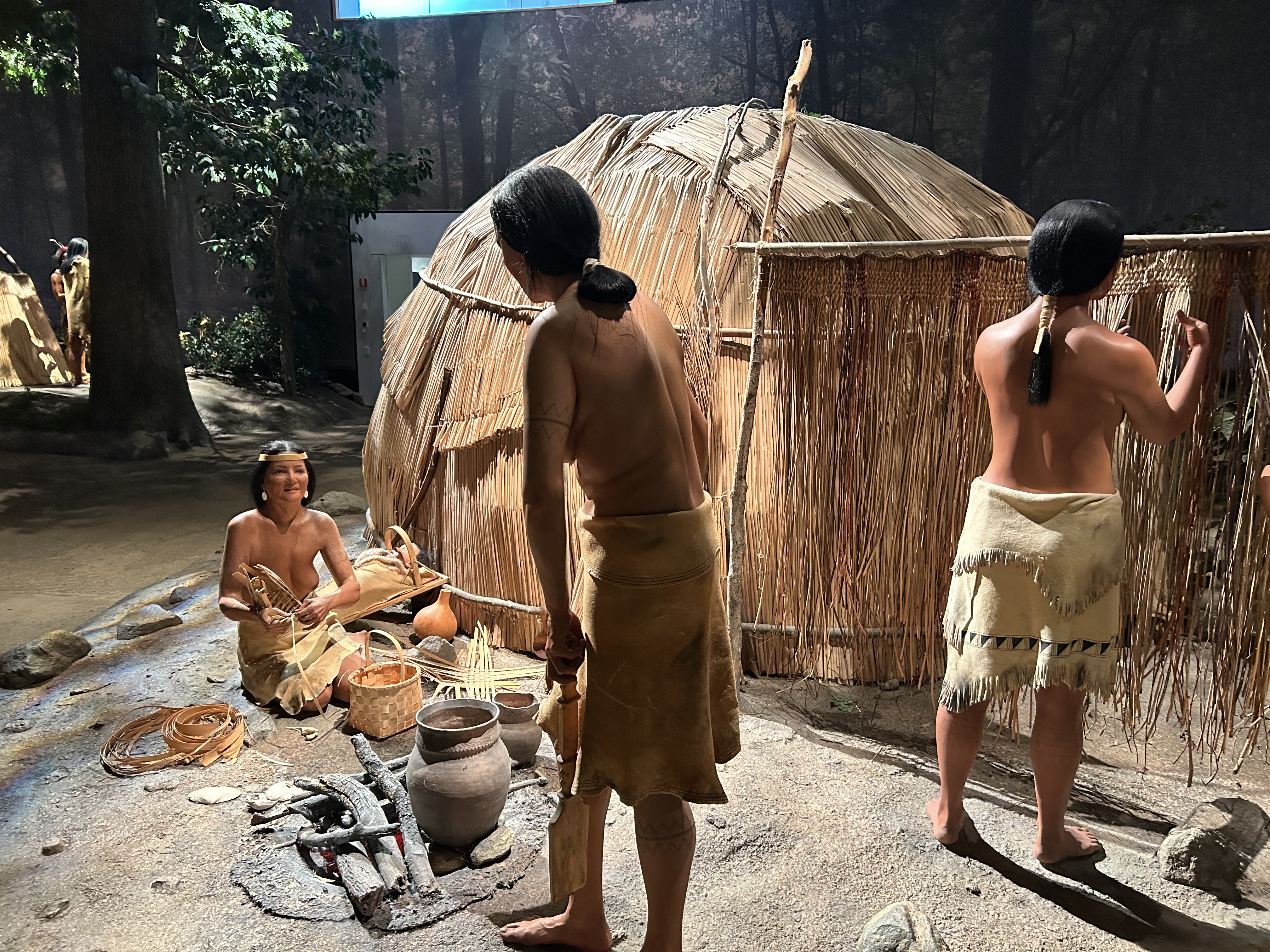
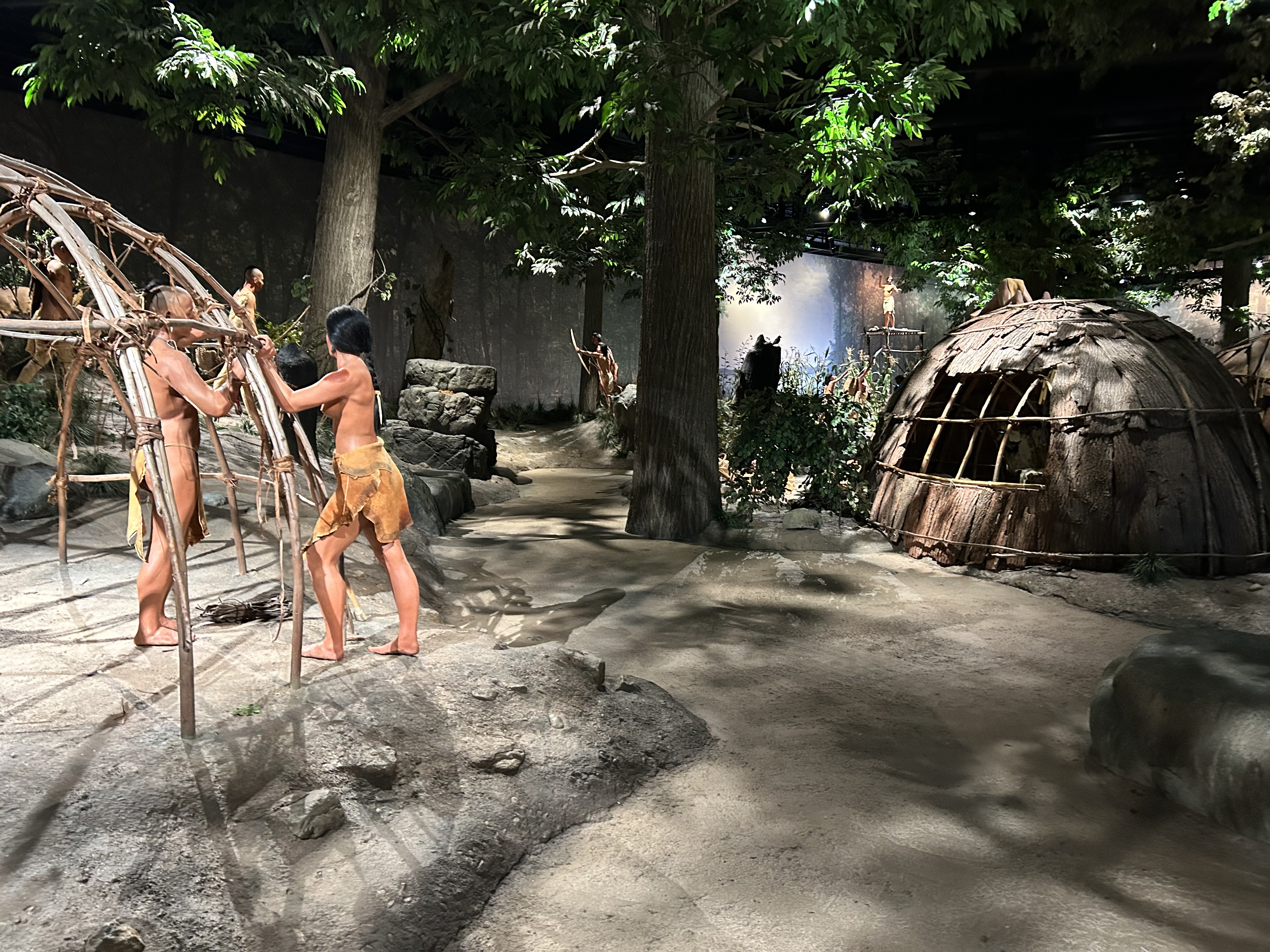
Visitors are encouraged to explore the Mashantucket Pequot Museum & Research Center, an unparalleled resource for understanding Pequot history, culture, and their ongoing contributions. Engaging with the exhibits, listening to the voices of the Pequot people, and walking the reconstructed village sites offers a tangible connection to the past that maps alone cannot convey. Understanding where the Pequot once lived, and where they continue to thrive today, fosters a deeper respect for Indigenous sovereignty and a more nuanced appreciation of American history.
This map is a call to acknowledge that the land we inhabit has a deep history, often marked by conflict and dispossession, but also by profound endurance and cultural survival. It invites us to see Connecticut not just as a collection of towns and cities, but as a living landscape, imbued with the stories, struggles, and triumphs of its First People.
Conclusion
The Pequot Tribe’s traditional lands map is a powerful, living document. It delineates not just geographical boundaries but also the ebb and flow of power, the devastation of war, the tenacity of survival, and the inspiring journey of a people reclaiming their rightful place in history. It serves as a vital educational tool, prompting us to look beyond simplistic narratives and to embrace the full, complex truth of Connecticut’s past and present. To engage with this map is to engage with the enduring spirit of the Pequot people – a spirit that has weathered centuries of adversity and continues to define the landscape of Connecticut today.
