The Hualapai Tribe Reservation map is far more than a geographical outline; it is a living document, a testament to enduring identity, a repository of profound history, and a blueprint for a resilient future. For the discerning traveler and history enthusiast, understanding this map means delving into the heart of a people who have navigated immense challenges while fiercely preserving their ancestral connection to the rugged, breathtaking landscape of northwestern Arizona. This article will explore the Hualapai Reservation map, unraveling its historical genesis, its geographical significance, and the deep cultural identity woven into every contour.
The Landscape as Genesis: Northwestern Arizona’s Rugged Embrace
The Hualapai (pronounced Wah-lah-pie), meaning "People of the Tall Pines," reside on a reservation encompassing approximately one million acres in northwestern Arizona. Its northern boundary traces a significant stretch of the mighty Colorado River, including a crucial section of the Grand Canyon. To the south, the reservation extends towards the foothills of the Music Mountains and Aubrey Cliffs, bordering historic Route 66.
This is a land of dramatic contrasts: arid desert shrubland gives way to rolling plateaus, deep canyons, and eventually, the higher elevations crowned with juniper and piñon pine forests. The elevation varies dramatically, from the scorching floor of the Grand Canyon at around 1,000 feet to the reservation’s higher points exceeding 6,000 feet. This varied topography has historically dictated the Hualapai way of life, enabling seasonal migration for hunting, gathering, and accessing vital water sources. The map, in its stark reality, delineates these environmental zones, each holding specific cultural and historical significance. The deep canyons offer protection and access to water, while the higher mesas provide hunting grounds and cooler retreats.

The administrative and cultural heart of the reservation is Peach Springs, located along the historic Route 66. This small community serves as the tribal headquarters, a hub for essential services, and a key entry point for visitors seeking to understand the Hualapai world. Its position on the map is strategic, providing a central access point to the vast tribal lands.
A Map Forged in Conflict and Resilience: A History of Displacement and Return
To comprehend the Hualapai Reservation map, one must journey back through time, acknowledging the immense ancestral lands that once stretched far beyond its current boundaries. Before European contact, the Hualapai occupied a vast territory of approximately five million acres, extending from the Colorado River in the north to the Bill Williams River in the south, and from the Grand Wash Cliffs in the west to the present-day city of Kingman in the east. Their traditional map was not drawn on paper but etched into memory, guided by oral histories, sacred sites, and an intimate knowledge of seasonal resources.
The arrival of American settlers in the mid-19th century brought an abrupt and violent disruption to this ancient way of life. The discovery of gold, the expansion of cattle ranching, and the establishment of wagon roads through Hualapai territory led to escalating conflicts. The Hualapai, fiercely independent and protective of their lands, resisted these encroachments. This resistance culminated in the Hualapai War (1866-1869), a brutal period of fighting against the U.S. Army and local militias.

The war ended with the Hualapai severely depleted and dispossessed. In 1874, the U.S. government forcibly removed the surviving Hualapai to the La Paz Indian Reservation along the Colorado River, a foreign and inhospitable land already occupied by the Mohave and Chemehuevi tribes. This forced march and subsequent exile were devastating, leading to disease, starvation, and further loss of life.
However, the Hualapai’s spirit of resilience proved indomitable. Unable to thrive in La Paz and yearning for their ancestral homelands, many Hualapai began to escape and make their way back to their traditional territories. This persistent return, against all odds, eventually compelled the U.S. government to act.
On January 4, 1883, President Chester A. Arthur, by executive order, established the Hualapai Indian Reservation. The map we see today began to take shape then, albeit as a drastically diminished fraction of their ancestral domain. The reservation boundaries were drawn, often arbitrarily, encompassing lands that were deemed less desirable by settlers or strategically important to the U.S. government. This act, while providing a permanent homeland, simultaneously codified the profound loss of the vast majority of their traditional lands.
The subsequent years saw further challenges, including the Dawes Act (General Allotment Act) of 1887, which sought to break up communal tribal lands into individual plots. While the Hualapai managed to resist the full impact of allotment more successfully than some tribes, the threat of land loss and cultural erosion remained constant. It wasn’t until the mid-20th century, with the rise of tribal self-determination movements, that the Hualapai began to assert greater control over their land and destiny, turning the reservation map from a symbol of confinement into a foundation for sovereignty and economic development.

Reading the Map: Identity, Economy, and Sacred Spaces
The Hualapai Reservation map is not merely a political delineation; it is a cultural blueprint, intricately connected to the tribe’s identity, economic aspirations, and spiritual beliefs.
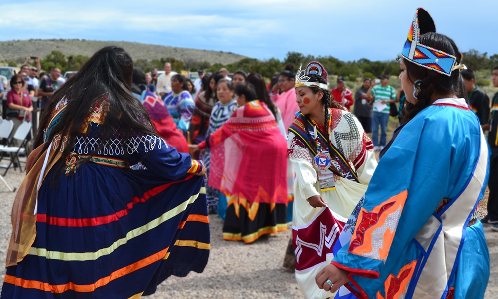
1. Cultural and Spiritual Significance: Every canyon, mesa, spring, and mountain range on the map holds stories, names, and spiritual meaning. The Hualapai language (a Yuman language) is deeply rooted in this landscape, with place names describing features, historical events, or resource availability. Sacred sites, often unmarked on commercial maps, are integral to Hualapai ceremonies, oral traditions, and their understanding of the world. The Grand Canyon itself, forming a significant northern boundary, is not just a geological wonder but a profound spiritual space, a source of creation stories and a pathway for ancestral spirits. The map thus represents a physical manifestation of their spiritual worldview.
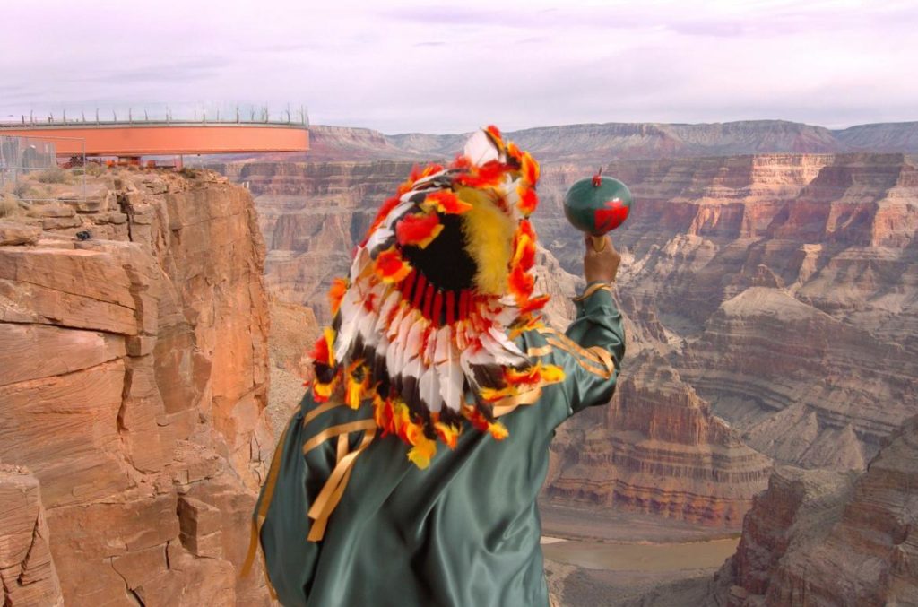
2. Economic Development and Sovereignty: The modern Hualapai Tribe has strategically leveraged its geographical location to foster economic self-sufficiency. The most prominent example is Grand Canyon West, located on the reservation’s northwestern edge. This includes the famous Skywalk, a horseshoe-shaped glass bridge extending over the canyon rim. The development of Grand Canyon West is a powerful demonstration of tribal sovereignty and economic ingenuity. It represents the tribe’s ability to control tourism on their land, creating jobs, generating revenue, and managing visitor impact in a way that respects their cultural values.
The map illustrates the logistical challenges and triumphs of this endeavor. Roads leading to Grand Canyon West are tribal roads, maintained and managed by the Hualapai. The enterprises within Grand Canyon West are tribally owned and operated. This economic engine allows the Hualapai to invest in tribal infrastructure, education, healthcare, and cultural preservation programs, directly benefiting their community.
Beyond tourism, the reservation map also delineates areas for traditional economic activities. Vast stretches of land are used for cattle ranching, a practice adopted and adapted by the Hualapai. The limited but vital water sources, often represented by springs and washes on the map, are carefully managed for both human consumption and livestock. The "tall pines" from which they derive their name also point to historical and potential future resource management in higher elevations.

3. Resource Management and Future Challenges: The map also highlights critical areas for environmental and resource management. The Colorado River frontage is not just a scenic boundary; it represents a fundamental water right, essential for the tribe’s survival and future development. Managing these water resources in an increasingly arid region is a constant challenge, necessitating careful planning and advocacy.
The varied ecosystems within the reservation boundaries require sophisticated land management strategies to balance conservation with sustainable use. Protecting sacred sites, maintaining biodiversity, and mitigating the impacts of climate change are ongoing concerns reflected in tribal planning documents, which effectively act as a detailed, forward-looking extension of the reservation map.
For the Traveler and History Enthusiast: Engaging with the Map
For those drawn to the Hualapai Reservation, understanding its map transforms a simple visit into a profound educational experience.
- Beyond the Skywalk: While the Grand Canyon Skywalk is a marvel, the map encourages visitors to explore beyond it. Peach Springs, the tribal capital, offers a deeper dive into Hualapai culture, with opportunities to interact with community members and learn about their daily lives. Route 66, running through the reservation, provides a tangible link to a different era of American history, intertwined with the Hualapai’s own story of adapting to external forces.
- Respecting Sacred Spaces: The map reminds visitors that the entire landscape is imbued with meaning. While specific sacred sites may not be publicly accessible, approaching the land with respect and an awareness of its spiritual significance is paramount.
- Supporting Tribal Enterprises: By choosing to visit Grand Canyon West and utilizing Hualapai-owned services, travelers directly contribute to the tribe’s self-sufficiency and cultural preservation efforts. This is a tangible way to honor the history and resilience represented by the map.
- Learning the History: Engaging with Hualapai history – from their ancestral domains to the Hualapai War, forced removal, and eventual return – provides context for every line on the map. It highlights the struggles and triumphs that shaped the land and its people.
Conclusion: A Living Map, An Enduring Legacy
The Hualapai Tribe Reservation map is a powerful, dynamic entity. It is a historical record of immense loss and incredible resilience, a geographical marker of cultural identity, and an economic blueprint for self-determination. For the Hualapai, it is the canvas upon which their past, present, and future are continuously painted. For the visitor, it is an invitation to look beyond the lines and discover the rich, enduring story of the "People of the Tall Pines," whose spirit, like the Grand Canyon itself, remains majestic and unconquered. To truly understand this map is to appreciate the profound connection between a people and their land, a bond that has persevered through generations and continues to define the Hualapai legacy in the heart of Arizona.
