>
More Than Lines on a Map: Navigating the History and Identity of the Blackfeet Nation in Montana
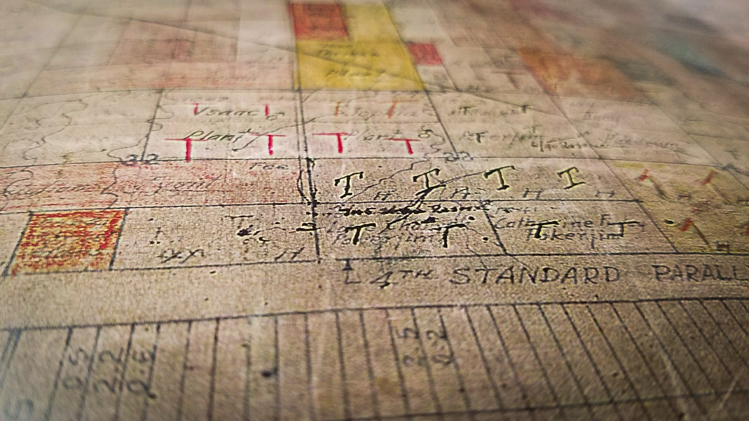
The Blackfeet Nation reservation map in Montana is far more than a geographical delineation of land; it is a living document, a palimpsest etched with centuries of history, resilience, and profound cultural identity. For any traveler or history enthusiast looking to understand the American West, or for those seeking a deeper connection to Indigenous cultures, navigating this map means embarking on a journey through time, spirituality, and the enduring spirit of the Siksikaitsitapi, the Blackfeet Confederacy. This article delves into the intricate layers of the Blackfeet Nation’s map, revealing the stories it tells about ancestral homelands, treaty negotiations, cultural survival, and the vibrant present of a sovereign people.
The Vastness Before the Lines: Ancestral Blackfeet Territory

Before the cartographer’s pen ever etched lines across the North American continent, the Siksikaitsitapi – the Blackfeet Confederacy, comprising the Pikuni (Blackfeet proper, often referred to as Southern Piegan), Kainai (Blood), Siksika (Northern Blackfoot), and Aamsskáápipikani (Northern Piegan) – held dominion over a sprawling, vital territory. Their ancestral lands, stretching from the North Saskatchewan River in present-day Canada south to the Yellowstone River in Montana, and from the Rocky Mountains eastward across the vast plains, encompassed an ecological diversity that sustained their nomadic, buffalo-centric way of life for millennia.
This pre-contact map was defined not by rigid borders, but by seasonal migrations, sacred sites, hunting grounds, and the intricate web of kinship that bound the bands together. The Rocky Mountains, particularly the area now known as Glacier National Park, were not merely scenic backdrops but sacred landscapes, home to spirits, vision quest sites, and crucial resources. The vast prairies teemed with bison, the very foundation of Blackfeet existence, providing food, shelter, clothing, and spiritual sustenance. Rivers like the Marias, Two Medicine, and St. Mary were lifelines, guiding their movements and watering their camps.
Identity for the Blackfeet was inextricably linked to this land. Their language, Siksiká, reflected the landscape; their ceremonies, like the Sun Dance, drew power from the natural world; and their oral histories chronicled generations of life lived in harmony with the rhythm of the seasons. This was a sophisticated, self-sufficient civilization, rich in spiritual practices, social structures, and a deep, intimate knowledge of their environment. The "map" of this era was held in collective memory, passed down through stories, songs, and lived experience – a far more complex and meaningful representation than any modern cartographic projection.
The Cartographer’s Hand: Treaties, Cession, and the Shrinking Domain

The arrival of European and American traders, settlers, and prospectors irrevocably altered this landscape and the Blackfeet’s traditional way of life. The fur trade initially brought new goods but also introduced disease and escalating intertribal conflicts fueled by access to firearms. As the United States pursued its policy of westward expansion, the Blackfeet, like countless other Indigenous nations, faced increasing pressure to cede their lands.
The concept of a "treaty" held vastly different meanings for the Blackfeet and the U.S. government. For the Blackfeet, agreements often signified shared use and temporary peace; for the U.S., they were instruments for permanent land acquisition. The pivotal Fort Laramie Treaties of 1851 and 1868, though intended to define tribal territories and establish peace, ultimately laid the groundwork for massive land cessions. While these treaties initially recognized extensive Blackfeet territory, they also introduced the concept of a "reservation" – a confined area set aside for the exclusive use of the tribe, a stark contrast to their expansive ancestral range.
The most significant reduction of Blackfeet land occurred through a series of agreements in the late 19th century, notably the "Agreement of 1895." Under immense pressure, facing starvation due to the decimation of the buffalo herds and aggressive federal policies, the Blackfeet were compelled to cede a vast tract of mountainous land, often referred to as the "Ceded Strip." This land, rich in natural beauty and resources, was later designated as the core of Glacier National Park. The irony is profound: a landscape revered by the Blackfeet for millennia, and central to their spiritual identity, was taken and subsequently celebrated as a "wilderness" for the enjoyment of others, often with little acknowledgment of its Indigenous history.
The reservation map, as it solidified by the turn of the 20th century, thus became a stark visual representation of profound loss. From millions of acres, the Blackfeet Nation was confined to approximately 1.5 million acres in northwestern Montana. This reduction was not just geographical; it was an assault on their economic independence, cultural practices, and spiritual connection to specific sites now outside their boundaries.

The Blackfeet Nation Reservation Map Today: Geography and Governance
Today, the Blackfeet Nation reservation, home to the Pikuni (Southern Piegan) band of the Blackfeet Confederacy, encompasses approximately 1.5 million acres in northwestern Montana. It is the largest reservation in Montana by land area and shares its western border with Glacier National Park, a poignant reminder of the "Ceded Strip."
Key Geographical Features:
The map reveals a diverse landscape, from rolling plains and vast grasslands in the east to the foothills of the Rocky Mountains in the west. Major rivers such as the Two Medicine, Cut Bank, and St. Mary traverse the reservation, providing vital water resources. The reservation’s elevation ranges from around 3,500 feet on the plains to over 9,000 feet in the mountainous regions, offering dramatic vistas and varied ecosystems. This geographical diversity supports ranching, agriculture, and provides habitats for a variety of wildlife, including elk, deer, and grizzly bears.
Major Communities:
Browning serves as the tribal capital and largest community, hosting tribal government offices, schools, and essential services. Other significant communities include Heart Butte, St. Mary, East Glacier Park Village, and Seville. These towns are not just dots on a map but hubs of community life, cultural preservation efforts, and economic activity.

Governance and Sovereignty:
The Blackfeet Nation operates as a sovereign tribal government, with a democratically elected Tribal Business Council overseeing all aspects of tribal affairs, from law enforcement and education to resource management and economic development. The map, therefore, also delineates a jurisdiction, representing the Blackfeet people’s inherent right to self-determination and self-governance within their recognized borders. This sovereignty is a cornerstone of their identity, ensuring the continuation of their culture and the ability to chart their own future.
Identity Woven into the Land: Culture, Resilience, and the Future
The map’s lines, though imposed, have not severed the Blackfeet people’s profound spiritual and cultural ties to their ancestral lands, both within and beyond the reservation boundaries. The reservation itself is not merely a place of confinement but a homeland, a sanctuary where Blackfeet culture continues to thrive and evolve.
Cultural Continuity:
Identity for the Blackfeet Nation remains deeply rooted in their language, Siksiká, which is undergoing significant revitalization efforts. Ceremonies like the Sun Dance (Okan), the Sweat Lodge, and various pipe ceremonies continue to be practiced, connecting contemporary Blackfeet to their ancestors and the spiritual essence of the land. Storytelling, traditional arts (such as beadwork, quillwork, and hide painting), and traditional ecological knowledge are passed down through generations, ensuring the vibrancy of their cultural heritage. The mountains, rivers, and specific geological formations within and adjacent to the reservation continue to hold immense spiritual significance, serving as powerful anchors for Blackfeet identity.
Economic Development and Challenges:
The map also highlights areas of economic activity and challenges. Ranching and agriculture have long been mainstays, adapting to the reservation’s landscape. The tribe also manages oil and gas resources, and increasingly, tourism plays a role, particularly given its proximity to Glacier National Park. However, like many Indigenous nations, the Blackfeet Nation faces significant socio-economic challenges, including poverty, unemployment, and disparities in healthcare and education. The reservation map, in this context, also points to areas targeted for development and community support, reflecting ongoing efforts to build a sustainable future for its people.
Environmental Stewardship:
The Blackfeet Nation are fierce guardians of their land and natural resources. Their traditional knowledge and spiritual connection imbue them with a deep understanding of ecological balance. The fight against resource extraction that threatens sacred sites, and their commitment to wildlife conservation, particularly the reintroduction of buffalo to tribal lands, exemplifies their ongoing stewardship of their traditional territories. This commitment is a direct expression of their identity as the "original caretakers" of this land.
The Map as a Call to Action: Responsible Engagement
For travelers and history enthusiasts, understanding the Blackfeet Nation map means embracing a journey beyond mere sightseeing. It means recognizing that every curve of a river, every rise of a mountain, and every line on the reservation boundary tells a story of survival, adaptation, and an enduring spirit.
Responsible Tourism:
Visiting the Blackfeet Nation reservation offers a unique opportunity for cultural immersion. Travelers are encouraged to engage respectfully:
- Support Tribal Businesses: Purchase authentic Blackfeet art, crafts, and patronize tribally owned enterprises.
- Visit Cultural Centers: The Museum of the Plains Indian in Browning and the Blackfeet Tribal College offer invaluable insights into Blackfeet history and contemporary life.
- Attend Public Events: If permitted, respectfully attend cultural events, understanding that many ceremonies are private.
- Learn and Listen: Engage with local residents, learn about their perspectives, and recognize the ongoing challenges and triumphs of the community.
- Respect the Land: Understand that the land is sacred. Practice Leave No Trace principles and respect private property.
Educational Imperative:
For educators and students, the Blackfeet Nation map serves as a powerful teaching tool. It challenges simplistic narratives of American history, foregrounding Indigenous perspectives on land, sovereignty, and resilience. It underscores the importance of acknowledging the true history of land dispossession and the ongoing impact of colonial policies, while also celebrating the incredible strength and adaptability of the Blackfeet people. Understanding this map is crucial for a more complete and just understanding of Montana and the American West.
Conclusion
The Blackfeet Nation reservation map is a testament to survival, a canvas of identity, and a roadmap for the future. It encapsulates a rich history of vast ancestral lands, the profound losses incurred through treaties, and the establishment of a sovereign territory where Blackfeet culture, language, and spiritual traditions continue to flourish. For those who look beyond the lines and truly see the land through the eyes of the Siksikaitsitapi, this map becomes an invitation – an invitation to learn, to respect, and to acknowledge the vibrant, enduring presence of the Blackfeet Nation in Montana, a people who remain deeply connected to their sacred homelands. Their story, etched across this landscape, is not one of the past, but a living narrative of profound resilience and self-determination.
>
